


Directions
From Seattle, take I-90 east for nearly 80 miles. Take exit 80 toward Salmon La Sac and turn left on Bullfrog Road. Continue to the 2nd traffic circle and take the second exit onto WA-903 north. Continue onto Salmon La Sac road. The campground is on the left, just past Cayuse Campground.
From Cle Elum, WA travel north on Highway 903 / Salmon la Sac Road for 19 miles. Stay left on Salmon La Sac road to the campground. The campground is on the left, just past Cayuse Campground.
Phone
509-852-1100
Activities
CAMPING, FISHING, HIKING, DAY USE AREA, PHOTOGRAPHY, SWIMMING, BERRY PICKING, WATER ACCESS
Keywords
SALM,OKANOGAN – WENATCHEE NF -FS
Related Link(s)
Washington State Road Conditions
Overview
Salmon La Sac Campground is bordered by the Cle Elum and Cooper Rivers in Okanogan-Wenatchee National Forest. This campground is a popular gathering place for individuals and families wanting to enjoy the mountains and a multitude of recreational activities at an elevation of 2,300 feet.
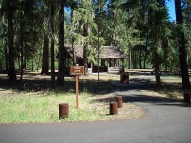
Recreation
In addition to being a prime location for hiking, fishing, swimming, horseback riding and mountain biking in summer and early fall, the area offers excellent cross country skiing and snowmobiling in the winter months. Snowmobiles are not allowed in the campground.
Salmon la Sac is closed to camping October through April. Nearby Salmon la Sac Sno-Park offiers access to groomed ski trails through the campground December through March.
Salmon la Sac Campground is also popular among anglers, with rainbow and cutthroat trout and kokanee salmon available in abundance.
Hikers will enjoy traversing rugged terrain from the Waptus River Trail, located within walking distance of the campground. Forested and lined with an underbrush of blueberries, hikers reach Hour Creek after strolling 3 miles. Take your lunch next to this clear mountain stream and return to camp or continue another 6 miles along the Waptus River to stunning views of Waptus Lake and craggy peaks of Summit Chief Mountain.
Facilities
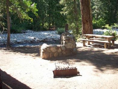
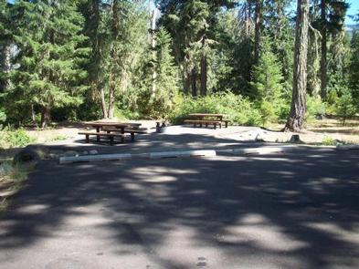
Salmon la Sac Campground offers drinking water, trash collection and vault toilets. There are 67 sites for both tent and RV camping, 40 of these are reservable.
Sites are equipped with picnic tables and campfire rings with grills.
Natural Features
Okanogan-Wenatchee National Forest offers stunning scenic views, with high, glaciated alpine peaks, valleys of old growth forest and rugged shrub-steppe country making up the diverse landscape. Elevations range from below 1,000 feet to over 9,000 feet. Visitors to the area can expect many days of warm, sunny weather in the summer, and winters with clear skies and plenty of snow. The surrounding undeveloped wilderness, clean streams and diverse forests support an abundance of wildlife, including deer, porcupine, native fish and migratory birds.
Nearby Attractions
The spectacular Pacific Crest Trail (PCT) is accessible near the campground. The PCT is one of the world’s premier National Scenic Trails, showcasing some of North America’s most fantastic scenery as it winds its way its way from Mexico to Canada through California, Oregon and Washington.