CLUBHOUSE LAKE, MN Campground Reservation, Info, Images, Map, Directions

CLUBHOUSE LAKE, Minnesota Campground Images, Info & Reservations

Directions

From the south, travel on Minnesota State Highway 38 from Grand Rapids to Marcell. Turn right on County Road 45, just north of Marcell, and continue five miles east. Then travel three miles north on Forest Road 2181 to the campground.

Phone

218-246-2123

Activities

BIKING, BOATING, CAMPING, FISHING, HIKING, SWIMMING SITE

Keywords

CLUBHOUSE,CHIPPEWA NF – FS

Related Link(s)

Rec Area Info & Images

Minnesota State Road Conditions

Minnesota State Tourism

Overview

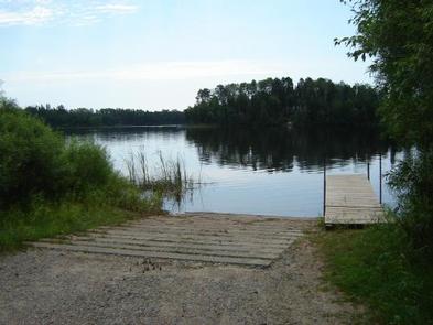
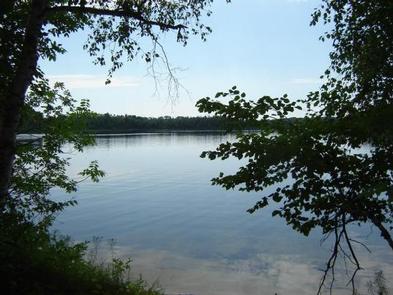
Clubhouse Lake Campground is located on its peaceful namesake in the beautiful Chippewa National Forest. Visitors enjoy the area for its fishing and canoeing opportunities in a scenic natural setting.

Recreation

Clubhouse Lake has excellent water quality and is about 90 feet deep, providing great fishing opportunities for northern pike, bass and panfish. Swimming, canoeing and kayaking are very popular activities on the lake. The Rice River Canoe Route starts its journey to the Big Fork River from waters that flow into Clubhouse Lake.

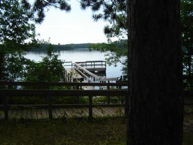
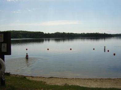
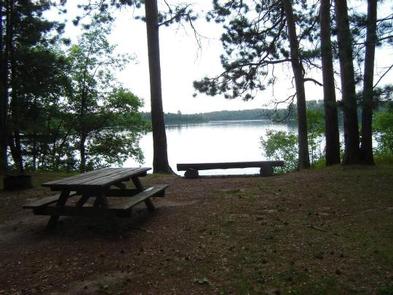
A sandy swimming beach, an accessible fishing pier and a day use area are located within the campground at the water’s edge. A kid’s fishing day is held at the campground in June, sponsored by the Big Fork Lion’s Club and the Forest Service.

Facilities

The campground offers 28 reservable and 19 first-come, first-served, single-family campsites. Each site is equipped with a picnic table and campfire ring. Vault toilets and hand-pumped drinking water are provided.

The campground is patrolled regularly by Forest Service personnel and Itasca County law enforcement officers.

Natural Features

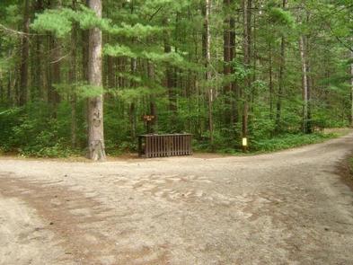
The campground lies off Highway 38, which is the nation’s first National Scenic Byway, known as "The Edge of the Wilderness." A beautiful stand of 200-year-old red and white pine trees cover the campground on the western shore of Clubhouse Lake.

Nearby Attractions

The Marcell Discovery Center is located a half-mile north of Marcell. It is a must-see for anyone camping in the area. The brand new facility offers many excellent displays, a gift shop and several weekly naturalist programs.

Reservation

More from CampingHiking.net:

INDIAN FORD CAMPGROUND, Oregon Campground Images, Info & Reservations

Directions From Sisters, OR: Travel 5.6 miles northwest on Highway 20. Phone 541-323-1746 Activities CAMPING Keywords Related Link(s) Rec Area Info & Images Oregon State Road Conditions Oregon State Tourism Overview Indian Ford Campground is named for its location on Indian Ford Creek and is conveniently located between the town

PALISADES RANGER RESIDENCE CABIN, Arizona Campground Images, Info & Reservations

Directions Driving Directions: From northeast Tucson, take East Tanque Verde Road to East Catalina Highway. Turn left (north) on East Catalina Highway, which becomes the General Hitchcock Highway, for approximately 23 miles to Organization Ridge Road and turn left (just before Palisades Visitor Center). The cabin is located approximately 100

GROUP LANDING, Florida Campground Images, Info & Reservations

Directions From the intersection of Hwy 441 and Hwy 90 in Lake City, FL, drive east on Hwy 90 for 12.6 miles. Turn left at the flashing light onto Pine Street. Cross over the railroad tracks. After about half a mile, you will see a sign directing you to turn

BIRCH COVE, Oklahoma Campground Images, Info & Reservations

Directions From Tulsa, take Highway 75 north to Hwy 20 west. First light in Skiatook turn right (north) on Hwy 11 to Barnsdall for 19 miles. Take a left on West Chestnut Avenue, then left on South Eighth Street at T. Travel 3 miles and Birch Cove entrance will be

SANDY BEACH CAMP, Iowa Campground Images, Info & Reservations

Directions From Interstate 380 (Shueyville, Iowa) take Exit 10 towards Shueyville. Travel east on 120th St. NW for 1.2 miles. At the stop sign, turn right onto NE Curtis Bridge Rd. Travel south on NE Curtis Bridge Rd for 1.1 miles. Turn left onto Sandy Beach Rd. NE and travel

CALPINE LOOKOUT, California Campground Images, Info & Reservations

Directions From Sierraville, the lookout is approximately 10 miles north on State Highway 89. Renters will be given a renters packet after check-in with the best access or parking based on current weather conditions. During the winter months, access is by snowshoes, skiis or snowmobiles on a 2 mile trail