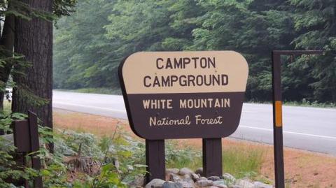
CAMPTON CAMPGROUND, NH Campground Reservation, Info, Images, Map, Directions

CAMPTON CAMPGROUND, New Hampshire Campground Images, Info & Reservations

Directions

From Highway 93 in central New Hampshire, take exit 28 and follow Highway 49 (Mad River Road) east for 2 miles.

Phone

603-536-6100

Activities

CAMPING, INTERPRETIVE PROGRAMS

Keywords

CAMP,WHITE MOUNTAIN NF -FS

Related Link(s)

Rec Area Info & Images

Forest Service Concessionaire

New Hampshire State Tourism

New Hampshire State Road Conditions

Overview

Campton Campground is a large and accommodating facility near the southern edge of White Mountain National Forest in New Hampshire. With many kid-friendly activities nearby such as hiking and nature programs, the campground is especially popular with families. It is convenient to U.S. Highway 93, which travels through the middle of the state, and is just two hours from Boston.

The White Mountains boast pristine forests, clear mountain streams and rivers and the tallest peaks in the Northeast. The forest encompasses nearly 800,000 acres in New Hampshire and western Maine, and is one of the most popular in the country.

Recreation

The White Mountains are a favorite among hikers. Many miles of hiking and mountain biking trails are within a short drive of the campground. Within the facility, nature programs are available on Saturday nights in July and August.

Anglers can cast a line for brook trout, pickerel, brown bullhead and yellow perch in the pond and river. No power boats are permitted on the pond.

Facilities

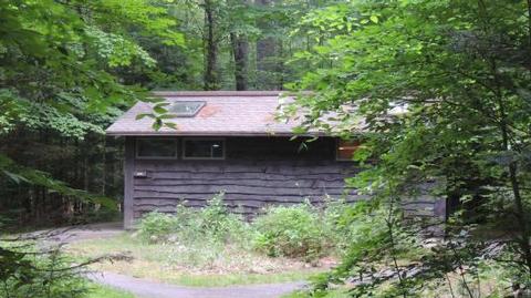
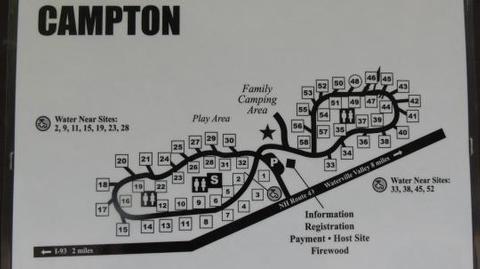
This is a large facility with many types of campsites that accommodate a variety of camping preferences. Despite its size, campsites are spaced well-apart. Restrooms, drinking water and hot showers (coin-operated) are provided.

Sites 33-58 are near the flush toilets.

Natural Features

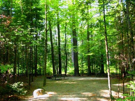
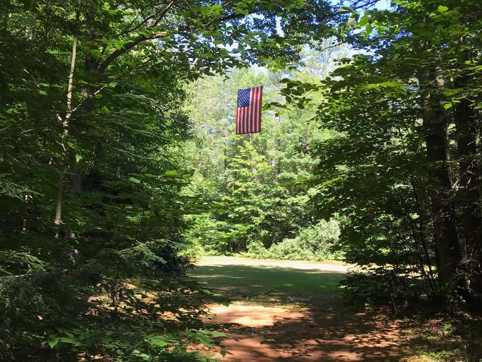
The campground lies amidst a beautiful thick forest of white pine and northern hardwoods that provide plenty of shade. The 30-acre Campton Pond and Mad River are close by.

The White Mountains are home to many species of northern wildlife, including moose, white-tailed deer and black bear. Almost 200 species of birds, including the rare Bicknell’s Thrush, live in the forest.

Nearby Attractions

Families who need a break from the woods can explore miniature golf, a water sports park, train rides and gondolas in nearby towns.

The White Mountains region hosts four alpine and five nordic ski areas, which provide year-round recreation opportunities such as skiing, hiking, mountain biking, outdoor concerts, interpretive trails, special events and regional and national skiing and snowboarding races.

The area also contains 1,200 miles of hiking trails, including 160 miles of the famous Appalachian Trail.

Learn more about recreation in the national forest.

Reservation

More from CampingHiking.net:

LITTCARR CAMPGROUND, Kentucky Campground Images, Info & Reservations

Directions From I-75, take Exit 38 (SR-192) east to Daniel Boone Parkway to SR-15. Travel SR-15 south to SR-160, turn north and follow for 4 miles. Campground is on the east side of SR-160. Phone 606-642-3052 Activities BOATING, CAMPING, FISHING, HUNTING, DAY USE AREA, SWIMMING SITE Keywords LITT,CARR CREEK CAMPGROUND,CARR

Beckler River Campground, Washington Campground Images, Info & Reservations

Directions From Seattle, Washington, go north on I-5 to US Highway 2, exit 194. Approximately 49 miles along Highway 2 turn north onto Forest Road 65. Turn at the campground sign and continue about 1.5 miles. Phone 360-419-5115 Activities BIKING, BOATING, CAMPING, FISHING, HIKING, HUNTING, WILDLIFE VIEWING Keywords BECR,MT. BAKER-SNOQU

HAWKER POINT, Missouri Campground Images, Info & Reservations

Directions From Stockton, Missouri, take State Highway 39 south for 6.2 miles, turn left on Highway H and continue for 5.2 miles to the park entrance. Phone 417-276-7266 Activities BOATING, CAMPING, FISHING, VISITOR CENTER, WILDLIFE VIEWING Keywords HAWK,STOCKTON LAKE,STOCKTON LAKE Related Link(s) Rec Area Info & Images Missouri State Tourism

THIRD FORK CABIN, Idaho Campground Images, Info & Reservations

Directions From Boise, Idaho, take Highway 55 north to Horseshoe Bend. Turn left on Highway 52 and drive west 9 miles to the junction at Sweet/Ola Highway (no road number), then take a slight right. Take this road north 17 miles to Ola. Make a slight left and continue north

THIBAUT POINT, Missouri Campground Images, Info & Reservations

Directions From Highway 65, take Highway T west for 3 miles. Turn south on Georgetown Ave and follow for a mile, following signs into the park. Phone 660-428-2470 Activities BOATING, CAMPING, FISHING, FISH HATCHERY, SWIMMING SITE Keywords THIB,TRUMAN LAKE,TEBO,HARRY S TRUMAN Related Link(s) Rec Area Info & Images Missouri State

WAVELAND PARK, Arkansas Campground Images, Info & Reservations

Directions From Booneville, Arkansas, follow State Highway 10 east for 17 miles to Waveland. Turn right on State Highway 309 and drive for one mile. Turn right again onto Waveland Park Road and continue another mile to Blue Mountain Dam, then follow signs into the park. Phone 479-947-2101 Activities BOATING,