HORSFALL, OR Campground Reservation, Info, Images, Map, Directions

HORSFALL, Oregon Campground Images, Info & Reservations

Listen

Directions

From Reedsport, Oregon, take Highway 101 south for 22 miles to the Horsfall Dunes and Beach road sign. Turn right and follow signs.

From Coos Bay/North Bend, Oregon, take Highway 101 north for about 2 miles to the Horsfall Dune and Beach road sign. Turn left and follow signs.

Phone

541-271-6000

Activities

CAMPING, PICNICKING, WILDLIFE VIEWING, BEACHCOMBING

Keywords

HORF,SIUSLAW NF – FS,horsefall

Related Link(s)

Rec Area Info & Images

Oregon State Tourism

Oregon State Road Conditions

Overview

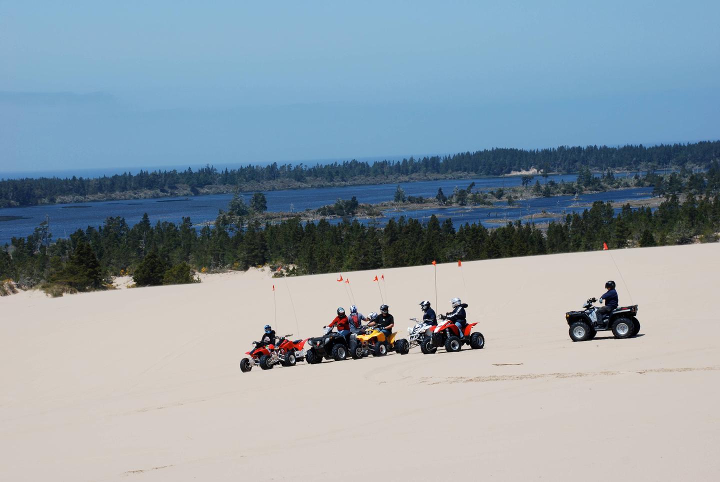
Horsfall Campground, tucked in the Oregon Dunes National Recreation Area, provides access to miles and miles of dunes, beckoning off-road vehicle riding enthusiasts. The unique landscape creates a contrast between the dry dunes and a number of watering holes. The campground sits within a mile of Horsfall Lake, Bluebill Lake and a selection of tranquil ponds.

Recreation

The number one activity is off-roading on the dunes. Trails and open riding zones are northwest of the campground.

Due west is the beach and the Wild Mare Horse Trail, open to hikers in addition to horseback riders.

Facilities

Amenities include flush toilets, drinking water, trash collection, campfire rings, recycling and token operated showers. An ATV loading ramp is also available. Picnic tables and grills are at each campsite. First come first serve sites may be available.

Natural Features

At an elevation of 100 feet, Horsfall sits in a valley of dunes near the Pacific Coast. The Haynes Inlet is a short distance east. Just over a mile away visitors can reach the Haynes Inlet, extending from Coos Bay, and the Pacific Coast.

Nearby Attractions

Explore Coos Bay, a picturesque inlet where the Coos River flows into the Pacific Ocean. The waterway is about 3 miles wide and 10 miles long, creating a flourishing habitat for sea birds.

Reservation

More from CampingHiking.net:

BURNS RUN WEST, Oklahoma Campground Images, Info & Reservations

Listen Directions From Highway 75 in Denison, Texas, take Exit 72 to Highway 91, travel north on 91 across Denison Dam, 5 miles. Take the second left, follow signs for about 1.5 miles. Physical address: 825 West Burns Run Road, Cartwright, OK 74731 Phone 580-965-4922 Activities CAMPING, SWIMMING SITE Keywords

CRANE VALLEY, California Campground Images, Info & Reservations

Listen Directions From Fresno, California, take Highway 41 north through Oakhurst. Turn right on Forest Road 222, towards Bass Lake. Keep right for 3.5 miles to the campground. Phone 559-642-3212 Activities BOATING, CAMPING, INTERPRETIVE PROGRAMS, FISHING, HIKING, WATER SPORTS, SWIMMING SITE Keywords CRVA,BASS LAKE OAKHURST AR,SIERRA NF – FS Related

WATAUGA POINT RECREATION AREA, Tennessee Campground Images, Info & Reservations

Listen Directions From Elizabethton, take US 19E/321 south for five miles to Hampton. Turn left on US 321/TN 67 south for six miles, then turn left into Watauga Point.  Phone 423-735-1500 Activities BOATING, FISHING, HIKING, KAYAKING, CANOEING, STAR GAZING, NON-MOTORIZED BOATING, WATER ACCESS, SCENIC DRIVE Keywords WATAUGA POINT RECREATION AREA

DENBY POINT, Arkansas Campground Images, Info & Reservations

Listen Directions From Hot Springs, Arkansas, take US 270 west about 26.5 miles to Ouachita Shores Parkway. Turn right and follow access road one mile north to park. From Mount Ida, Arkansas, take US 270 east approximately 9.5 miles to Ouachita Shores Parkway. Turn left on access road one mile

CIMARRON CAMPGROUND, New Mexico Campground Images, Info & Reservations

Listen Directions Driving Directions: From Costilla, NM, on State Highway 522, travel east on State Highway 196 past Amalia to the intersection of Forest Service Road 1950. Travel on 1950 (a gravel road) east to the unit boundary. Follow Forest Service Road 1950 to the junction with Forest Service Road

COSBY GROUP CAMP, Tennessee Campground Images, Info & Reservations

Listen Directions From Cosby, TN, proceed south on TN 32 about 1.5 miles from junction with US 321. Turn right at Cosby sign. Group camp is another 2.2 miles. Phone 423-487-2683 Activities HISTORIC & CULTURAL SITE, CAMPING, FISHING, HIKING, WILDLIFE VIEWING, DAY USE AREA Keywords Great Smokey Mountains National Park,Great