UPPER SAGE FLAT, CA Campground Reservation, Info, Images, Map, Directions

UPPER SAGE FLAT, California Campground Images, Info & Reservations

Directions

In Big Pine, on US Highway 395, turn west at the yellow flashing traffic light onto Crocker Street (Big Canyon Road). Continue on this road for 9 miles to campground, on your left.

Phone

760-935-4339

Activities

CAMPING, FISHING, HIKING, HORSEBACK RIDING, WILDLIFE VIEWING

Keywords

UPSF,UPPER SAGE CAMPGROUND,INYO NF – FS

Related Link(s)

Rec Area Info & Images

California State Tourism

Forest Service Concessionaire

California State Road Conditions

Overview

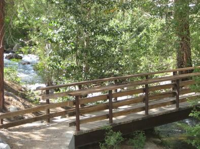
Take the family to Upper Sage for a pleasant camping trip along the banks of Big Pine Creek. Here, visitors can experience the beauty of the creek that runs along the base of a narrow canyon. Visitors can swim or fish, in the creek that is stocked annually with trout, or head to a nearby lake for power boating.

Recreation

Rainbow, brown, brook and alpers trout swim in the stream, enticing anglers. Hikers are fans of the Big Pine Creek Trail, a 1.5-mile footpath that provides access to the John Muir Wilderness trails.

Facilities

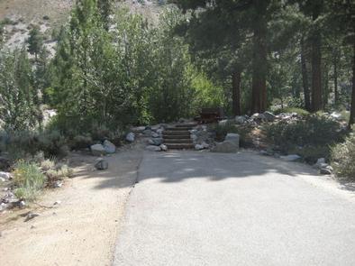
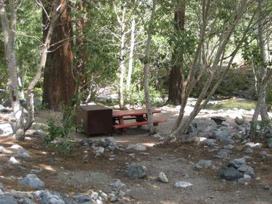
Parking aprons are paved and most are 40 feet long. Amenities include flush toilets, drinking water, picnic tables and campfire rings.

Natural Features

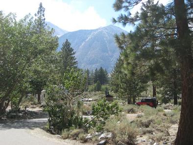
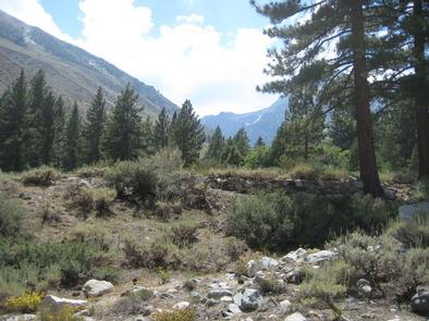
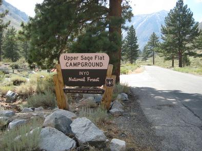
The campground is sprawled out along Big Pine Creek beneath shady Jeffrey pines and cottonwoods, just 9 miles west of the town of Big Pine.

Inyo National Forest is home to many natural wonders, including Mt. Whitney, Mono Lake, Mammoth Lakes Basin, and the Ancient Bristlecone Pine Forest atop the White Mountains.

Bristlecone pines rank as the oldest trees in the world and have achieved immense scientific and cultural importance.

Nearby Attractions

Head to the neighboring John Muir Wilderness for incredible views of Palisades Glacier, the southern-most glacier in the country. Nearby Tinemaha Reservoir provides additional fishing opportunities.

Reservation

More from CampingHiking.net:

DEEP CREEK GROUP CAMP, North Carolina Campground Images, Info & Reservations

Directions Seasonal phone is 828-488-3184 From downtown Bryson City, NC: Follow signs to Deep Creek, 3 miles away. Phone 828-488-3184 OR 865-436-1261 Activities HISTORIC & CULTURAL SITE, CAMPING, FISHING, HIKING, HORSEBACK RIDING, VISITOR CENTER, WILDLIFE VIEWING Keywords CG31,Great Smokey Mountains National Park,Great Smoky Mountains National Park,”Flaming Gorge National Recreation Area”

SIGNAL CREEK CAMPGROUND, Alaska Campground Images, Info & Reservations

Directions From the State ferry terminal, take Tongass Highway north 4.8 miles to milepost 7. Turn right onto Revila Road. Go 1.4 miles and turn right at the Ward Lake Road Intersection. Travel 1.1 miles past Ward Lake Day Use Area to the entrance sign for Signal Creek Campground. Phone

ANGEL CREEK, Nevada Campground Images, Info & Reservations

Directions Take Interstate 80 to the West Wells exit. Turn south on Angel Lake Road (State Route 231) and travel 8 miles to Angel Creek. Turn left and follow the road for one mile to the campground. Phone 775-752-3357 Activities BOATING, CAMPING, FISHING, HIKING, HORSEBACK RIDING, WILDLIFE VIEWING Keywords ANGC,RUBY

WESTLAKE DAY USE, Texas Campground Images, Info & Reservations

Directions From Dallas, go north on I-35E and take the Swisher Exit (exit 458). Cross over I-35 onto North Denton Drive. Stay on Denton Drive until the Main Street stop sign. Turn left and stay on Main St. until it enters into the park. (2000 Main St., Hickory Creek TX)