ALMANOR, CA Campground Reservation, Info, Images, Map, Directions

ALMANOR, California Campground Images, Info & Reservations

Directions

From Chester, take Highway 36 west to Highway 89 South. Turn left on Highway 89 and continue south about 6 miles, to Almanor Drive West (not to be confused with Almanor West development and Almanor West Drive). Turn left on Almanor Drive West (directly across from the Almanor Group Camp and rest area) and continue approximately 1 mile to Almanor South Campground.

For the Almanor Group camp.
From Chester, take Highway 89 South. Turn left on Highway 89 and continue about 6 miles to Almanor Drive west (not to be confused with Almanor West development and Almanor West Drive). Turn right into Almanor Group Camp and rest area ( across from Almanor West Drive).

Phone

530-258-2141

Activities

BIKING, BOATING, CAMPING, FISHING, HIKING, WATER SPORTS, WILDLIFE VIEWING, DAY USE AREA, SWIMMING SITE

Keywords

ALMA,LASSEN NF – FS

Related Link(s)

Rec Area Info & Images

California State Tourism

California State Road Conditions

Overview

Almanor Campground is a large family-friendly facility for individuals and large groups alike. It provides direct access to beautiful Lake Almanor and a variety of recreational opportunities in the area.

Recreation

The 28,000-acre lake provides ample boating, swimming, water skiing and sailing opportunities. A boat ramp can be found next to the north campground. The adjacent beach is mostly rocky, but contains some sand.

Fishing in the lake or nearby streams, is a popular activity. Anglers will find a variety of trout, bass, salmon and catfish, among other species.

The Lake Almanor Recreation Trail can be accessed from within the campground. The trail winds through the forest, providing spectacular views of the lake, nearby Dyer Mountain and Lassen Peak. The trail stretches approximately 11 miles along the west shore of the lake. It is a non-motorized trail, open to all non-motorized activity.

Facilities

The campground offers numerous single-family campsites, as well as a group site. Campsites are available for tent and RV camping, however, no hookups are provided. Many sites are available on a first-come, first-served basis.

Each site is equipped with a table and campfire ring with grill. Accessible vault toilets and drinking water are provided. Limited parking is available at the campground. An amphitheater is located on-site.

Natural Features

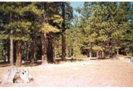
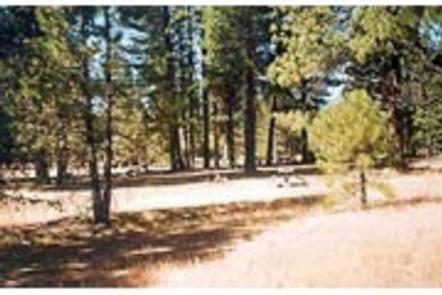
The campground sits on the west shore of Lake Almanor at an elevation of 4,540 feet. A scenic mixed conifer forest covers the area. Parts of the campground are shaded, while other sections have grassy meadows that often contain wildflowers.

Nearby Attractions

The campground is located 12 miles outside of the town of Chester, California.

Reservation

More from CampingHiking.net:

SHAWNEE BEND, Missouri Campground Images, Info & Reservations

Directions From Highway 7, travel north on the Dam Access Road for 3 miles and follow signs into the park. Phone 660-438-7317 Activities BOATING, CAMPING, FISHING, SWIMMING SITE Keywords SHAW,TRUMAN LAKE,HARRY S TRUMAN Related Link(s) Rec Area Info & Images Missouri State Tourism Missouri State Road Conditions Overview Shawnee Bend

BRIDGES CAMPGROUND, Utah Campground Images, Info & Reservations

Directions From Huntington, Utah, travel north on Utah Highway 31 for 23 miles, to the campground. It is on the west side of Highway 31, at the mouth of Day Canyon. Phone (435)384-2372 Activities BIKING, CLIMBING, CAMPING, FISHING, HIKING, HUNTING, WILDLIFE VIEWING Keywords BRID,BRIDGES CAMPGROUND,DAY CANYON CAMPGROUND,MANTI-LASAL NF -FS Related

TURKEY POINT, Kansas Campground Images, Info & Reservations

Directions From Osage City, Kansas, take K-170 south. Turn east onto 301st Street and continue 2 miles. Turn south onto Indian Hills Road and proceed about a mile to Turkey Point Parkway. Follow into the campground. Phone 785-549-3318 Activities BOATING, CAMPING, FISHING, HUNTING Keywords TURP,MELVERN LAKE,MELVERN PROJECT,MELVERN STATE LAKE,TURKEY CREEK,MELVERN

Lakeview Gunnison, Colorado Campground Images, Info & Reservations

Directions From Gunnison, travel north on Highway 135 for approximately 10 miles to Almont. Turn right on County Road 742 and continue 25 miles to the campground entrance, which is on the right. Phone 970-642-0566 Activities BIKING, BOATING, CAMPING, FISHING, HIKING, HUNTING, WILDLIFE VIEWING Keywords LABI,LAKEVIEW TAYLOR PARK,GUNNISON,GM,UNCOMP NF –

CHUTE GROUP, Utah Campground Images, Info & Reservations

Directions The campground is located about 26 miles west of Huntington, Utah, along Utah Highway 31. Phone 435-384-2372 Activities BIKING, CAMPING, FISHING, HIKING, HUNTING, WILDLIFE VIEWING Keywords CHUT,MANTI-LASAL NF -FS Related Link(s) Rec Area Info & Images Utah State Tourism Utah State Road Conditions Overview Chute Group Campground is located

WOODED HILL GROUP, California Campground Images, Info & Reservations

Directions Located 50 miles east of San Diego, California. Take I-8 to the Sunrise Highway exit. Go approximately 8.1 miles and turn west onto Wooded Hill Road. Phone 619-445-6235 Activities BIKING, CAMPING, HIKING, PICNICKING Keywords WOOH,CLEVELAND NF – FS Related Link(s) Rec Area Info & Images California State Tourism California