
Directions
From Albuquerque, drive east on I-40 to Exit 175. Continue north on NM State Road 14 for another 6 miles to Highway 536. Turn west onto NM State Road 536. Balsam Glade is approximately 7 miles up State Road 536, about one mile past the base of the Sandia Peak Ski area.
Phone
505-281-3304
Activities
BIKING, CLIMBING, HIKING, WILDLIFE VIEWING
Keywords
BAL1,BALSAM PICNIC GROUND,CIBOLA NF – FS
Related Link(s)
New Mexico State Road Conditions
Overview
Balsam Glade Picnic Site was named by an early American settler who mistook the white fir that grows here for balsam fir, as they are similar in appearance. He called this area “Balsam Glade” for so long that the name stuck.
From 1935 to 1941 the YMCA operated a summer camp for boys here. One young man who attended the camp as a youth, later became a counselor for boys at the “Y” camp. He was a fun loving fellow and gained the title “Ghost of the Sandia’s”
for his wild antics, like flying over the campfire on a zip line and scaring the campers. The only evidence of the ‘Y’ camp are two sets of steps that led thousands of hungry kids into the dining hall and out again to make more memories.
Balsam Glade is a great place for you and yours to make your own memories. The surrounding forest and mountains provide a perfect backdrop for photography, flower walks, bird watching, hiking, relaxing and taking in nature and other recreational opportunities. Please note that there is no overnight camping at this picnic site.
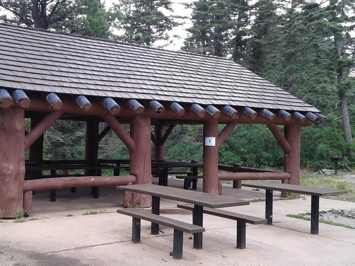
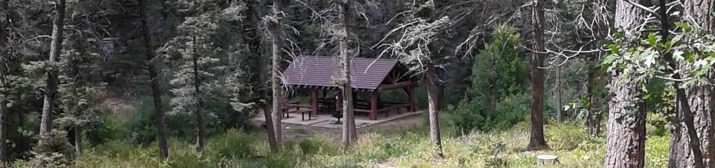
The sheltered area is a replica of a mid-1930s Civilian Conservation Corps design. The Civilian Conservation Corps (CCC) has a rich history and lasting presence throughout the Sandia’s. In their honor, we ask that you take extra care to “leave no trace” when you visit.
Recreation
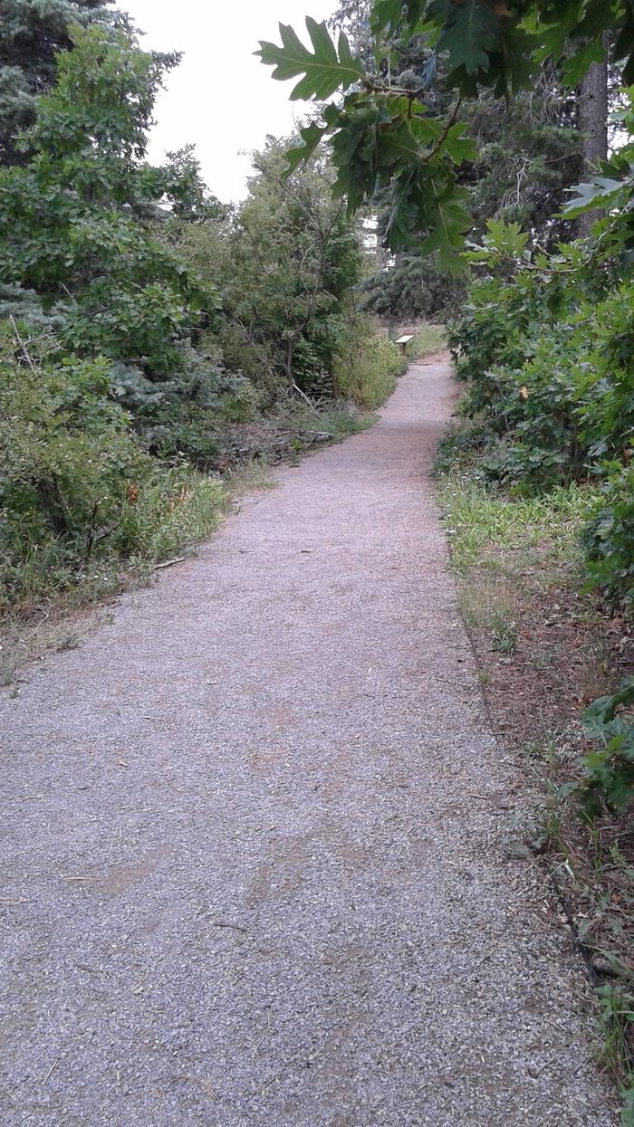
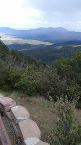
The nature trail within this picnic site is well suited for any age, young or old. It is .3 (three tenths) of a mile long, with very little elevation gain. It leads from the reserved site to an overlook at Madera Canyon. There you will find an observation deck where many lovers have sealed their devotion to one another thru wedding vows. Resting places and informative signage along the path give opportunity to relax and learn as you go.
There is also an overgrown pathway that leads northwest from Balsam Glade toward the Capulin Picnic site. These trails are suitable for children and adults to enjoy hiking in the great outdoors.
Facilities
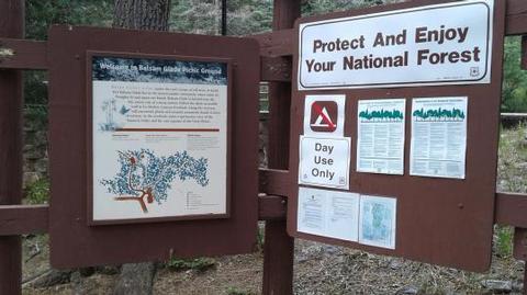
Water and electricity, firewood/charcoal are not available at the site. Accessible vault toilets and bear proof trash receptacles are provided.
Balsam Glade picnic site has one covered shelter, which is a replica of a mid-1930s Civilian Conservation Corps design. It can accommodate up to 30 people and is equipped with multiple picnic tables and grills.
PARKING: Each reservation comes with ten (10) day use parking passes which should be picked up before hand, at the Sandia Ranger Station, Monday through Friday between 8:00 a.m. and 4:30 p.m., (505) 281-3304.
Additional dispersed picnic sites, which do not require a reservation, are available on a first-come, first-served basis. Each site can accommodate a small family group and have no covering. Tables and grills provided.
Natural Features
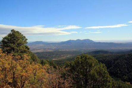
The picnic site is located at an elevation of about 8,650 feet. It is adjacent to La Madera Canyon Overlook with views of South Mountain. Elevation gain throughout this site is minimal. La Madera Overlook affords views of the eastern Sandias and beyond. Hawks and turkey vultures fly through the canyon in graceful circles scouting for food. A fault line reveals pre-Cambrian rocks intermixed with ancient Sandia granite. Mountain mahagony grows near the overlook on the sunny and drier slopes. Yucca, pinon and juniper trees grow here also, above their normal vegetation levels creating a diversified ecosystem.
Nearby Attractions
There are privately owned businesses and restaurants all along NM State Road 14 and a museum on your way up the 536 Scenic Byway.
If you are interested in taking a short jaunt to the very top of the Sandia Mountains, take a right turn out of the Balsam Glade parking area, onto the Sandia Crest 536 Scenic Byway and wind your way up. The byway extends 13.6 miles from the base of the Sandia’s to the Sandia Crest, where you will find parking, a gift store, snack bar and a lookout deck. There you can see panoramic views from any direction you look. Sunsets are spectacular. It was voted Best Place to “Pop the Question” in 2011. It is a popular path for motorcyclists, with its winding road to the peak.
The Peak area provides two launch pads for hang gliding, which is a popular sport during summer months.
Charges & Cancellations
$10.00 non refundable processing fee through recreation.gov