BIG MEADOWS RESERVOIR CAMPGROUND, CO Campground Reservation, Info, Images, Map, Directions

BIG MEADOWS RESERVOIR CAMPGROUND, Colorado Campground Images, Info & Reservations

Directions

From South Fork, Colorado, take Highway 160 for 13 miles west, turn onto Forest Road 410 SW, and go 1.8 miles to Big Meadows Campground.

Phone

435-245-6521

Activities

BOATING, CAMPING, FISHING, WILDLIFE VIEWING, DAY USE AREA

Keywords

BIGS,RIO GRANDE NF- FS

Related Link(s)

Rec Area Info & Images

Colorado State Road Conditions

Colorado State Tourism

Overview

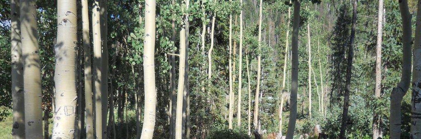
Big Meadows is located in the San Juan Mountains in south-central Colorado, about 11 miles west of South Fork. The campground is lightly wooded with spruce trees, creating a beautiful meadow atmosphere.

The Rio Grande National Forest spans 1.86 million acres in south-central Colorado. The Continental Divide runs for 236 miles along most of the forest’s western border, presenting a myriad of ecosystems from alpine desert to dense wilderness.

Recreation

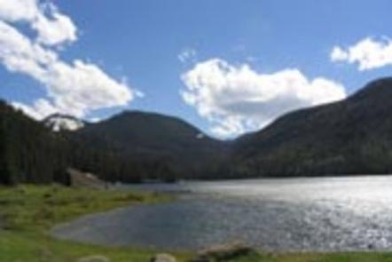
An accessible fishing pier, located on the north shore of the reservoir, allows anglers to cast for rainbow, brown and brook trout. Hunting, boating and hiking are also popular pastimes.

Hikers and horseback riders will enjoy the 6-mile Archuleta Trail. The trail accesses the Weminuche Wilderness, Colorado’s largest wilderness, which boasts the headwaters of dozens of major streams and rivers that feed into the Rio Grande and San Juan rivers.

Facilities

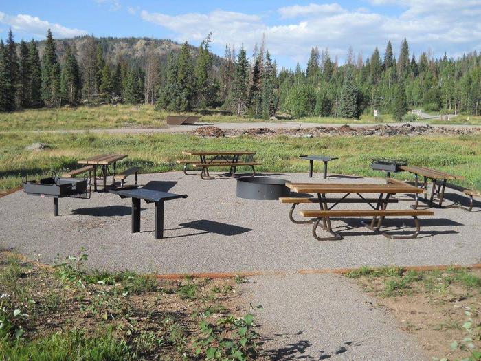
Each site has a campfire ring and picnic tables. Drinking water is available.

The nearest dump station is 13 miles away, and a boat ramp is located on the north shore of the reservoir.

Natural Features

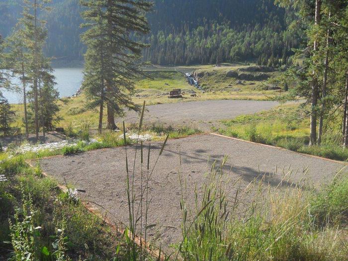
The campground meanders up a mountainside above Big Meadows Reservoir in a series of loops. As a sub-alpine region, the campground gets more rainfall than the opposite side of the lake, resulting in plentiful wildflowers and aspens surrounding the campsites.

Nearby Attractions

The surrounding area has plenty to keep visitors busy, with attractions like Great Sand Dunes National Park, Native American ruins, remnants of the Spanish Conquistadors and gold rush ghost towns. The Sangre de Cristo and San Juan Ranges are laced with trails for avid hikers.

Reservation

More from CampingHiking.net:

OPOSSUM CREEK, Illinois Campground Images, Info & Reservations

Directions From Shelbyville, Illinois, take State Route 128 north for 3.5 miles. Turn right onto County Road 1650 N. Continue nearly a mile to County Road 1880 E. Turn right and travel 0.5 mile to County Road 1600 N. Turn right again and drive one mile into the Opossum Creek

LOWRY CAMPGROUND, Colorado Campground Images, Info & Reservations

Directions From I-70, take exit 205. Travel east on Highway 6 towards Keystone, Colorado, for approximately 3 miles. Turn right on Swan Mountain Road and proceed 1.5 miles to the Lowry Campground sign. Turn left and proceed a half mile to the campground. Phone 970-468-7681 Activities BOATING, CAMPING, FISHING, HIKING,

SPURT COVE CABIN, Alaska Campground Images, Info & Reservations

Directions The cabin is accessible by boat or float plane only and the journey is about 18 miles by boat and 16 miles by plane from Petersburg. The cabin is accessible at any tide, but care should be taken when entering the cove at high tide because boats can go

KASPIAN CAMPGROUND, California Campground Images, Info & Reservations

Directions The campground is located 4 miles south of Tahoe City, on California Highway 89. Phone 530-583-3642 Activities BIKING, BOATING, CAMPING, INTERPRETIVE PROGRAMS, FISHING, HIKING, WATER SPORTS, SWIMMING SITE Keywords KASP,LAKE TAHOE,WEST SHORE,LAKE TAHOE BASIN – FS Related Link(s) Rec Area Info & Images California State Road Conditions California State

LONGSHOAL, Missouri Campground Images, Info & Reservations

Directions From Warsaw, Missouri, take Highway 7 for about 8 miles northwest. Follow signs into the campground. Phone 660-438-2342 Activities BOATING, CAMPING, FISHING, HIKING Keywords LOSH,TRUMAN LAKE,HARRY S TRUMAN Related Link(s) Rec Area Info & Images Missouri State Tourism Missouri State Road Conditions Overview Longshoal Park sits on the shores

LOWER TWIN CAMPGROUND (VA), Virginia Campground Images, Info & Reservations

Directions From John W. Flannagan Dam & Reservoir continue on RT. 739. Turn left on Rt. 611, travel 2 miles, turn left on to Corps Lower Twin Rd. Campground is .25 miles. Phone 276-835-9544 Activities BIKING, BOATING, CAMPING, FISHING, HIKING, WILDLIFE VIEWING Keywords Related Link(s) Rec Area Info & Images