MILL SPRINGS MILL SHELTER, KY Campground Reservation, Info, Images, Map, Directions

MILL SPRINGS MILL SHELTER, Kentucky Campground Images, Info & Reservations

Listen

Directions

From downtown Monticello, Kentucky: Head east on South Main Street, cross Hwy 90/Hwy 1275, continue to follow Hwy 1275, approximately 6.6 miles, 14 minutes.

Phone

606-679-6337

Activities

HISTORIC & CULTURAL SITE

Keywords

MILL SPRINGS MILL SHELTER,MILL SPRINGS

Related Link(s)

Rec Area Info & Images

Kentucky State Tourism

Kentucky State Road Conditions

Overview

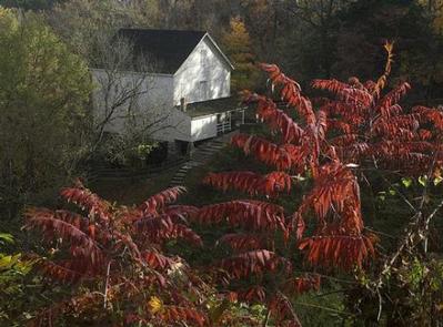
Mill Springs Mill is located at 9135 Highway 1275 North, Monticello, KY and is a day-use facility located on the shores of Lake Cumberland, overlooking the main body of the lake. There is NO overnight camping allowed in the area.

Click here for the Lake Cumberland virtual tour.

Recreation

Lake Cumberland is the largest man-made lake east of the Mississippi River. Its large surface acreage and over 1,200 miles of shoreline provide a myriad of recreational opportunities. The lake has an abundance of largemouth, smallmouth, white and Kentucky bass, bluegill, crappie, rockfish, and walleye making it a favorite among anglers.

Facilities

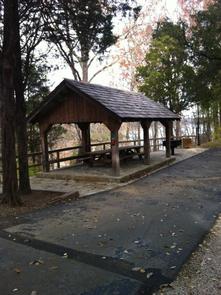
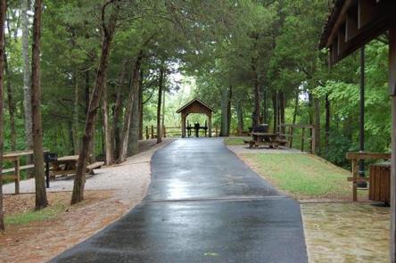
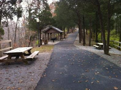
Mill Springs Mill offers a small reservable group picnic shelter and six picnic sites with tables and grills. Flush toilets, drinking water and a courtesy tie-up boat slip are also provided.

Natural Features

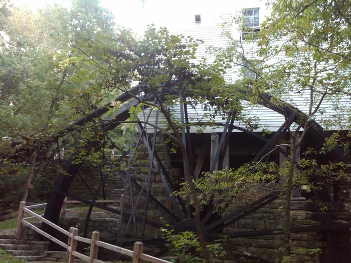
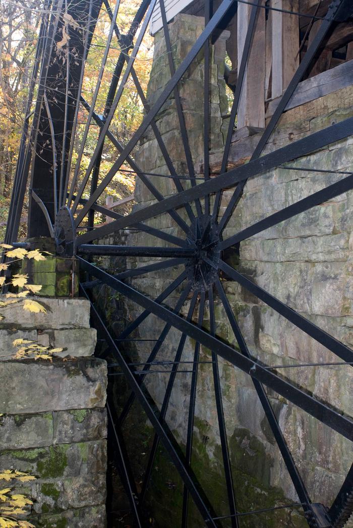
Mill Springs Mill, a water-powered grist mill listed on the National Register of Historic Places, was built in 1877 and is on the public lands of Lake Cumberland. Its 40-foot overshot water wheel is one of the largest in the world and probably the largest water wheel currently operating. The mill and water wheel were restored as a bicentennial project in 1976, and are now operated by the U.S. Army Corps of Engineers as an interpretive demonstration. Tours of the mill are conducted for the public during the recreation season.

Nearby Attractions

While visiting the Mill you can tour the historic Millers home, the Brown-Lanier house (ca.1830-1860) that was used as a headquarters and hospital during the Civil War battle of Mill Springs. Conley Bottom Marina is 10 minutes away with a campground, boat rentals, a restaurant and general store.

Reservation

More from CampingHiking.net:

White Earth Campground, Montana Campground Images, Info & Reservations

Listen Directions Heading north along MT highway 12/287 from Townsend. Drive north to the town of Winston, MT, and turn right onto Beaver Creek Road and follow the road 5.5 miles to the campground. Phone 406-475-3921 Activities BOATING, CAMPING, FISHING, WATER SPORTS, WILDLIFE VIEWING, MOTOR BOAT, KAYAKING Keywords White Earth

WOODBINE CAMPGROUND, Montana Campground Images, Info & Reservations

Listen Directions Take Montana Highways 78 and 419 south of Columbus (on 1-90) 43 miles west of Billings, Montana. Phone 406-587-9054 Activities BIKING, CAMPING, FISHING, HIKING, WILDLIFE VIEWING Keywords None Related Link(s) Rec Area Info & Images Overview Woodbine Campground is remotely located adjacent to the Absaroka-Beartooth Wilderness in southwestern

WYETH CAMPGROUND, Oregon Campground Images, Info & Reservations

Listen Directions From east or west on Oregon Interstate 84, take Wyeth exit #51. Turn west on Herman Creek Road. Wyeth Campground is 1/4 mile west of the interchange. Phone 541-308-1700 Activities BIKING, HIKING, BIRDING Keywords Related Link(s) Rec Area Info & Images Overview Wyeth Campground is just off of

SMITH SPRINGS, Tennessee Campground Images, Info & Reservations

Listen Directions From downtown Nashville, TN, take I-40 east 5 miles to exit 219. Turn right on Stewarts Ferry Pike, then left on Smith Springs Road. The recreation area is on the left after about 2 miles. Phone 615-889-1975 Activities BOATING, FISHING, PICNICKING, WILDLIFE VIEWING Keywords SMSP,J. PERCY PRIEST,PERCY PRIEST

TWOGOOD CABIN, Montana Campground Images, Info & Reservations

Listen Directions From Missoula, Montana, travel south on Highway 93 to Medicine Creek Road/Forest Service Road 370, which is approximately 36 miles south of Hamilton. Turn right and continue about 4 miles to the trailhead, which is located at Crazy Creek Campground. An easy, 6-mile hike leads to the cabin