BIG MEADOW STANISLAUS NATL FS, CA Campground Reservation, Info, Images, Map, Directions

BIG MEADOW STANISLAUS NATL FS, California Campground Images, Info & Reservations

Directions

From Arnold, California, take Highway 4 east for 25 miles to the Big Meadow Campground.

Phone

209-795-1381

Activities

BOATING, CAMPING, VISITOR CENTER, SWIMMING SITE

Keywords

BIGD,BIG MEADOW Stanislaus Nat l FS,STANISLAUS NF -FS

Related Link(s)

Rec Area Info & Images

California State Road Conditions

California State Tourism

Overview

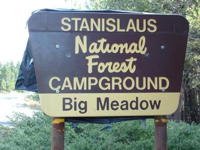
Big Meadow Campground lies at about 6,400 feet elevation on the Stanislaus National Forest. It is located 21 miles east of Arnold, California. Breathtaking views abound, and wildlife viewing opportunities include marmots, squirrels, coyotes and deer.

Recreation

Picnicking, birding and hiking are popular pastimes at Big Meadow.

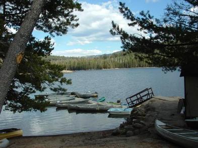
Lake Alpine and Spicer Meadow Reservoir, both just a 15 minute drive away, offer fishing and other water activities.

Facilities

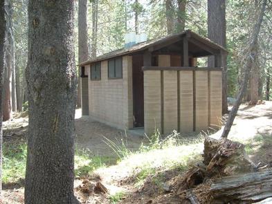
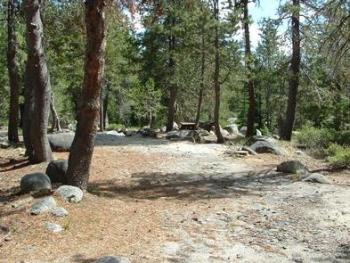
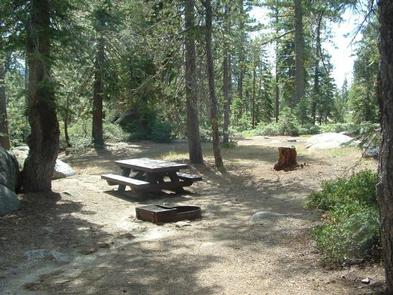
Big Meadow has 65 individual camping units and a group site. The group camp, easily accessible from Highway 4, can accommodate a maximum of 50 guests and 20 vehicles. Vault toilets and drinking water are among the conveniences found here. Pets are allowed.

Natural Features

Situated in the central Sierra Nevada Mountains, Stanislaus National Forest is sandwiched between the well-known destinations, Lake Tahoe and Yosemite. It boasts gorgeous views of snow-capped mountain peaks and California’s Great Central Valley.

Reservation

More from CampingHiking.net:

STUB CREEK CABIN, Colorado Campground Images, Info & Reservations

Directions From Fort Collins, get off I-25 at the Mulberry Street/Highway 14 exit. Travel west on Mulberry to Riverside Ave, then north on College Avenue to Highway 287. Turn left and go west on Highway 14 (Poudre Canyon) for about 60 miles, to County Road 103. Go north on County

TOMPKINS BEND, Arkansas Campground Images, Info & Reservations

Directions From Hot Springs, Arkansas, take US 270 west approximately 24.5 miles to Tompkin Bend Road. Turn right and follow access road 2.4 miles north to park. From Mount Ida, Arkansas, take US 270 east about 10.7 miles to Tompkins Bend Road. Turn left and follow access road 2.4 miles

WAWONA, California Campground Images, Info & Reservations

Directions Take Highway 41 north from Fresno, Highway 140 east from Merced, or Highway 120 east from Manteca into Yosemite National Park. Follow signs to Wawona. The campground is located 8 miles inside of the park on Highway 41, and 27 miles south of Yosemite Valley. Phone 209-375-9535 Activities CAMPING