
Directions
Bucks Lake is 10 miles west of Quincy on the Oro-Quincy Highway (Highway 162). From Oroville, travel east on Highway 162 for approximately 45 miles to Bucks Lake Dam Road. Turn left and continue 3 miles to the campground.
Phone
530-283-0555
Activities
BOATING, CAMPING, FISHING, HIKING, SWIMMING SITE
Keywords
HUTC,BUCKS LAKE GROUP SITES,PLUMAS NATIONAL FOREST GROUP S,PLUMAS NF – FS
Related Link(s)
California State Road Conditions
Overview
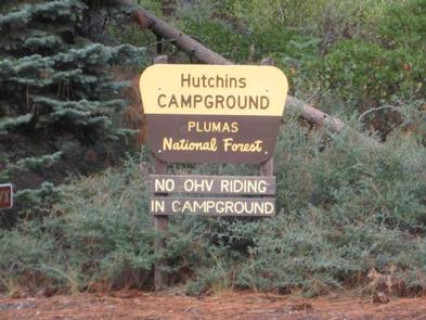
Hutchins Campground is within walking distance of beautiful Bucks Lake, which boasts clear water and sandy beaches, surrounded by the Plumas National Forest. It is a popular recreation destination for visitors driving through the Feather River Canyon or coming from the Reno area.
Bucks Lake wilderness area is home to numerous mountain creeks and meadows, with great loop trails, providing ample opportunity to enjoy the outdoors.
Recreation
Boating, swimming and fishing are popular activities enjoyed by visitors during spring, summer and fall months. Anglers can enjoy a variety of fishing opportunities, including plentiful salmon and trout. Winter season offers various skiing and snow activities, especially snowmobiling.
Hiking is also available, with the Pacific Crest Trailhead and others very close to the campground. Trailheads with parking are within 3 miles of the campground and a foot trail for day walks and fishing follows the perimeter of the lake shore.
Facilities
The campground offers three large group campsites for tent and RV camping. Each site has a limit of eight vehicles and 24 people.
Multiple tables and campfire rings with grills are provided, as well as vault toilets and drinking water. A campground host is available on-site to answer questions and provide additional information.
There are several boat ramps available around the perimeter of the 1,820-acre lake, including the closest one to Hutchins, at Sandy Point. A convenience store with gas, phone and propane is located within five miles of the campground.
Natural Features
At a 5,000-foot elevation, Hutchins campground is settled in a mix of pine trees that provide the area with sufficient shade. Various birds and wildlife, including osprey and bald eagles, make their home in, and migrate through the region.
Nearby Attractions
The campground is located within walking distance of Bucks Lake. Bucks Lake Wilderness borders the lake and the Pacific Crest National Scenic Trail System traverses the surrounding area. A wilderness permit is not required; however, it is advised that hikers and backpackers leave an itinerary at the trailhead or with campground host.