

Directions
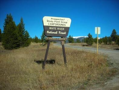
From I-70, take the Silverthorne exit 205. Travel east on Highway 6, approximately 4 miles to Swan Mountain Road. Turn right and travel for 2 miles to Prospector and Windy Point Campground sign. Take dirt road 1 mile to campground entrance.
Phone
970-468-7681
Activities
BIKING, BOATING, CAMPING, FISHING, HIKING, WILDLIFE VIEWING
Keywords
PROS,WHITE RIVER NF -FS
Related Link(s)
Colorado State Road Conditions
Overview
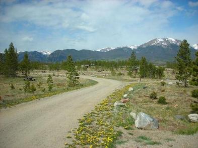
At an elevation of 9,000 feet, Prospector Campground is in the heart of Summit County in the White River National Forest.
The sites offer open views to Dillon Reservoir and several mountain ranges, an ideal setting for guests seeking recreation and relaxation.
Due to the pine beetle infestation and removal of hazard trees, there is little or no shade in the campground.
Recreation
Dillon Reservoir, often referred to as Lake Dillon, is the greatest draw to this campground. At 3,233 acres and 26.8 miles of shoreline, Dillon Reservoir is an ideal spot for fishing, boating, and sailing. The reservoir supports a healthy population of rainbow trout and brown trout. Occasionally, a few cutthroat trout make their way into the lake from feeder streams.
Opportunities for hiking and biking include more than 7 paved miles of the 50-mile Summit County trail system.
From the reservoir, the Old Dillon Reservoir trail is a favorite. This short, easy trail has spectacular views of the Tenmile Range and the Continental Divide. The Old Dillon Reservoir was built in the 1930s to supply water to the original town of Dillon, which is now covered by the new Dillon Reservoir.
For those wanting a bit more solitude, hiking in the Ptarmigan Wilderness area is a wonderful escape from the crowds.
Facilities
Prospector Campground has 105 sites, able to accommodate tents, trailers, and RVs. Roads and spurs are not paved.
The campground is equipped with picnic tables, campfire rings, vault toilets, and drinking water. No electrical hook-ups are available. Firewood is for sale from hosts at the campground.
Boat ramp access is available in the marinas located in the nearby towns of Frisco and Dillon.
Natural Features
In the heart of the Rocky Mountains, the 2.3 million acre White River National Forest is a place of serenity and adventure, boasting 8 wilderness areas, 4 defined seasons, and 10 peaks surpassing 14,000 feet in elevation.
Wildlife in the area abounds. Bighorn sheep navigate rocky ridges and bull elk bugle at dusk. Scenic rivers sustain populations of cutthroat, rainbow, and brown trout. Alpine regions provide habitat for pika and ptarmigan. These species, along with many others, depend on surrounding undeveloped wilderness, clean streams, and diverse forests to live.
Nearby Attractions
Arapahoe Basin, Keystone, Breckenridge, and Copper Mountain ski resorts are all located within 10 miles from Dillon Reservoir. These resorts stay open year round.
Charges & Cancellations
A $10.00 service fee will apply if you change or cancel your reservation. Late cancellations are subject to additional fees. For full details see NRRS Reservation Policy.