KELLY DAHL, CO Campground Reservation, Info, Images, Map, Directions

KELLY DAHL, Colorado Campground Images, Info & Reservations

Directions

From Denver, go north on Interstate 25 to US Highway 36 west to Boulder. Take Colorado Highway 119 (Canyon Boulevard) west for 22 miles to Nederland. Continue south for 4 miles to the campground.

Phone

303-541-2500

Activities

CAMPING, HIKING, HORSEBACK RIDING

Keywords

KELD,KELLY DAHL,ARAPAHO AND ROOSEVELT NF – FS

Related Link(s)

Rec Area Info & Images

Forest Service Concessionaire

Colorado State Tourism

Colorado State Road Conditions

Overview

Kelly Dahl Campground is located adjacent to the Peak-to-Peak Scenic Byway, near the historic mining towns of Nederland, Rollinsville, Central City and Black Hawk.

Recreation

Although no formal trails exist in the campground, a few closed roads offer campers the opportunity to explore the surrounding area. West Magnolia and East Portal Trailheads offer trails within a short drive. The Rollins Pass Road (Moffat Road) and other off-road routes can be found in the vicinity.

The lakes across the highway are on private property and access is prohibited.

Facilities

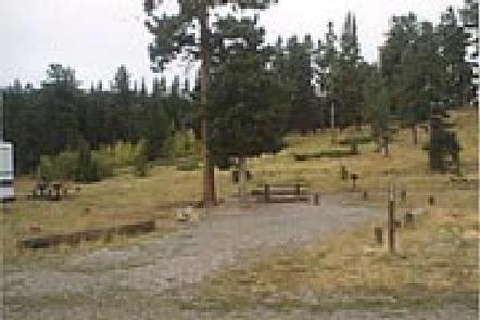
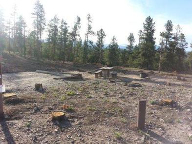
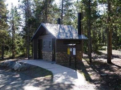
The campground offers 46 single-family sites that will accommodate tents, trailers or RVs. Campsites #1 through #20 are first-come, first-served. Each site is equipped with a picnic table and campfire ring with grill. There is a maximum of eight people per site. Vault toilets, drinking water, and trash collection are provided throughout the campground. Firewood is for sale in campground. The road through the campground is gravel/dirt.

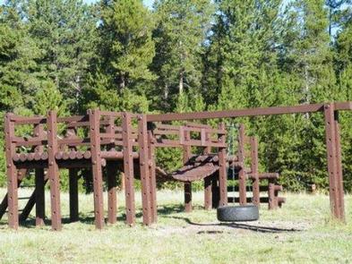
A playground suitable for small children is located within the campground.

Natural Features

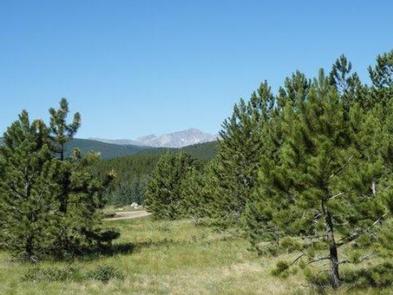
The campground is situated among ponderosa pines, on a gentle slope, at an approximate elevation of 8,600 feet.
Due to the mountain pine beetle infestation and consequent hazardous tree removal, the campground offers little to no shade.

Nearby Attractions

The town of Nederland, which is four miles north of the campground, offers grocery and hardware stores, restaurants, gas, a post office, bank and Barker Reservoir.

Reservation

More from CampingHiking.net:

LOS PRIETOS, California Campground Images, Info & Reservations

Directions From Highway 101 in Santa Barbara, turn east onto Highway 154 and continue about 11 miles. Turn onto Paradise Road and travel about 3 miles to the campground. Phone 805-434-1996 Activities BIKING, CAMPING, FISHING, SWIMMING SITE Keywords LOSP,Santa Ynez Recreation Area,Los Padres National Forest,LOS PADRES NF -FS Related Link(s)

BALSAM, Utah Campground Images, Info & Reservations

Directions From I-15 take Springville exit 260. Continue east, towards Springville, through the intersection of Main Street and Highway 400 South. At the four-way stop at the end of 400 South, turn right onto Canyon Road. Keep heading east up Canyon Road for about 6 miles. After passing Hobble Creek

Trapper Creek Campground, Oregon Campground Images, Info & Reservations

Directions From I-5 take exit 188A, heading west on Highway 58 for 62.4 miles, then continue 1.9 miles south on Road 5810 to the campground. Phone 541-323-1746 Activities BIKING, BOATING, CAMPING, FISHING, HIKING, WATER SPORTS, SWIMMING SITE Keywords TRPC,Trapper,Trap,Shelter Cove,Odell,Trapper Creek,Trapper Creek Campground Related Link(s) Rec Area Info & Images

WILBUR D. MILLS, Arkansas Campground Images, Info & Reservations

Directions From Dumas, Arkansas, travel north on US-165 for 9 miles to State Route 212. Turn right and continue 4 miles east, through Pendleton Bend Park, to the campground. Phone 870-548-2291 Activities BOATING, CAMPING, FISHING, HIKING, HUNTING, BIRDING Keywords WILB,WILBUR D. MILLS LOCK AND DAM,WILBUR MILLS PARK,MILLS PARK,WILBUR D MILLS,WILBUR

BLACKHAWK, Utah Campground Images, Info & Reservations

Directions From I-15, take exit 250 toward North Payson/Salem and proceed south on Main Street, then turn east onto 100 North/Highway. Turn south onto 600 East, which becomes the Nebo Loop Scenic Byway/Payson Canyon Road. Travel up the canyon to the campground. Phone SPANISH FORK RANGER DISTRICT 801-798-3571 OR UTAH

FAIRVIEW CAMPGROUND, California Campground Images, Info & Reservations

Directions Off of Highway 99 in Bakersfield, California, take Highway 178 east to Lake Isabella. From Lake Isabella take Highway 155 around the west side of the lake to the town of Kernville. From Kernville go north on Sierra Way/Mountain 99 for 16 miles to the campground. Phone 760-376-1815 Activities