

Directions
In summer: from Crouch, take Middle Fork Road/Forest Road 698 north 24 miles to the cabin. In winter, all access is over snow. From Crouch, take Middle Fork Road (Forest Road 698) north 13 miles to the snowmobile parking lot at the end of the plowed road on FR 698, just north of Tie Creek Campground. Distance to the cabin from the trailhead is 11 miles.
Phone
541-351-1182
Activities
BIKING, BOATING, CAMPING, FISHING, HUNTING, WINTER SPORTS, SWIMMING SITE
Keywords
BOIL,BOISE NF – FS
Related Link(s)
Overview
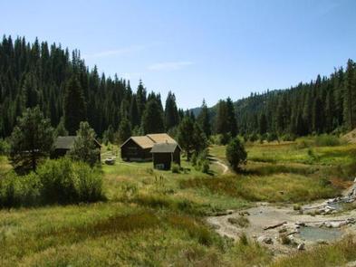
Boiling Springs Cabin is a popular destination for those who enjoy soaking in mineral hot springs that are adjacent to the cabin. Other hot springs are within the vicinity as well. Guests who stay here also have a variety of other recreational activities to enjoy, such as fishing, hiking, and off-road motor vehicle riding.
The cabin was renovated in 2012 and offers many conveniences, but guests should bring some supplies and equipment to ensure a comfortable and enjoyable stay.
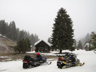
The cabin is accessible by car in warmer months and by snowmobile in winter. Guests arriving in snowy conditions should be prepared to snowmobile 11 miles to the cabin from the Middle Fork snowmobile parking lot.
Recreation
Numerous hiking, biking, horse and off-road vehicle trails are in the vicinity, including the Middle Fork Trail. Many miles of groomed snowmobile trails criss-cross the area in winter. Snowshoers and cross-country skiers can also use the trails in winter.
Sections of the Middle Fork Payette River offers opportunities for rafting, canoeing, kayaking, and swimming. Anglers can fish for rainbow and bull trout. Big game hunting is a popular activity in the surrounding mountains.
Guests can soak in the on-site hot springs during their stay, and a few other hot springs are also nearby for soaking.
Facilities
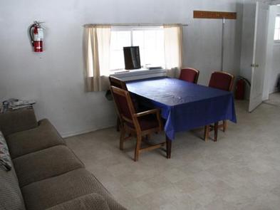
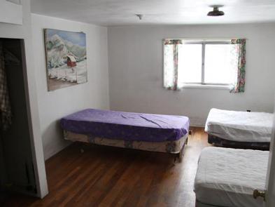
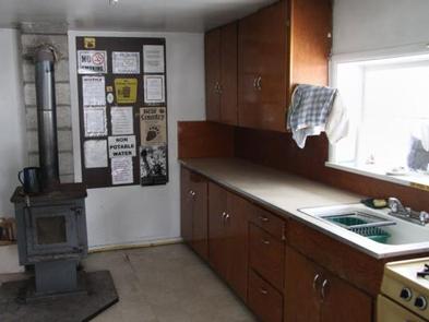
The cabin accommodates five people. Sleeping quarters consist of one bedroom with wood stove and includes three single beds (one providing a trundle bed) with mattresses. A couch, table and chairs, sink, propane cook range and refrigerator, and wood stove are located in the front room. Some dishes, pots and pans, and other kitchenware are available. Firewood is provided October 15 through December 31, but it may need to be split.
A vault toilet, picnic table and campfire ring are located outside the cabin. Camp hosts are available during the summer months at Trail Creek Campground and Boiling Springs Campground.
Potable water is available (hand pump outside) during the summer season only. Electricity is not available. Guests need to supply their own lighting and garbage bags. Guests are expected to clean the cabin before leaving. Bedding, pillows, and an axe are not provided.
Natural Features
Boiling Springs Cabin is located at an elevation of 4025 ft. in a narrow mountain valley situated between a hot springs, a stream, and the Middle Fork Payette River. The surrounding mountains are steep and densely forested with conifers, but the cabin sits in an open meadow with little shade.
Wildlife enthusiasts may spot nesting ospreys along the Middle Fork Payette River. Elk and deer are often spotted grazing along its banks. Bald eagles, hawks, quail and a variety of waterfowl also inhabit the area.