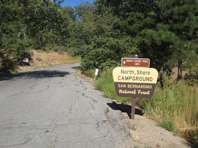
NORTH SHORE (CA), CA Campground Reservation, Info, Images, Map, Directions

NORTH SHORE (CA), California Campground Images, Info & Reservations

Directions

From San Bernardino, take Highway 18 about 20 miles to the Lake Arrowhead exit. Take Highway 173 for 5 miles to the northeast side of the lake. Turn right on Hospital Road and follow it to the campground.

Phone

909-866-8550

Activities

BOATING, CAMPING, FISHING, HIKING, SWIMMING SITE

Keywords

SAN BERNARDINO NF – FS

Related Link(s)

Rec Area Info & Images

California State Road Conditions

California State Tourism

Forest Service Concessionaire

Overview

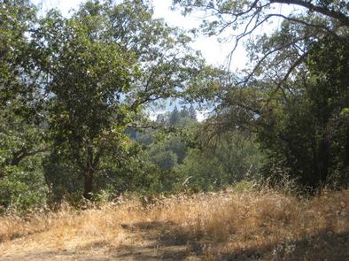
North Shore Campground is a quiet place to camp, away from the hustle and bustle of nearby cities. The campground is nestled among Southern California’s pine-covered mountains, providing ample opportunity for outdoor relaxation and recreation.

Recreation

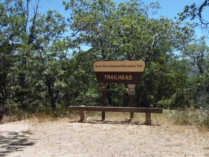
The North Shore National Recreation Trail connects the campground with Papoose Lake (trail is not accessible). The 1.7-mile trail descends through a mixed conifer forest and settles along Little Bear Creek, providing scenic views of the surrounding area. Please note, nearby Lake Arrowhead is a private lake.

Facilities

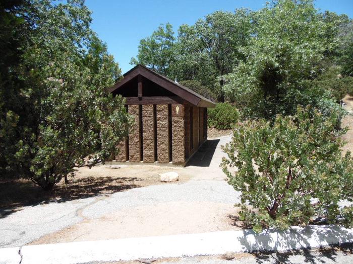
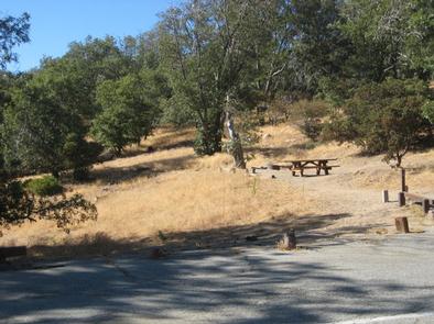
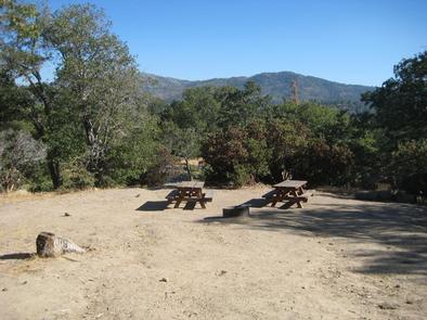
The campground offers multiple single-family campsites, available mostly for tent camping. Some sites can accommodate RVs, but hookups are not available. Each site is equipped with a table and campfire ring with grill. Flush toilets and drinking water are provided.

Natural Features

The campground is located 23 miles northeast of San Bernardino in the San Bernardino National Forest. It is about 3 miles from the community of Lake Arrowhead. Settled in an oak woodland environment, the campground is close to many outdoor amenities.

Nearby Attractions

Lake Gregory is located 20 minute away and offers fishing, boat rentals and a waterslide park.

Reservation

More from CampingHiking.net:

COTTONSHED PARK (AR), Arkansas Campground Images, Info & Reservations

Directions Approximately 5 miles south of Mineral Springs on Highway 355, turn right / west onto Bright Star Road travel approximately 3 miles, turn left / south onto Cottonshed Lane. OR North on Hwy 355 approximately 5 miles, turn left / west onto Bright Star Road travel approximately 3 miles,

PORTAL BUNKHOUSE, Arizona Campground Images, Info & Reservations

Directions From Tucson, take I-10 east for 139 miles to Road Forks, NM. Turn right (south) on US 80 and drive 28 miles to Portal Road. Turn right (west) and drive 7 miles through the town of Portal. Turn left on Forest Road 42 for approximately 1 mile. The Bunkhouse

HOSPITAL FLAT, California Campground Images, Info & Reservations

Directions From Kernville, go 6.5 miles north on Sierra Way (Mountain 99) to the campground. Phone 760-376-1815 Activities BOATING, CAMPING, FISHING, SWIMMING SITE Keywords HOSP,KERN RIVER,UPPER KERN CANYON,SEQUOIA NF – FS Related Link(s) Rec Area Info & Images California State Tourism Forest Service Concessionaire California State Road Conditions Overview Hospital

DOYLE CREEK CAMPGROUND, Wyoming Campground Images, Info & Reservations

Directions From Buffalo, WY, take US Hwy 16 west 24 miles to County Rt. 3 (Hazelton Road). Turn left onto Hazelton Rd., and go 6.2 miles to campground turn off. Turn left and go 0.3 miles. Phone 406-587-9054 Activities BIKING, BOATING, CAMPING, FISHING, HIKING, WILDLIFE VIEWING, OFF ROAD VEHICLE TRAILS,

FISHHOOK PARK, Washington Campground Images, Info & Reservations

Directions From Pasco, Washington, take Highway 12 east. After crossing the Snake River Bridge, take the first exit and head east on State Route 124. Continue for 19 miles, then turn left, heading north on Fishhook Park Road. Follow for 4 miles to the park entrance; the campground is on