BLUE MEADOW, WV Campground Reservation, Info, Images, Map, Directions

BLUE MEADOW, West Virginia Campground Images, Info & Reservations

Directions

From White Sulphur Springs, travel 8 miles north on State Route 92. Turn left (west) at Alvon, West Virginia, onto State Route 16. Travel 4 miles to the recreation area.

Phone

304-536-2144

Activities

CAMPING, FISHING, HIKING, WILDLIFE VIEWING, SWIMMING SITE

Keywords

BLUM,MONONGAHELA NF -FS

Related Link(s)

Rec Area Info & Images

West Virginia State Road Conditions

West Virginia State Tourism

Overview

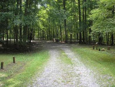
Blue Meadow is a group campground. In the event that this campground has not been reserved, it may be opened for overflow. At this time, sites 1-17 may be claimed as individual campsites on a first come, first serve basis.

Recreation

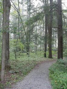
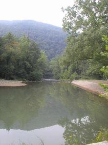
Anthony Creek attracts anglers looking for trout. The “Blue Hole” in the creek is a favorite spot for swimming. Nearby Big Draft Wilderness provides an opportunity to explore more remote areas of teh Forest.  Anthony Creek Trail follows the creek in a narrow valley filled with rhododendron and many flowering forest trees. Blue Bend Loop Trail offers 3 scenic overlooks.  Both trails are recommended for hikers and bird watchers.

Facilities

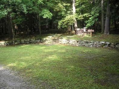
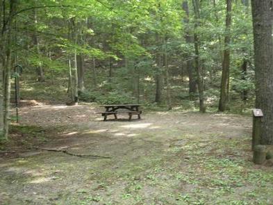
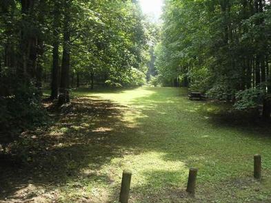
Blue Meadow’s group campground is divided into 17 campsites, including 4 walk-to sites. It comes with picnic tables, grills, lantern posts and trash collection services.

Vault toilets are available, but drinking water is not on-site. Drinking water can be accessed from the Blue Bend Campground.

Natural Features

At an elevation of 1,860 feet, the campground is in a pleasant, wooded valley along Anthony Creek. Across the creek lies Round Mountain.

The Monongahela National Forest comprises about a million acres of forest that attracts 1.3 million visitors each year. A variety of animals make their home here, including black bear, coyote, wild turkey, white-tailed deer, red and gray fox, bobcat, fisher, otter and mink.

Nearby Attractions

The Greenbrier Resort in White Sulphur Springs, West Virginia is a 15 minute drive. The West Virginia State Fair, held in August each year, is located 30 minutes away in Lewsiburg, West Virginia.

Reservation

More from CampingHiking.net:

BOCA SPRING, California Campground Images, Info & Reservations

Directions From Reno, take I-80 west to Hirschdale Exit. Go north approximately 3 miles then turn right and go 1 mile to the campground. From Truckee, take I-80 east to Hirschdale exit. Turn left and travel approximately 3 miles then turn right and go 1 mile to the campground. Phone

LIZ CREEK CABIN, Idaho Campground Images, Info & Reservations

Directions There are no services located on the district, so travelers should have plenty of gas, food and water for their visit, including planning for possible emergency situations. The travel route to the cabin can be quite challenging even treacherous at times, as the gravel roads on the district can

SHADY COVE GROUP CAMPGROUND, California Campground Images, Info & Reservations

Directions From Running Springs, drive approximately one mile on Highway 18 to the Deerlick Ranger Station/Children’s National Forest Visitor Center. Turn right on Keller Peak Road and continue about five miles. Follow signs to the campground. Phone 909-866-8550 Activities BIKING, CAMPING, INTERPRETIVE PROGRAMS, FISHING, HIKING, WILDLIFE VIEWING Keywords SHAC,Shady Cove,Children’s

PINE CREEK COVE, Oklahoma Campground Images, Info & Reservations

Directions From Valliant, OK, travel Pine Creek Road 7 miles north to the access road. Follow signs into the campground. Phone 580-933-4215 Activities BOATING, CAMPING, FISHING, PICNICKING, DAY USE AREA, SWIMMING SITE, SWIMMING, WATER ACCESS Keywords PICR,PINE CREEK LAKE,PINE CREEK LAKE Related Link(s) Rec Area Info & Images Oklahoma State

GONE CREEK, Oregon Campground Images, Info & Reservations

Directions From Sandy, Oregon, travel east on Highway 26 for approximately 40 miles to Skyline Road/Road 42. Turn right on Skyline Road and continue south for about 9 miles. Turn right on Forest Service Road 57 and travel west for 1 mile, then turn right again at the Gone Creek