COLORADO CAMPGROUND, CO Campground Reservation, Info, Images, Map, Directions

COLORADO CAMPGROUND, Colorado Campground Images, Info & Reservations

Directions

From the I-25 and Highway 24 intersection in Colorado Springs, travel west on Highway 24 for about 18 miles to the intersection with Highway 67 in Woodland Park. Turn right (north) on Highway 67 and drive about 6.7 miles to Colorado Campground. The campground is on the right side of the road.

Phone

719-636-1602 (INFORMATION ONLY, NO RESERVATIONS TAKEN AT THIS NUMBER)

Activities

BIKING, BOATING, CAMPING, FISHING, HIKING, DAY USE AREA

Keywords

COLO,WOODLAND PARK,MANITOU LAKE,PIKE AND SAN ISABEL NF- FS

Related Link(s)

Rec Area Info & Images

Colorado State Road Conditions

Colorado State Tourism

Forest Service Concessionaire

Overview

Colorado Campground is a favorite family destination near Manitou Lake Picnic Area north of the town of Woodland Park. A short trail leads to the lovely lake, where visitors enjoy fishing, bird watching and canoeing.

Recreation

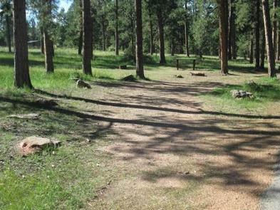
Manitou Lake offers trout fishing and lakeside picnicking. Canoeing on the small lake is also a popular activity. The Centennial Bike Trail, a paved, accessible recreation trail, connects Colorado Campground to Manitou Lake Picnic Area and South Meadows Campground. The trail is popular among hikers, roller bladers and bicyclists. The nearby Rainbow Falls OHV Trail System and North Divide OHV Trail System are recommended for off-road vehicle enthusiasts.

Facilities

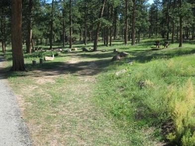
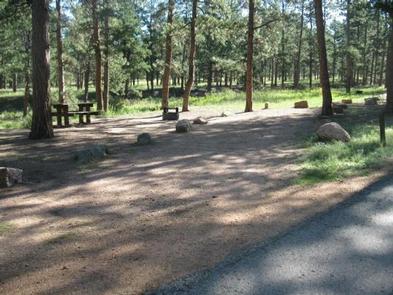
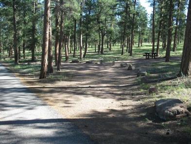
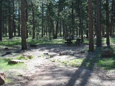
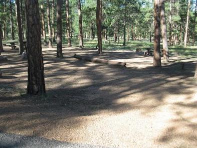
The campground offers single and double-family campsites. Picnic tables and campfire rings are provided, as are vault toilets, drinking water and trash collection. The road is paved and parking spurs are gravel. Campfire programs are held at the campground’s amphitheater on most Saturday evenings.

Natural Features

The campground is situated at 7,800 feet in a ponderosa pine forest near the 5-acre Manitou Lake. The campground lies in the Front Range of the Rocky Mountains, due north of Pikes Peak. Pikes Peak summit reaches an elevation of 14,115 feet and is America’s easternmost peak over 14,000 feet.

Nearby Attractions

Colorado Springs is about 25 miles southeast of the campground and offers many services. Garden of the Gods is a popular attraction just outside of town. This free park offers hiking trails, rock climbing routes, a visitor center and cafe. Pikes Peak lies west of Manitou Springs, which is about 20 miles from the campground. Visitors can hike, or drive to the summit of this beautiful mountain. The town of Woodland Park, located 6 miles south of Colorado Campground, offers gas, groceries, dining and shopping.

Reservation

More from CampingHiking.net:

SILVER CREEK-TRUCKEE, California Campground Images, Info & Reservations

Directions From Truckee, travel south on Highway 89 for about 8 miles. Campground is on the left. Phone (530)587-3558. FOR RESERVATIONS, PLEASE CALL: 1 (877) 444-6777. Activities BIKING, CAMPING, FISHING, HIKING, SWIMMING SITE, MOUNTAIN BIKING, WATER ACTIVITIES, WATER ACCESS Keywords SICR,SILVER CREEK TRUCKEE,TAHOE NF – FS Related Link(s) Rec Area

SPRING CREEK CAMPGROUND, Idaho Campground Images, Info & Reservations

Directions From Weiser, Idaho, travel north on Highway 95 for approximately 12 miles, then turn onto Upper Mann Creek Road/Forest Road 009 and travel another 18 miles to the campground. Phone 208-549-4200 Activities BIKING, CAMPING, FISHING, HIKING, HUNTING, WILDLIFE VIEWING, DAY USE AREA Keywords SPCK,SPRING CREEK GROUP SITE,SLEEPING SPRINGS INTERPRETATION,PAYETTE

TURKEY CREEK, Oklahoma Campground Images, Info & Reservations

Directions From Broken Bow, OK, travel Highway 3 west for 28 miles to the entrance sign. Follow access road north 5 miles to the campground. Phone 580-876-3720 Activities BOATING, CAMPING, FISHING Keywords TURK,PINE CREEK LAKE,PINE CREEK LAKE Related Link(s) Rec Area Info & Images Oklahoma State Road Conditions Oklahoma State

MORGANTON POINT, Georgia Campground Images, Info & Reservations

Directions Take U.S. Highway 515 north from Blue Ridge for 4 miles to Georgia Highway 60. Turn right (southwest) and continue 3 miles to the town of Morganton. In Morganton, turn right on County Road 616 (Lake Drive) and proceed for 1 mile. To enter the campground, take the first

YAAK RIVER DAY USE AREA, Montana Campground Images, Info & Reservations

Directions From Troy, travel west on Highway 2 for approximately 7 miles. The fee station and campground hosts are located on the east side of the road, prior to crossing the Yaak River. Phone 406-295-4693 Activities BIKING, BOATING, HISTORIC & CULTURAL SITE, CAMPING, FISHING, HIKING, WILDLIFE VIEWING, SWIMMING SITE Keywords

ROCK CREEK PAVILION, Oregon Campground Images, Info & Reservations

Directions From Roseburg, travel east on Highway 138 for 22 miles. Turn left (north) on Rock Creek Road and proceed 6.5 miles. Enter Rock Creek Campground and make an immediate right. Phone 541-440-4930 Activities BIKING, CAMPING, FISHING, HIKING, WATER SPORTS, FISH HATCHERY, SWIMMING SITE Keywords RCPA,rockcreek Related Link(s) Rec Area