


Directions
From the I-25 and Highway 24 intersection in Colorado Springs, Colorado, travel west on Highway 24 for about 18 miles to the junction with Highway 67 in Woodland Park. Turn right (north) on Highway 67 and drive about 7 miles to Painted Rocks Road and turn left (west). Take the gravel road about 1/2 mile to campground entrance on the left.
Phone
719-636-1602 (INFORMATION ONLY, NO RESERVATIONS TAKEN AT THIS NUMBER)
Activities
BIKING, BOATING, CAMPING, FISHING, HIKING
Keywords
PAIN,MANITOU LAKE,PIKE AND SAN ISABEL NF- FS
Related Link(s)
Colorado State Road Conditions
Overview
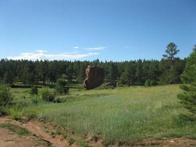
Painted Rocks Campground is located a short distance from Manitou Lake Picnic Area and the Centennial Bike Trail in central Colorado. The rustic campground is named for the sandstone outcroppings in the area that resemble colorful streaks from an artist’s paintbrush.
Recreation
The paved, accessible Centennial Bike Trail is a half-mile from the campground. It connects to nearby Colorado and South Meadows Campgrounds, and leads to 5-acre Manitou Lake. Visitors enjoy riding bicycles on this trail to Manitou Lake for fishing and bird watching. Waterfowl and songbirds are often seen in the area.
The nearby Rainbow Falls OHV Trail System and North Divide OHV Trail System are recommended for off-road vehicle enthusiasts.
Facilities
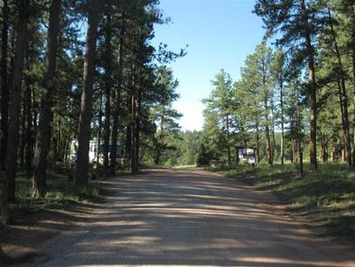
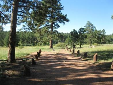
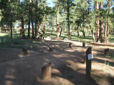
The campground offers single-family sites on two loops. Each site is equipped with a picnic table and campfire ring. Vault toilets, drinking water and trash collection are provided. Roads and parking spurs are gravel.
Natural Features
The campground is nestled on the edge of a grassy meadow at an elevation of 7,800 feet. Most sites on the west loop are shaded by ponderosa pines, while sites on the east loop are more open and less shady.
Nearby Attractions
The town of Woodland Park is located approximately 7 1/2 miles south of Painted Rocks Campground, where campers can find gas, groceries, dining and shopping. Colorado Springs is about 30 miles southeast of the campground and offers many services. Garden of the Gods is a popular attraction just outside of town. This free City of Colorado Springs park offers hiking trails, rock climbing routes, a visitor center and cafe. Pikes Peak lies west of Manitou Springs, which is about 25 miles from the campground. Visitors can hike, bike, or drive to the summit of this beautiful mountain.
Charges & Cancellations
A $10.00 service fee will apply if you change or cancel your reservation. Late cancellations are subject to additional fees. For full details see NRRS Reservation Policy.