


Directions
From Placerville, drive 21 miles east on Highway 50, turn left on Ice House Road and go 23 miles north to the Robbs Hut Road turnoff. Look for small sign and turn left on dirt road. In winter, park here and ski or hike 3 miles along the road to the hut. In summer, use combination to access both gates and drive up. Follow blue arrows to the hut.
Phone
530-644-2324
Activities
BIKING, CAMPING, HIKING
Keywords
ROBB,Crystal Basin,Icehouse Road,ELDORADO NF – FS
Related Link(s)
California State Road Conditions
Overview
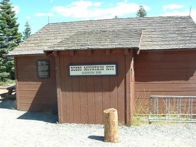
Robbs Hut offers a peaceful, rustic getaway with phenomenal views of the Sierra Nevada. The cozy, yet minimalistic cabin is open year-round and can be accessed by car in warmer months. From November to mid-June, guests can expect to hike, snowshoe or ski up a 3-mile trail with a 1,000-foot elevation gain to reach the hut. This trail runs along Robbs Road from Ice House Road.
Originally a sleeping quarters for rangers of the adjacent Forest Service lookout from 1934 to 1978, the hut makes an ideal recreation spot with mountain biking and off-road vehicle trails nearby. The lookout is open to the public for day use.
Recreation
Mountain biking, hiking and cross country skiing are popular activities for visitors. Access by skis to the cabin is recommended for intermediate to advanced skiers.
Facilities
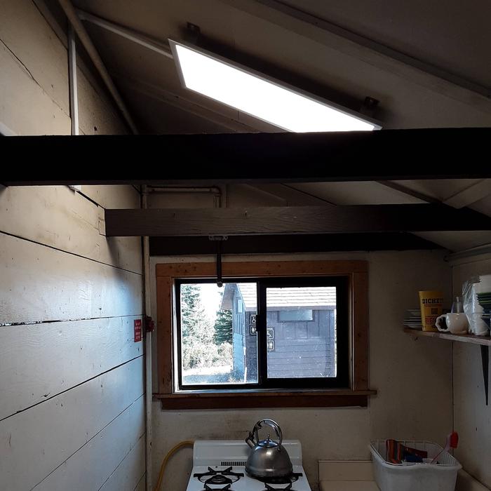
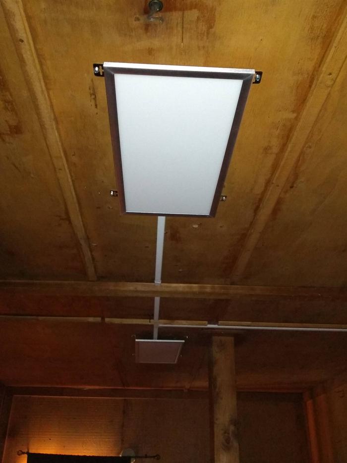
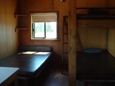
The hut is equipped with a propane heater and a cookstove. The cookstove is served by piped-in propane, and there is a newly installed solar lighting system. Other amenities include three sleeping platforms (3/4 inch width), mattresses, four wool blankets, a shovel, bucket and cleaning supplies. Outside on the stone deck by the lookout are a charcoal grill, campfire ring, picnic table and vault toilet building.
No water, electricity or garbage service are available. Guests must bring their own supply of water and garbage bags. Additional items to bring include food, cooking utensils and pots, sleeping bags, toilet paper, first aid supplies, matches and a flashlight. Click here for more cabin details.
Natural Features
Perched atop Robbs Peak at an elevation of 6,686 feet, the hut boasts panoramic views of the Crystal Range in the Desolation Wilderness and the Sacramento Valley. The peak is part of the Sierra Nevada Mountains in Eldorado National Forest and sits in a clearing surrounded by Jeffrey and Ponderosa pine.
Nearby Attractions
The nearest phone a pay phone at the Crystal Basin Information Station on Ice House Road, 13 miles southwest of the hut. This station is open in summer only.