BUSHYTAIL, CA Campground Reservation, Info, Images, Map, Directions

BUSHYTAIL, California Campground Images, Info & Reservations

Directions

From I-5, take 299 west to Weaverville. Then take State Highway 3 north for 16 miles. Turn right at Minersville/Bushytail, then turn left into campground.

Phone

530-275-8113

Activities

BOATING, CAMPING, FISHING, HIKING, WATER SPORTS, SWIMMING SITE

Keywords

BUSH,SHASTA-TRINITY -FS

Related Link(s)

Rec Area Info & Images

Forest Service Concessionaire

California State Road Conditions

California State Tourism

Overview

Bushytail Campground is nestled in a grove of tall Douglas firs and Ponderosa Pines, just a short distance from Trinity Lake.

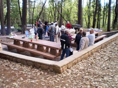
This campground makes an excellent base for enjoying a variety of water sports, sightseeing and other activities and is ideal for single families and small groups.

Recreation

Trinity Lake offers a variety of recreational opportunities, including boating, water skiing, sailing, swimming and fishing. Anglers can catch catfish, in addition to a variety of salmon, trout and bass.

The Clark Springs Public Boat Ramp is less than a mile from Bushytail Campground.

Hikers may be interested in the 4-mile Trinity Lakeshore Trail, which starts at the nearby Clark Springs Campground.

Facilities

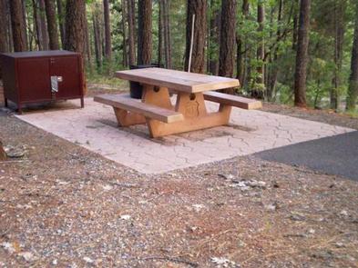
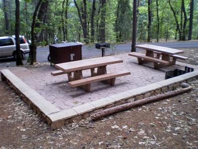
Bushytail offers single, double, triple and quad sites. All sites have grills, bear-proof food lockers, campfire rings and picnic tables.

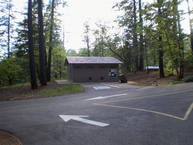
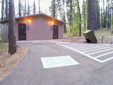
This campground has electric and water hookups in most sites and paved parking spurs. Flush toilets and drinking water are available. There are 2 coin-operated showers.

Natural Features

Shasta-Trinity is the largest national forest in California with a diverse landscape encompassing five wilderness areas, hundreds of mountain lakes and 6,278 miles of streams and rivers.

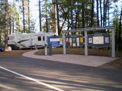
Bushytail Campground is part of the Whiskeytown-Shasta-Trinity National Recreation Area. Nearby Trinity Lake sits at an elevation of 2,370 feet and is surrounded by the Trinity Alps.

Black bears are frequently spotted in the area, as well as bobcats, mountain lions and a variety of bird species.

Nearby Attractions

The nearby town of Weaverville is listed on the National Register of Historic Places. This former mining town offers restaurants, shopping and self-guided walking tours.

Reservation

More from CampingHiking.net:

PALISADES RANGER RESIDENCE CABIN, Arizona Campground Images, Info & Reservations

Directions Driving Directions: From northeast Tucson, take East Tanque Verde Road to East Catalina Highway. Turn left (north) on East Catalina Highway, which becomes the General Hitchcock Highway, for approximately 23 miles to Organization Ridge Road and turn left (just before Palisades Visitor Center). The cabin is located approximately 100

BLEDSOE FERRY, Missouri Campground Images, Info & Reservations

Directions From Highway 7, travel north on the Dam Access Road for 2 miles and follow signs to the day-use area. Phone 660-438-7317 Activities BIKING, BOATING, CAMPING, FISHING, HIKING, WILDLIFE VIEWING, MOUNTAIN BIKING, KAYAKING, CANOEING, BERRY PICKING, BIRDING, WATER ACCESS Keywords BLED,TRUMAN LAKE,BLEDSOE,HARRY S TRUMAN Related Link(s) Rec Area Info

OLD FOLKS FLAT, Utah Campground Images, Info & Reservations

Directions The campground is located 21 miles from Huntington, Utah, along Highway 31. Phone 435-384-2372 Activities BIKING, CAMPING, HIKING, WILDLIFE VIEWING Keywords OLFF,MANTI-LASAL NF -FS Related Link(s) Rec Area Info & Images Utah State Road Conditions Utah State Tourism Overview Old Folks Flat Campground is nestled in beautiful Huntington Canyon

FISH CREEK CABIN, Alaska Campground Images, Info & Reservations

Directions The cabin is located approximately 20 air miles from Ketchikan, at the North end of Thorne Arm. Accessible by float plane or boat. A saltwater mooring buoy is available on a first-come, first-served basis. Refer to USGS topographic map for Ketchikan B-4, and check local tide tables if navigating

MUDDY GUARD CABIN, Wyoming Campground Images, Info & Reservations

Directions From Buffalo, Wyoming, take Wyoming State Highway 16 west 24 miles. Turn left on Crazy Woman Road (FSR 33), travel 400 feet, turn right on Forest Service Road 473. Visitors will use a gate to access the cabin. Please keep the gate closed. Phone 307-684-7806 Activities BIKING, BOATING, CAMPING,