
Directions
From Seattle, Washington, go north on I-5 to Everett. Take exit 194 onto Highway 2. Head north at Highway 204 toward Lake Stevens. Turn north on Highway 9. Turn east on Highway 92 to Granite Falls. Campground is located approximately 14 miles east of Granite Falls on Highway 7 Scenic Byway.
Phone
360-804-1103
Activities
CAMPING, DAY USE AREA
Keywords
WILE,MT. BAKER-SNOQU NF – FS
Related Link(s)
Washington State Road Conditions
Overview
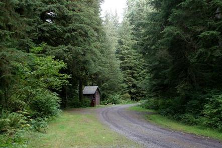
Wiley Creek, a popular campground for youth groups and organizations, is situated in an old-growth Douglas fir forest with lovely shaded trails. It is the first group site located on the north side of Mountain Loop Road, about 5 miles east of the Verlot Public Service Center in the Mt. Baker-Snoqualmie National Forest.
Whether visitors choose to hike on trails leading into towering forests or enjoy a moment of solitude on the banks of the nearby Stillaguamish River, this campround offers opportunities to experience both the serene and wild aspects of the Cascade region.
Recreation
In addition to being a prime location for hiking, fishing, picnicking, and horseback riding in summer and early fall, visitors can take advantage of skiing and snowshoeing in the winter months.
Anglers enjoy fishing from the gently-flowing Stillaguamish River. The Stillaguamish sustains a large salmon and trout population including chinook, coho, chum, pink and sockeye salmon, steelhead trout, sea-run cutthroat and bull trout.
Gold Basin Mill Pond Interpretive Trail invites visitors to learn more about the natural and cultural history of the area. The short, accessible trail passes by mill relics and ends on a floating viewpoint, looking across the millpond. The trailhead is located directly across from Gold Basin Campground.
Facilities
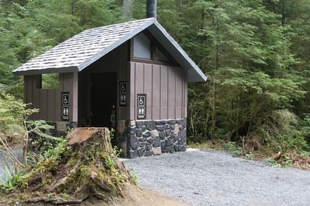
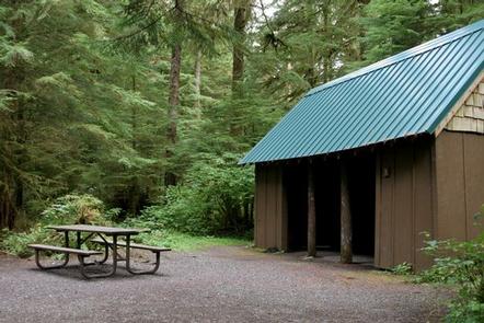
Wiley Creek Campground has two group sites that can accomodate up to 20 people each, with Adirondack shelters, tables and rock barbeque pits. Vault toilets are provided but there is no drinking water. Visitors must bring their own supply.
Group A has two Adirondacks. One shelter can accomodate 8 people on bunk beds and the second can sleep 12 on the attic floor. About 250 square feet are available on each floor.
Group B has a two-level shelter with about 400 square feet of space on each level.
Natural Features
The Mt. Baker-Snoqualmie National Forest offers visitors the chance to explore the region’s rugged peaks, scenic rivers and interesting wildlife that comprise the forest and surrounding designated wilderness areas.
Exploring the banks of the Stillaguamish River, one will find unique ecosystems typical for the area. Old-growth forests of cedar, fir, and hemlock line the wide, gently-flowing river, and tower over trails winding through moss-covered rocks.
On a clear day visitors will see Mt. Baker, the most prominent feature of the Mt. Baker Wilderness Area. The active volcano rises to an elevation of 10,781 feet, and is perpetually snow-capped and mantled with an extensive network of creeping glaciers. Mt. Baker’s summit, Grant Peak, is actually a 1,300-foot-deep mound of ice, which hides a massive volcanic crater.
Undeveloped wilderness, clean streams, and diverse forests provide important habitat for wildlife, including birds, amphibians, reptiles and more rare species such as lynx, moose, wolves and wolverine.
Nearby Attractions
Traverse a portion of the spectacular Pacific Crest Trail (PCT), one of the world’s premier National Scenic Trails. This trail showcases some of North America’s most fantastic scenery as it winds its way from Mexico to Canada through California, Oregon and Washington.