MINERAL SPRINGS GROUP, WA Campground Reservation, Info, Images, Map, Directions

MINERAL SPRINGS GROUP, Washington Campground Images, Info & Reservations

Directions

Located on Highway 97, about 21 miles northeast of Cle Elum, Washington. The group camping area is to the left after crossing the bridge into the campground.

Phone

509-852-1100

Activities

CAMPING, HIKING, WILDLIFE VIEWING, BIRDING

Keywords

MINE,OKANOGAN – WENATCHEE NF -FS

Related Link(s)

Rec Area Info & Images

Washington State Road Conditions

Washington State Tourism

Overview

At an elevation of 2,500 feet, Mineral Springs Group Campground sits in the mountainous terrain of the Okanogan-Wenatchee National Forest in northern Washington.

Nearby peaks and old-growth forests provide visitors with a variety of scenic landscapes. 

Recreation

The area around Mineral Springs is a prime location for hiking, horseback riding and mountain biking in summer and early fall, and offers opportunities for skiing, snowshoeing and snowmobiling in the winter months.

The campground is a great base camp for day-hikers and overnight backpackers, and several access trails are available from the area.

Facilities

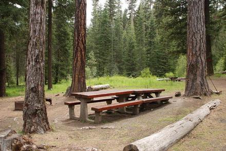
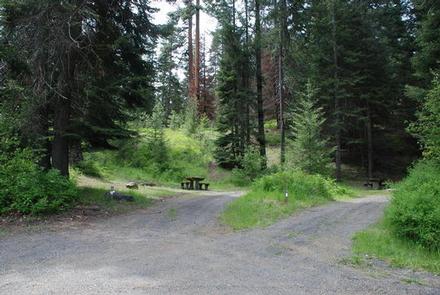
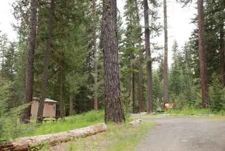
Mineral Spring Campground offers eight first-come first-serve single family sites and one reservable group site that can accommodate up to 50 guests. The sites are equipped with tables and campfire rings with grills. Vault toilets and drinking water are also available on site.

Natural Features

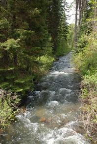
The Okanogan-Wenatchee National Forest features high, glaciated alpine peaks towering along the Cascade Crest. Lush valleys of old growth forest define its western boundary, and at its eastern edge, rugged shrub-steppe country comprises a more arid region. Mount Stuart, a towering mass of granite located in the nearby Alpine Lakes Wilderness area, is the second highest non-volcanic peak in Washington, perched at an elevation of 9,415 feet. The surrounding undeveloped wilderness, clean streams and diverse forests support an abundance of wildlife, including deer, porcupine, native fish and migratory birds.

Nearby Attractions

Nearby Red Top Mountain is a popular excursion for those wanting to reach a vista point after a short hike. Perched atop a basalt outcrop is Red Top Fire Lookout, where on a clear day visitors are treated to spectacular views of Mt. Stuart, Mt. Rainier and the Teanaway Valley. July through mid-September the historic lookout is often open to visitors. 

Reservation

More from CampingHiking.net:

PIONEER TRAIL, California Campground Images, Info & Reservations

Directions From Sonora, California, take Highway 108 east for about 30 miles. Exit at Pinecrest Lake and turn right on Dodge Ridge Road. Continue 1 mile to Pioneer Trails Campground, located on the left. Phone 209-965-3474 Activities BOATING, CAMPING, FISHING, HIKING, SWIMMING SITE Keywords PION,STANISLAUS NF -FS Related Link(s) Rec

WEST LAKE, Colorado Campground Images, Info & Reservations

Directions From Fort Collins, take Highway 287 north approximately 24 miles to Livermore. Turn west on County Road 74 and continue 24 miles to the campground. Phone 970-295-6700 Activities BIKING, BOATING, CAMPING, FISHING, HIKING, WILDLIFE VIEWING, CANOEING Keywords WLCO,REDFEATHER LAKES,ARAPAHO AND ROOSEVELT NF – FS Related Link(s) Rec Area Info

HOYER, Arizona Campground Images, Info & Reservations

Directions From Show Low, Arizona, take Highway 260 southeast 42 miles to Highway 373. Take Highway 373 south 3 miles to the campground, which is on the right. Phone 928-735-7313 Activities CAMPING, PICNICKING, DAY USE AREA Keywords HOYE,APACHE-SITGREAVES NF-FS Related Link(s) Rec Area Info & Images Forest Service Concessionaire Arizona

GUNTER HILL, Alabama Campground Images, Info & Reservations

Directions From I-65, take exit 167 onto US-80 west. Continue for 9 miles, then turn right on County Road 7 and follow signs into the campground. Phone 334-269-1053 Activities BIKING, BOATING, CAMPING, FISHING, HUNTING Keywords GUNT,JONES BLUFF,ALABAMA RIVERS,WOODRUFF,ROBERT F. HENRY,ROBERT F HENRY,ALABAMA RIV. – WO Related Link(s) Rec Area Info

Indian Creek (WA), Washington Campground Images, Info & Reservations

Directions From Yakima, travel 37 miles west on Highway 12 (White Pass Highway) to the campground entrance, about 16 miles west of the junction of 12 and 410. From Packwood, travel east on Highway 12. The campground is about 20 miles east of White Pass. Phone 541-338-7869 Activities BIKING, BOATING,

NORTH SHORE PICNIC AREA, Idaho Campground Images, Info & Reservations

Directions From Stanley, Idaho, take State Highway 75 south for 4 miles. Turn west onto Forest Road 214 at the Redfish Lake sign and travel approximately 2 miles. Turn right at the North Shore Picnic Area entrance sign. Phone 928-537-8888 Activities BIKING, BOATING, CAMPING, FISHING, HIKING, HORSEBACK RIDING, WATER SPORTS,