GOOSEBERRY RESERVOIR, UT Campground Reservation, Info, Images, Map, Directions

GOOSEBERRY RESERVOIR, Utah Campground Images, Info & Reservations

Directions

From Fairview, Utah, travel north about a mile on Highway 89, to the junction with Highway 31. Travel east on Highway 31 for about nine miles, to the junction with Forest Development Road 124. Go north on Forest Development Raod 124 for three miles, to the campground.

Phone

(435)283-4151

Activities

BIKING, BOATING, CAMPING, FISHING, HIKING

Keywords

GOOR,MANTI-LASAL NF -FS

Related Link(s)

Rec Area Info & Images

Utah State Road Conditions

Utah State Tourism

Overview

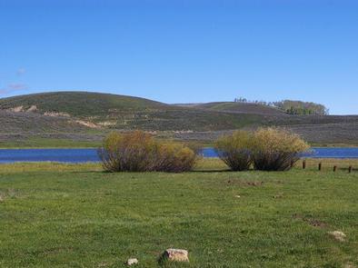
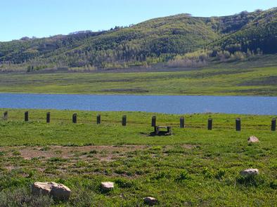
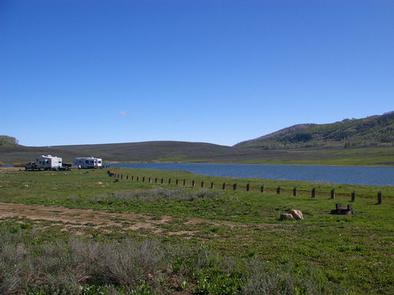
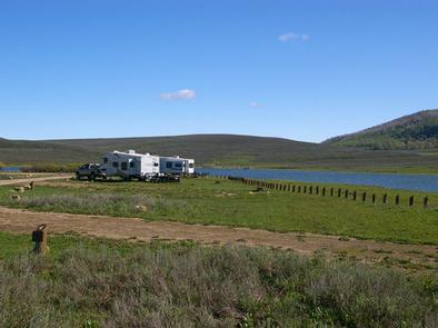
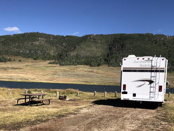
Gooseberry Reservoir Campground is located in a scenic mountain valley in an open meadow next to Gooseberry Reservoir. It is situated at an elevation of 8,400 feet. Visitors enjoy canoeing and fishing on the small reservoir and exploring area trails.

Recreation

The reservoir offers good cutthroat and rainbow trout fishing, as well as canoeing. It is open to hand-powered watercraft only, and no boat ramp is available on the lake.

The Great Western Trail runs next to the campground, offering excellent opportunities for hiking, biking and off-road vehicle riding. Mammoth Guard Station is located just one mile south.

Facilities

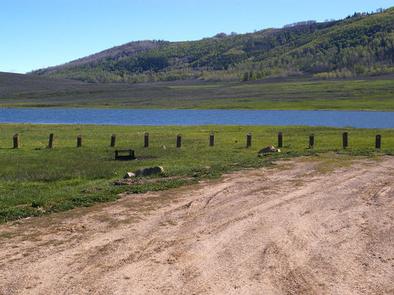
The campground contains several standard RV sites with long parking spurs that easily accommodate large RVs. Vault toilets are provided, but no water or garbage service is available. A well-maintained dirt road leads to the campground, providing relatively easy access for cars and RVs alike.

Natural Features

The surrounding mountains are dotted with aspens, fir trees and sagebrush, but the campground has no trees and no shade. Each site has a nice lake view. Grasses and summer wildflowers cover the valley.

Reservation

More from CampingHiking.net:

BLOODY DICK CABIN, Montana Campground Images, Info & Reservations

Directions From Dillon, travel south on I-15 for about 19 miles and exit at Clark Canyon Reservoir (Hwy 324). Travel 17 miles west on Highway 324 through Grant, MT. Proceed west and turn north onto Bloody Dick Road/Forest Road 181. Continue about 18 miles following road signs. The Bloody Dick

SPRING CREEK CAMPGROUND, Idaho Campground Images, Info & Reservations

Directions From Weiser, Idaho, travel north on Highway 95 for approximately 12 miles, then turn onto Upper Mann Creek Road/Forest Road 009 and travel another 18 miles to the campground. Phone 208-549-4200 Activities BIKING, CAMPING, FISHING, HIKING, HUNTING, WILDLIFE VIEWING, DAY USE AREA Keywords SPCK,SPRING CREEK GROUP SITE,SLEEPING SPRINGS INTERPRETATION,PAYETTE

CHAPMAN CAMPGROUND AND GROUP, Colorado Campground Images, Info & Reservations

Directions Take I-70 west of Denver to Glenwood Springs, Colorado. Take exit 116 (Highway 82) south to Basalt. At Basalt, take Frying Pan Road. Go 29 miles to Chapman Campground. Phone 970-927-0107 Activities BIKING, CAMPING, FISHING, HIKING, WILDLIFE VIEWING Keywords CHAP,CHAPMAN LAKE,WHITE RIVER NF -FS Related Link(s) Rec Area Info

Sand Island Group Sites, Utah Campground Images, Info & Reservations

Directions Sand Island Campground is located on the north bank of the San Juan River about 3 miles west of Bluff, Utah, on the south side of Highway 191. Phone 435-587-1500 Activities HISTORIC & CULTURAL SITE, CAMPING, PICNICKING, PHOTOGRAPHY, PADDLING, WATER ACCESS, WHITEWATER RAFTING Keywords None Related Link(s) Rec Area

MAGRUDER RANGERS HOUSE, Montana Campground Images, Info & Reservations

Directions From Darby, Montana, travel south on Highway 93 for 4 miles to West Fork Road/Highway 473. Continue on this road for approximately 14 miles to the Nez Perce Road/Magruder Corridor Road and go another 34 miles on the one-lane gravel, and partially paved road. Just before the Deep Creek

Esswine Group Camp, Washington Campground Images, Info & Reservations

Directions From Seattle, Washington, go north on I-5 to Everett. Take exit 194 onto Highway 2, then at Highway 204 go north toward Lake Stevens. Turn north on Highway 9, then east on Highway 92 to Granite Falls. The campground is approximately 16 miles east of Granite Falls on Highway