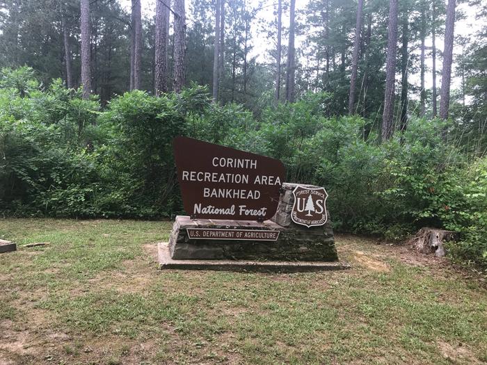
CORINTH RECREATION AREA, AL Campground Reservation, Info, Images, Map, Directions

CORINTH RECREATION AREA, Alabama Campground Images, Info & Reservations

Directions

From Double Springs, travel 8 miles east on Hwy 278; turn right at Corinth Recreation Area sign on County Road 57. 

Phone

205-300-1463

Activities

BIKING, BOATING, CAMPING, INTERPRETIVE PROGRAMS, FISHING, HIKING, RECREATIONAL VEHICLES, WATER SPORTS, DAY USE AREA, SWIMMING SITE, PHOTOGRAPHY, PADDLING, SWIMMING, CANOEING, WATER ACCESS

Keywords

CORI,NFs IN ALABAMA – FS

Related Link(s)

Rec Area Info & Images

Forest Service Concessionaire

Alabama State Road Conditions

Alabama State Tourism

Overview

The Corinth Recreation Area is a modern state-of-the art campground located on the shores of Lewis Smith Lake. It offers facilities for individual and group camping, picnicking, swimming, and boat launching. Two camping loops contain 52 campsites, with electrical, water, and sewer hookups. There are four bathhouses, with warm showers, serving the camping areas. A boat ramp is provided for campers. In addition, 10 tent campsites are provided. The day-use area contains dressing rooms and warm showers, 29 picnic sites, a 100-person pavilion, a swimming beach, and a double lane boat ramp. ADA accessible sites are available.

Recreation

  • Day-use visitors and campers have access to a boat ramp and swim beach.  
  • The lake provides excellent fishing for Kentucky Spotted Bass and Hybrid Striped Bass.  
  • Hikers can access the 1.3-mile Bobwhite Trail.  
  • Interpretive programs are hosted during the summer.

Facilities

  • All facilities are wheelchair accessible. 
  • Flush toilets, drinking water and showers are offered for both campers and day-use visitors.  
  • The campground offers spacious standard sites with full hookups that can accommodate RVs of any size. 
  • Sites contain paved parking spurs, picnic tables, grills and tent pads. 
  • There is a reservable group picnic shelter that can accommodate up to 100 people, as well as 29 first-come, first-served picnic sites.

Natural Features

Bankhead National Forest is located in northwestern Alabama, and its prominent feature is the Sipsey Wilderness. Known as “The Land of a Thousand Waterfalls,” it’s an area of abundant streams, old-growth forests, limestone bluffs and lush canyons. Lake Lewis Smith boasts more than 500 miles of shoreline marked by high rock bluffs. The water is clear and deep and provides excellent fishing.

Nearby Attractions

Three nearby attractions within Bankhead National Forest are: 

  • The Little Natural Bridge 
  • The 19th-century Pine Torch Church
  • The Houston Civil War Jail

Reservation

More from CampingHiking.net:

OWL CREEK CORRAL, Montana Campground Images, Info & Reservations

Directions Owl Creek Corral is located at the Owl Creek Packer Camp, about 4 miles off Montana State Highway 83 in the Swan Valley. From Highway 83 turn east onto Holland Lake Road #44 near mile marker 35. After 2.5 miles, turn right on Owl Loop Road #9558. Go about

BIG CREEK LAKES CAMPGROUND, Colorado Campground Images, Info & Reservations

Directions From Walden, follow Route 125 north for 9 miles into Cowdrey. Turn left (west) onto CR 6W and travel 18 miles to Pearl. Turn onto Forest Road 600 and drive for 6 miles, following signs to campground. Phone 970-723-2700 Activities BOATING, CAMPING, FISHING, HIKING, WILDLIFE VIEWING Keywords BIGL,MEDICINE BOW-ROUTT

AUNTS CREEK, Missouri Campground Images, Info & Reservations

Directions From Branson, Missouri, take Highway 13 south for about 4 miles. Turn west onto Highway 00 and continue for nearly 3 miles to the campground. Phone 417-739-2792 Activities BIKING, BOATING, CAMPING, FISHING, HIKING, PICNICKING, WATER SPORTS, WILDLIFE VIEWING, DAY USE AREA, SWIMMING SITE, PHOTOGRAPHY, SWIMMING, RANGER STATION, WATER ACCESS

WHITE SULPHUR SPRINGS CABIN, Alaska Campground Images, Info & Reservations

Directions Accessible year round, weather permitting. Located 65 miles northwest of Sitka on Chichagof Island within the West Chichagof-Yakobi Wilderness Area. Boat access is possible with anchorage in Mirror Harbor, where 0.9-mile White Sulphur Springs Trail leads to the cabin; however, local knowledge is recommended before attempting anchorage there. White

DIMOND O, California Campground Images, Info & Reservations

Directions From the Groveland District Office, head east 15 miles on Highway 120, then turn left on Evergreen Road and travel 4 miles. The campground is located on the left. Phone 209-379-2258 Activities BIKING, BOATING, CLIMBING, CAMPING, FISHING, HIKING, CANOEING, ROCK CLIMBING Keywords DIMO,DIAMOND O,DIMOND O,STANISLAUS NF -FS,Diamond (CA) Related