
Directions
Campground is at the end of Big Creek Entrance Rd. Waterville, NC, 28785 (Haywood County) Very close to the NC-TN State line.
The campground is located off I-40 Exit 451 (Waterville). It sixteen miles east of Newport, TN. Follow Waterville road, crossing over the Pigeon River, past the Walters Power Generating Station and continue one mile to the 4-way intersection at Mt Sterling Gap.
Follow the signs to Big Creek.
The 4 way intersection is composed of Big Creek Campground Road and Waterville Rd (from I-40) + Mt. Sterling Road (from Cataloochee) + Hwy 32 (from Cosby)
Drive up to the end of Big Creek Entrance Road. You will pass the Ranger Station and horse camp. Group camp will be the last left turn immediately before hiker parking.
Use Mailing Address or coordinates if you’re using GPS :
236 Big Creek Park Road
Newport, Tennessee, 37821
GPS coordinates are 35°45’08.4″N 83°06’33.4″W
35.752328, -83.109287
Phone
423-487-2683
Activities
BIKING, CAMPING, FISHING, HIKING, PICNICKING, WILDLIFE VIEWING, BIRDING, BACKPACKING
Keywords
Big Creek National Park,Great Smoky Mountains National Park,Great Smokey Mountains National Park,Big Creek Group Site,Big Creek Group Camp
Related Link(s)
National Park Services Concessionaire
North Carolina State Road Conditions
Overview
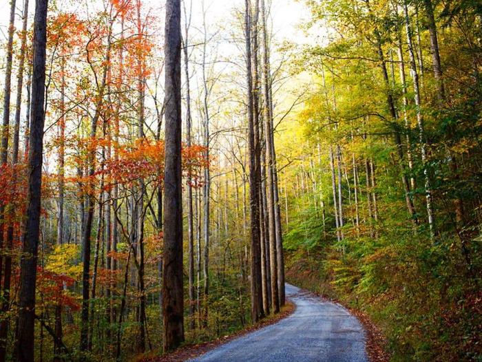
Big Creek Group Camp is located in the far northeastern corner of the Great Smoky Mountains National Park, near the Tennessee-North Carolina border.
With the gentle waters of Big Creek running alongside the site, and a handful of trailheads within walking distance, this campsite offers an ideal setting for group camping excursions.
Recreation
Numerous hiking and horseback riding trails are accessible from the campground and in the surrounding areas. Most notably, the Appalachian Trail is easily reached via the Chestnut Branch Trail, a 2.1 mile trail for hikers only, beginning down the road from the campground.
Nearby Baxter Creek Trail meanders along the water, while equestrian campers might enjoy taking the Big Creek Trail to Mouse Creek Falls or Midnight Hole, an area where Big Creek squeezes between large boulders, forming a deep, beautifully-colored pool.
Compared to some other areas of the park, Big Creek is not crowded with anglers. Spring provides ideal conditions for fly fishing on Big Creek, with Rainbow and Brook trout looking for the aquatic insects which hatch during this time.
Facilities
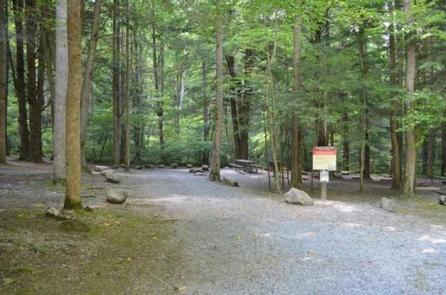
Big Creek Group Camp offers an unforgettable outdoor experience combined with the convenience of flush toilets, drinking water and sinks.
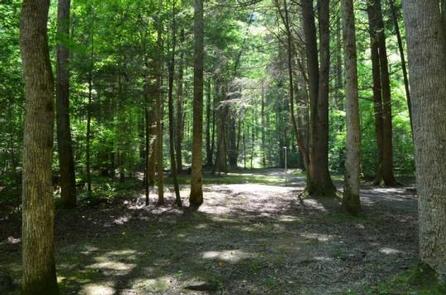
The campsite can accommodate up to 25 guests and tent pads, grills and fire rings are provided. The site is surrounded by a heavy canopy of towering forest, providing plenty of shade for guests.
Natural Features
Big Creek Group Camp is nestled among the scenic mountains and pristine streams surrounding the big creek section of the North Carolina Smokies.
Nearby Mouse Creek Falls, a 35 foot waterfall forming at the confluence of Mouse Creek and Big Creek, is a stunning geological feature of the area.
The falls splits over moss covered rocks and falls about 20 ft. before pooling and falling another 15 ft. into Big Creek. The falls can be reached via the Big Creek Trail, which is covered in wildflowers during spring months.
Nearby Attractions
The Big Creek Horse Camp is located nearby, with horse stables and riding trails available.
Full service grocery stores and medical facilities are located 16 miles away in Newport, Tennessee.