Directions
From Maryville, TN: Take U.S. 321 North (you’ll actually be driving south!) from Maryville to Townsend, TN (about 22 miles). At the traffic light in Townsend, continue straight on TN 73 and follow signs to Cades Cove.
From Pigeon Forge, TN take US 321 South (you’ll be driving westerly) to Townsend, TN. Turn left (south) at Townsend onto TN 73. Follow signs to Cades Cove.
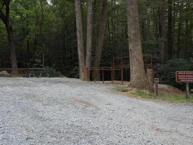
The horse camp is accessed through the back of the Cades Cove picnic area, through an unlocked gate.
Phone
865-448-4103
Activities
HISTORIC & CULTURAL SITE, CAMPING, INTERPRETIVE PROGRAMS, FISHING, HIKING, HORSEBACK RIDING, WILDLIFE VIEWING
Keywords
CG24,Great Smoky Mountains National Park,Great Smokey Mountains National Park
Related Link(s)
Tennessee State Road Conditions
National Park Services Concessionaire
Overview
Anthony Creek Horse Camp is located near the gently rolling waters of Anthony Creek. Whether blanketed in bright wildflowers in the spring or vivid colors in the fall, the scenery at Anthony Creek never disappoints.
You MUST have a HORSE to camp in Anthony Creek Horse Camp!
Recreation
With access to several of the Smokies’ popular horseback riding trails, equestrians will never be bored. Anthony Creek Trail intersects the campground and takes travelers up Bote Mountain, a 3,000 foot altitude gain. Although the trek is fairly strenuous, the trail is one of the most popular in the area due to the extraordinary views.
For access to the Appalachian trail, visitors can take the Anthony Creek Trail to either the Bote Mountain Trail or the Russell Field Trail, both of which intersect with the Appalachian Trail.
During spring, stopping to see the pink Mountain Laurel blooms on Spence Field is a must for anyone in the area.
The nearby horse stable provides one-hour horseback rides as well as hay rides and carriage rides from March through October, providing recreational activities for the entire family.
Campers can enjoy high-quality backcountry fishing in the cool waters of the countless streams and rivers that snake through the mountains, with trout available in abundance.
The park also holds one of the best collections of log buildings in the eastern United States. Over 90 historic structures, including houses, barns, outbuildings, churches, schools and grist mills, have been preserved or rehabilitated in the park, a few of which are easily accessible from Anthony Creek via the Cades Cove Loop Road.
Facilities
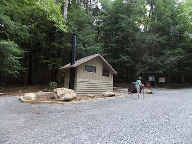
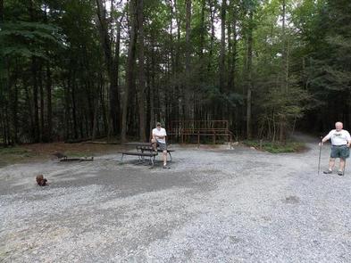
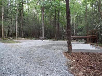
Anthony Creek offers primitive-woods camping. There are no hookups or showers at the campground.
Potable water is available from the campground spigot, about 1/2 mile away, and water for horses can be collected from the nearby stream. However, visitors must bring their own drinking water.
The nearby Cades Cove area offers additional amenities.
You MUST have a HORSE to camp in Anthony Creek Horse Camp!
Natural Features
Anthony Creek Horse Camp is surrounded by picturesque mountain ranges, pristine streams and rivers and clear blue skies that set the backdrop for your camping and horseback riding adventure. At 1,800 feet elevation, Anthony Creek provides a moderate climate, typified by mild winters and hot, humid summers.
Great Smoky Mountains National Park preserves the rich cultural history of Southern Appalachia. The mountains have a long human history spanning thousands of years, from the prehistoric Paleo Indians to early European settlements in the 1800s, to loggers and Civilian Conservation Corps enrollees in the 20th century. The park strives to protect the historic structures, landscapes and artifacts that tell the stories of all the people who once called these mountains home.
Nearby Attractions
The Cades Cove Campground, Group Campground and Picnic Area are located just a short walk away, providing additional camping for larger groups without horses.
The area offers a popular 11-mile loop road, where campers often bike and hike. A camp store offers basic supplies as well as bicycle rentals, and three historic churches are all located along the loop.
Townsend, located about nine miles away, offers full service grocery stores and fuel.
Charges & Cancellations
¢ If you plan to arrive at a date later than your arrival date you MUST contact the campground office 865-448-4103 in order to avoid a cancellation to your reservation. If you wish to cancel your reservation the day of your arrival you MUST contact the campground office 865-448-4103 in order to receive a refund.
¢ Rules and reservation policies can be found at https://www.recreation.gov/rules-reservation-policies


