Directions
From San Francisco (travelling north):
Cross the Golden Gate Bridge and take exit 442 onto Alexander Avenue. This will be the exit after the Vista Point. Continue straight for about a mile, and then turn left onto Bunker Road. Travel through the Baker-Barry Tunnel and continue straight until you can turn left onto McCullough Road. Continue uphill until you hit the traffic cricle, and take the 2nd exit onto Conzelman Road. Travel downhil until you reach Battery Spencer. The dirt road to Kirby Cove will be behind the white service gate.
From Marin (travelling south):
From US-101 South, take the last exit before the Golden Gate Bridge onto Alexander Avenue. Turn right at the stop sign and continue straight for about a mile, until you can turn left onto Bunker Road. Travel through the Baker-Barry Tunnel and continue straight until you can turn left onto McCullough Road. Continue uphill until you hit the traffic cricle, and take the 2nd exit onto Conzelman Road. Travel downhil until you reach Battery Spencer. The dirt road to Kirby Cove will be behind the white service gate.
Phone
415-331-1540 FOR RESERVATIONS PLEASE CALL 1-877-444-6777 OR ONLINE AT RECREATION.GOV
Activities
HISTORIC & CULTURAL SITE, CAMPING, INTERPRETIVE PROGRAMS, FISHING, HIKING, PICNICKING, DAY USE AREA, MOUNTAIN BIKING, BERRY PICKING, BIRDING, WATER ACCESS
Keywords
CG18,Marin Headlands,Golden Gate National Recreation Area,Kirby Cove National Park,Kirby Cove,Golden Gate
Related Link(s)
California State Road Conditions
Overview
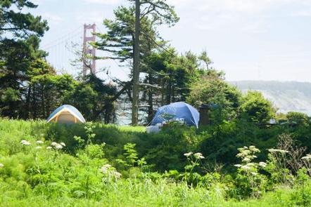
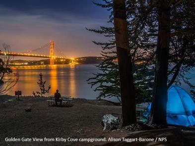
Kirby Cove is located just north of the Golden Gate Bridge at historic Battery Kirby. Visitors are awarded breathtaking views of San Francisco, its famous Golden Gate Bridge, and the rugged Pacific Coast of northern California.
Recreation
Hiking, picnicking and taking in the beautiful views from Kirby Cove are among the park’s most popular activities.
Visitors also enjoy exploring Battery Kirby, a historic army battery in use from 1898-1934. The Point Bonita Lighthouse and Nike Missile Site SF-88 are also close to the campsite.
Facilities
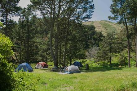
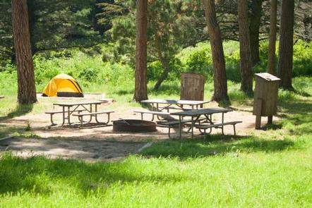
Kirby Cove offers five overnight camping sites and one day-use picnic site, all reached via driving on a steep access road. The day-use site is available as an accessible picnic site for persons with a disability or otherwise limited physical mobility. Sites 2 and 5 are available as accessible campsites for persons with a disability or otherwise limited physical mobility. If sites 2 or 5 are already reserved and you are looking for an accessible campsite, please contact the Marin Headlands Visitor Center (415) 331-1540 for assistance.
Natural Features
Kirby Cove offers a pristine coarse-sand beach with spectacular views – when it’s not foggy – of the iconic Golden Gate Bridge and northern San Francisco, including the historic Presidio. The cove is nestled at the foot of the craggy Marin Headlands and has beach access.
A steep, mile-long trail to the cove begins at the parking area above Battery Spencer on Conzelman Road. The path descends through a stately grove of Monterrey pine and cypress and Blue Gum eucalyptus. Coastal sage and colorful Lupine dot the hillsides.
Temperatures are mild year-round. Expect lows from 50-55 degrees and highs from 60-65. Fog is prevalent in the summer months from May-Sept. It is best to bring clothing that can be layered. Lightweight summer clothes are rarely comfortable to wear at Kirby Cove.
Nearby Attractions
The San Francisco Bay Area has no shortage of fun and interesting things to do and see. Awe-inspiring Muir Woods National Monument, with its old-growth coastal redwood forest and numerous hiking trails, is just a 20-minute drive from Kirby Cove. Mount Tamalpais State Park, with hiking and sweeping views of the Bay Area, is another 10 minutes past Muir Woods.
Downtown San Francisco offers a myriad of restaurants, shops, museums and tourist attractions. Fisherman’s Wharf, Alcatraz Island and Chinatown are popular destinations. Visitors love riding San Francisco’s world famous cable cars up and down the city’s hilly streets.
Charges & Cancellations
For cancellations with less than 24 hours’ notice, no fees will be refunded.


