
Directions
From Eufaula, Alabama, follow US 431 north. Turn right on State Route 165 and continue for 18 miles, then follow signs into the campground.
Phone
334-855-2746
Activities
BOATING, CAMPING, FISHING, HUNTING, WILDLIFE VIEWING
Keywords
LAKE EUFAULA (ALABAMA),WALTER F GEORGE LAKE
Related Link(s)
Overview
Bluff Creek Campground is situated on the shores of Walter F. George Lake on the Georgia and Alabama border. The lake is a great place to get away for a week, a weekend or just an afternoon.
Boating, swimming, fishing and camping are popular activities.
Click here for a virtual tour of the many facilities at Walter F. George Lake.
Recreation
The Chattahoochie River lakes are an angler’s paradise, where largemouth bass, white bass, hybrids, crappie, channel catfish and bream are found. The lake’s 640 miles of shoreline offer many excellent locations for bank fishing, and a boat ramp is conveniently located nearby.
The lake and its surrounding forests provide a great locale for hiking, hunting or simply observing wildlife.
Facilities
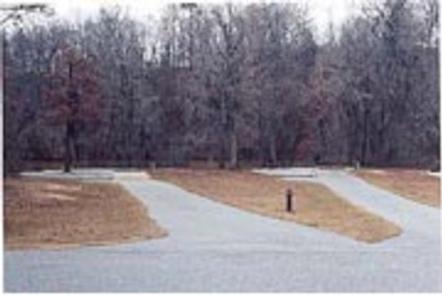
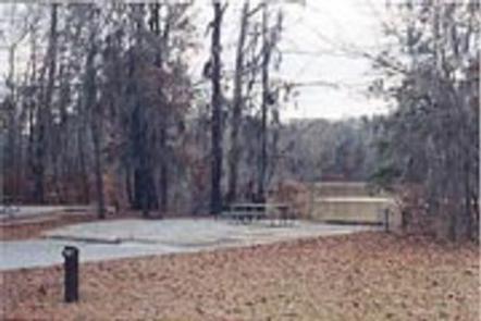
The campground offers 77 sites with electric and water hookups. Amenities include flush toilets, showers, drinking water, laundry facilities, a dump station and fish cleaning station. A group picnic shelter is available on a first come, first served basis.
Natural Features
Walter F. George Lake, sometimes called Lake Eufaula, stretches 85 miles up the Chattahoochee River. Visitors come to relax and play among the natural beauty of the area.
The lands surrounding the lake are forested with dense stands of mixed hardwoods. A wide variety of wildlife is commonly seen, including waterfowl, deer, squirrels, rabbits, eagles, hawks, bobcats and dozens of species of songbirds.
Nearby Attractions
The historic towns of Eufaula, Alabama and Cuthbert, Georgia are nearby. Eufaula boasts more than 20 structures and districts listed on the National Register of Historic Places. Beautiful antebellum mansions are located throughout both towns.