CUMBERLAND POINT CAMPGROUND, KY Campground Reservation, Info, Images, Map, Directions

CUMBERLAND POINT CAMPGROUND, Kentucky Campground Images, Info & Reservations

Directions

From Nancy, Kentucky, take Highway 235 south for a mile to Highway 761. Turn right and travel 9 miles to the campground entrance.

Phone

606-871-7886

Activities

BOATING, CAMPING, FISHING

Keywords

CUMB,LAKE CUMBERLAND,WOLF CREEK DAM

Related Link(s)

Rec Area Info & Images

Kentucky State Tourism

Kentucky State Road Conditions

Overview

Cumberland Point Campground is situated along the shores of the vast Lake Cumberland in southern Kentucky.

Click here for the Lake Cumberland virtual tour.

Recreation

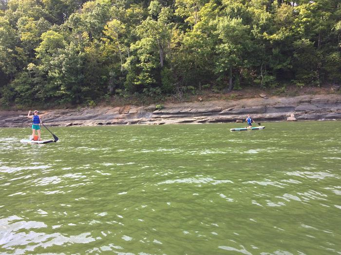
Lake Cumberland is the largest man-made lake east of the Mississippi River. Its large surface acreage and over 1,200 miles of shoreline provide a myriad of recreational activities.

The lake has an abundance of largemouth, smallmouth, white and Kentucky bass, bluegill, crappie, rockfish and walleye, making it a favorite among anglers.

Facilities

Visitors enjoy the 30-acre site and its 30 shaded campsites. Fourteen of these sites are waterfront, making them prime locations for weekend recreation. Cumberland Point has a day-use area, picnic shelter and public parking.

Amenities include flush toilets, showers, drinking water and a dump station. A boat ramp and playground are located within the park.

The entrance and exit roads have a moderate to severe grade.

Natural Features

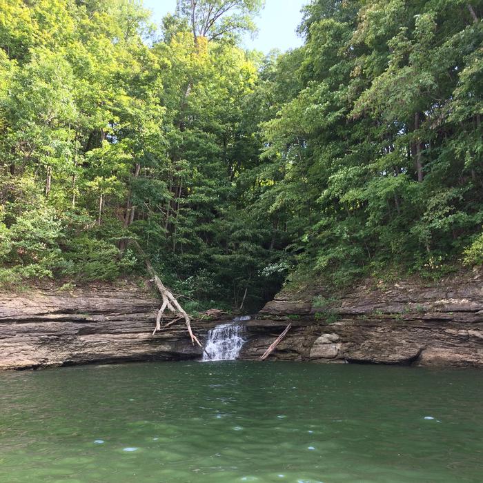
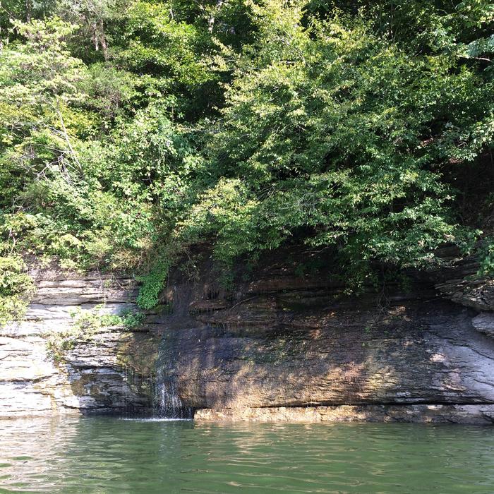
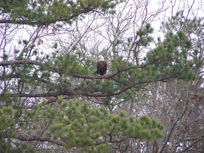
The campground overlooks the main body of the lake, offering sweeping scenic views. Dense stands of mature hardwoods forest the site, offering scenic views, pleasant shade and wildlife habitat.

Because of the temperate climate and relatively long recreation season, the lake provides varied outdoor recreational opportunities for millions of visitors each year.

Nearby Attractions

The Mill Springs Battlefield Park is just a 20-minute drive from the campground. This historic Civil War site offers interpretive exhibits, a gift shop and driving tour. Special events are held throughout the year.

Reservation

More from CampingHiking.net:

CHILHOWEE CAMPGROUND, Tennessee Campground Images, Info & Reservations

Directions The campground is located on FDR 77/Oswald Dome Road. Be Aware; Do not use GPS directions: GPS coordinates will direct you up Benton Springs Rd. This route is not recommended. We recommend using Forest Service Road 77 to reach the recreation area. It’s important to note, this facility requires

EMIGRANT GROUP, California Campground Images, Info & Reservations

Directions From Truckee, Calif., travel east on Highway 80 for 10 miles, to the Hirschdale Road exit. Follow Hirschdale Road/Stampede Dam Road north for eight miles, to the Stampede Reservoir. Take a left on Dog Valley Road to go over Stampede Dam. In a quarter mile the campground will be

BEAVER CREEK CABIN (ID), Idaho Campground Images, Info & Reservations

Directions In summer: from Idaho City, travel 20 miles northeast on State Highway 21. Turn right on Forest Road #362 and travel 1/2 mile to the cabin. In winter: from Idaho City, travel approximately 18 miles northeast on State Highway 21 to the Whoop-Um-Up Parking Area. Ski or snowshoe 1.5

ALLEN SPRINGS CAMPGROUND, Oregon Campground Images, Info & Reservations

Directions From Sisters OR: Travel 9.6 miles northwest on Highway 20, then 11.1 miles north on Forest Road 14. Phone 541-323-1746 Activities CAMPING Keywords Related Link(s) Rec Area Info & Images Oregon State Tourism Oregon State Road Conditions Overview Like the other campgrounds on the Metolius, Allen Springs is located

LIGHTFOOT LANDING, Missouri Campground Images, Info & Reservations

Directions From Springfield, MO, go north on Highway 13 to Bolivar, MO. Take Highway 83 northeast to RB Highway. Follow the RB Highway east to the Lightfoot Park entrance. Phone 417-282-6890 Activities CAMPING, PICNICKING Keywords LIGL,POMME DE TERRE LAKE,POMME DE TERRE LAKE Related Link(s) Rec Area Info & Images Missouri