
Directions
From Celina, Tennessee, take Highway 53 North for 2 miles. Turn right on Dale Hollow Dam Road, then take the second right on Campground Road. Follow signs to Dale Hollow Dam Recreation Area. It is recommended that visitors do not rely soley on GPS or Mapquest to reach the park.
Phone
931-243-3554 CAMPGROUND; 931-243-3136 RESOURCE MANAGEMENT OFFICE, DALE HOLLOW LAKE
Activities
BIKING, CAMPING, FISHING, HIKING, FISH HATCHERY, DAY USE AREA
Keywords
DALH,DALE HOLLOW LAKE,DALE HOLLOW DAM CAMPGROUND,BELOW THE DAM,DAMSITE,NEAR FISH HATCHERY
Related Link(s)
Tennessee State Road Conditions
Overview
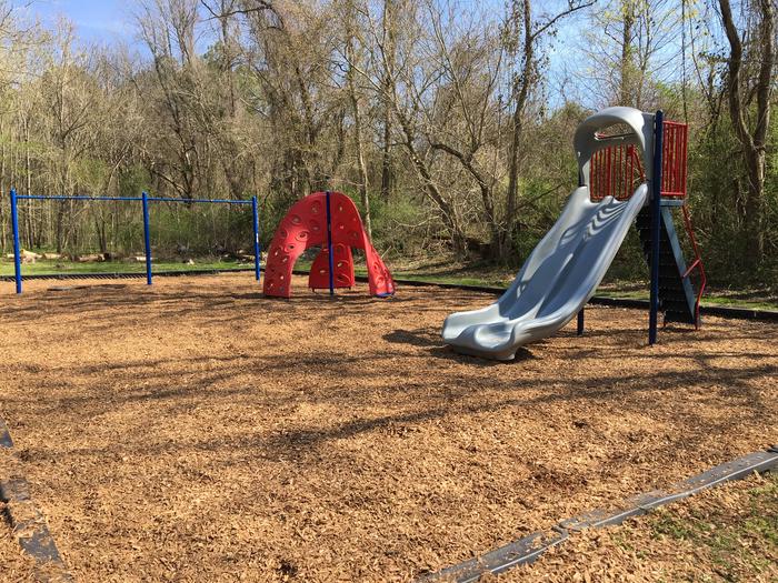
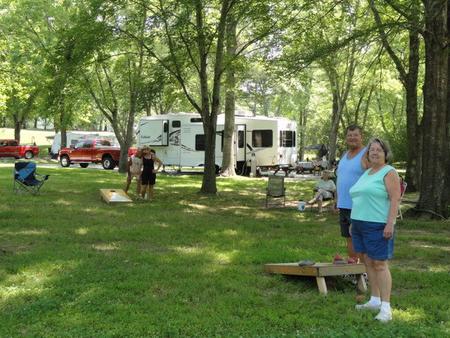
Dale Hollow Damsite is a quiet, peaceful campground in the green hills of Tennessee. The campground is a popular area for families, with an abundance of amenities and recreational activities available.
In the late fall through early spring the American Bald Eagle can be spotted flying overhead or perched on low-lying limbs. Dale Hollow hosts the second-largest wintering eagle population in the states of Tennessee and Kentucky.
Recreation
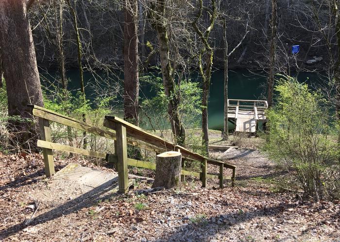
Dale Hollow is renowned for its fishing opportunities. In addition to yielding the world record smallmouth bass and being known as a trophy smallmouth lake, the Obey River below Dale Hollow Dam is also known for excellent rainbow and brown trout fishing.
Boating and water skiing are also popular activities, and with 27,700 surface acres of water and 620 miles of shoreline, there is plenty of space for campers to explore the lake. Secluded tie-ups are located around the shore, offering campers a peaceful nature experience.
A one-mile paved walking and biking trail winds through forest, along streamside and past a rolling meadow.
The Red Oak Ridge Trail is about nine miles away and hosts 18 miles of trails, mainly developed for horseback riding, but the area is available to hikers as well. The Accordian Bluff Hiking Trail is a 7.5 mile one-way trail which ascends to a ridge-top and back down to the shoreline of Dale Hollow Lake. It is an ideal trail for birders and wildflower enthusiasts and connects both Lillydale and Willow Grove Campgrounds. Trail access is located approximately 30 miles from Dale Hollow Dam Campground.
Facilities
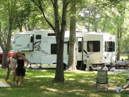
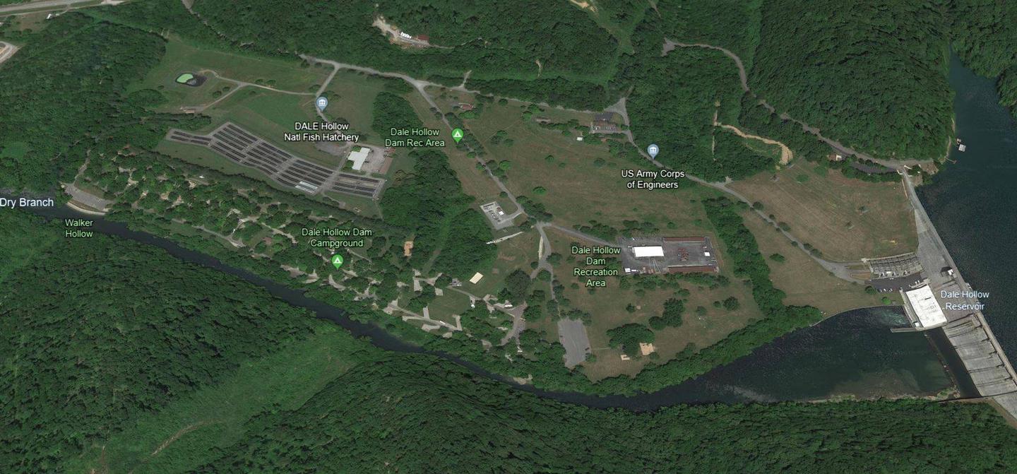
Dale Hollow Damsite Campground features 78 campsites and one large group picnic shelter. Electric hookups, drinking water, flush toilets and a dump station all create a comfortable camping experience.
There is no direct access to Dale Hollow Lake from the campground, but visitors can launch at the nearby Pleasant Grove Day Use Area, an easy 3 mile drive from the campground.
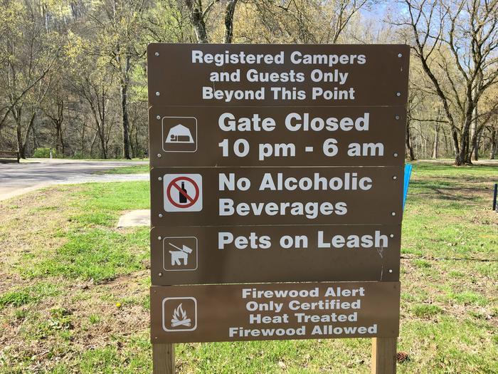
Camping is limited to a 14-day stay within a 30-consecutive day period.
Site Type Definitions:
- An RV Site is a paved/concrete site for wheeled camping units such as motorhome, fifth wheel, pull trailer and pop-up campers. RV sites are not suitable for tents.
- A Standard Site is one with a fine gravel surface pad. It will accommodate wheeled units and tents.
- A Tent Site will accommodate tents only.
- Group Sites are the picnic shelters.
For site specifics such as site measurements, parking and if the site is level, be sure to review the Information text at the bottom of each specific site page.
All camping equipment and vehicles are to be located on the designated site pad or parking areas.
General Site Notes:
- 50 Amp Service and Water Hookups on all sites EXCEPT site 37
- Site 37 does NOT have water/electric hookups
- Paved Sites: 19, 21, 22, 24, 25, 27, 29, 31, 33, 34, 38, 39, 40, 69 & 70
- Accessible Sites: 60, 61 & 62
- Visitors to Campers will be charged $3 per vehicle per day
- Fees are subject to change
Natural Features
Dale Hollow Dam and Lake was completed in 1943. Although the dam was built for flood control and power generation, it has now become a recreational oasis for more than 3 million visitors each year.
The dam is located on the Obey River, about 3 miles east of Celina, Tennessee. Surrounded by a thick expanse of forest, the clear blue lake creates a stunning scenic backdrop for a variety of water and land recreational activities.
Nearby Attractions
The Dale Hollow National Fish Hatchery sits adjacent to the campground. Operated by the U.S. Fish and Wildlife Service, the hatchery is the largest federal trout hatchery east of the Mississippi, producing 1.5 million trout annually. The hatchery is open to visitors daily.
Charges & Cancellations
Full rules and reservation policies for fees associated with changes and cancellations can be found at https://www.recreation.gov/rules-reservation-policies
There is no fee to make a reservation.
- A $10 service fee will be withheld from any refund for a cancellation.
- A $10 service fee may be charged to changes made to an existing reservation (see full policies for when this is applicable).
- A customer who cancels a reservation the day before or on the day of arrival will pay a $10.00 service fee AND forfeit the first night’s use fee (not to exceed the total paid for the original reservation).
- Customers who cancel a group day-use facility reservation (picnic shelter) less than 14 days before the arrival date will forfeit the total day-use fee.
- No-shows are assessed $20.00 service fee and forfeit the first nights recreation fee for a campsite or forfeit the entire day-use fee for a day-use facility.
- Applicable fees, including service/cancellation fees and change fees, are non-refundable and subject to change.
- No refunds for recreation use fees may be made at the campground.