

Directions
Traveling north from Lexington, take I-64 to the Mountain Parkway. Exit at Slade, take KY 11 South through Beattyville. Continue on Highway 11 to Booneville, continuing past the courthouse to KY 28 West. Follow KY 28 about 23 miles to Buckhorn.
Traveling east From Hazard, take KY 15 North 9 miles to 28 W (left turn) through Chavies. Follow Highway 28 West straight and go 15 miles to Buckhorn.
Phone
606-398-7220
Activities
BOATING, CAMPING, SWIMMING SITE
Keywords
BUKH,TAILWATER CAMPGROUND,DAM SITE CAMPGROUND,BUCKHORN DAM CAMPGROUND,TAILWATER,BUCKHORN LAKE
Related Link(s)
Kentucky State Road Conditions
Overview
Buckhorn Campground on Buckhorn Lake, provides the perfect outdoor escape in eastern Kentucky’s lush Cumberland Plateau.
The campground is packed with activities to entertain all ages, including monthly interpretive programs offered during summer months and convenient access for boating and fishing on Buckhorn Lake.
Recreation
Buckhorn Lake welcomes fishing, boating, water skiing, hiking, swimming, hunting and just plain relaxing. The campground provides access to a nature trail and fishing areas as well.
Facilities
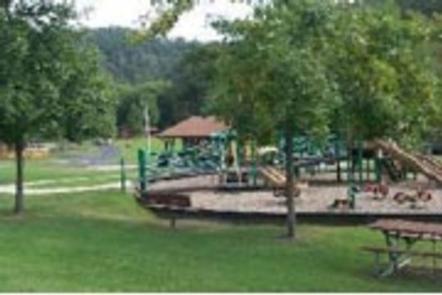
Buckhorn is packed with amenities to make your stay comfortable. A basketball court, playground and horseshoe pits will entertain visitors on-shore, while a swimming area and boat ramp, cater to visitors eager to explore the lake.
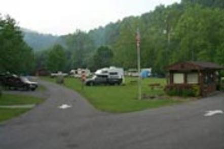
Additional amenities include free wireless internet, electric hookups, laundry facilities, hot showers, vending machines, a dump station and flush toilets.
Natural Features
Buckhorn campground sits near the dam on Buckhorn Lake, surrounded by the beauty of the scenic Appalachian Mountain Range.
The rugged plateau landscape is deeply traversed by a series of narrow, winding valleys separated by steep watersheds with branching streams.
Fed by the waters of the Kentucky River, Buckhorn Lake extends for 1,230 surface-acres, providing plenty of water recreation opportunities.
Buckhorn Campground was also recently recongnized as the location for the largest River Birch Tree in the country by The National Register of Big Trees, the tree measures 205 inches around, 117 feet high and an 85 foot crown on top, making this tree surely a sight to see.
Nearby Attractions
The park is just minutes from attractions like Carr Creek Lake and the Buckhorn Log Church. Rent a pontoon from Buckhorn Lake State Resort Park, explore the Red River Gorge Geological Area or hike through the Daniel Boone National Forest.