HIGHWAY K, MO Campground Reservation, Info, Images, Map, Directions

HIGHWAY K, Missouri Campground Images, Info & Reservations

Directions

From Annapolis, MO, follow MO Highway K west for 5 miles. The park will be on the left, and is on both sides of the bridge.

Phone

573-223-7777 (CLEARWATER LAKE PROJECT OFFICE) 573-558-2202 (HIGHWAY K GATEHOUSE)

Activities

BOATING, CAMPING, FISHING, SWIMMING SITE

Keywords

HIGW,CLEARWATER LAKE,CLEARWATER LAKE

Related Link(s)

Rec Area Info & Images

Missouri State Tourism

Missouri State Road Conditions

Overview

Campers looking to enjoy a scenic stay on the clear waters of the Black River, will enjoy the calming riverside atmosphere at Highway K Park.

Recreation

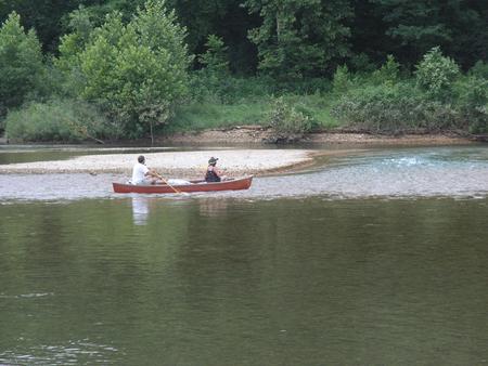
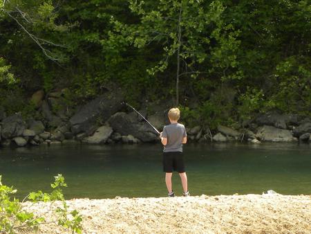
Fishing and canoeing are very popular on the river, where campers also enjoy wading out into the clear waters during warmer months.

Facilities

The campground offers 83 sites, including many with electric hookups and some sites with water hookups. Additional amenities include a dump station, hot showers, a picnic shelter and playground.

Natural Features

Highway K is a few miles upstream of Clearwater Lake on the Black River. Campsites extended over both sides of the river bank, in a lush, wooded area of mixed hardwoods.

Nearby Attractions

The Elephant Rocks State Park, Johnson Shut-ins State Park, and the historic Civil War site at Fort Davidson State Park make for an interesting, scenic day trip.

Reservation

More from CampingHiking.net:

RAVEN CABIN, Alaska Campground Images, Info & Reservations

Directions The cabin is located 8 air miles east of Yakutat on the east bank of Situk River. Access is by trail, boat or wheeled aircraft. From Nine Mile Bridge on Forest Highway 10, hike the 3-mile trail or boat 3.2 miles downriver (1.5 hour float). The cabin is 9.6

GORDON REESE CABIN, Montana Campground Images, Info & Reservations

Directions From Wisdom, travel west on Highway 43 for 26 miles, the parking area is located at the top of Chief Joseph Pass. The route has many signs. Maps of the area may be purchased by calling the Wisdom Ranger District. Phone 406-689-3243 Activities BIKING, HISTORIC & CULTURAL SITE, CAMPING,

BLACK CANYON RIM CAMPGROUND, Arizona Campground Images, Info & Reservations

Directions Located 13 miles west of Heber, Arizona. From Forest Lakes, travel east on Highway 260 for approximately 1 mile. Turn south on Forest Road 300 and travel approximately 2.4 miles. The campground is located at the intersection of Forest Roads 300 and 86. Phone 9285359859 Activities CAMPING Keywords BLACK