OLD FEDERAL, GA Campground Reservation, Info, Images, Map, Directions

OLD FEDERAL, Georgia Campground Images, Info & Reservations

Directions

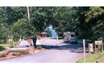
Take I-85 north to I-985, take Exit 8, turn left on Hwy 347/Friendship Rd., turn right on McEver Rd., turn left on Jim Crow Rd. and follow signs to the campground.

Phone

770-967-6757

Activities

BIKING, BOATING, CAMPING, FISHING, PICNICKING, SWIMMING SITE, SWIMMING, WATER ACTIVITIES, WATER ACCESS

Keywords

OLDF,LAKE LANIER,LAKE SIDNEY LANIER

Related Link(s)

Rec Area Info & Images

Georgia State Tourism

Georgia State Road Conditions

Overview

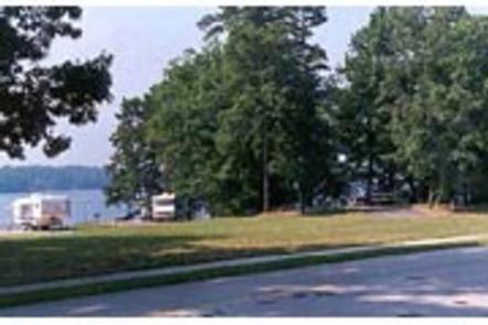
Old Federal Campground lies on the eastern banks of Lake Sidney Lanier in Northern Georgia. Popular for its aqua-blue waters and spectacular scenery, Lake Sidney Lanier hosts over 11 million visitors annually for fantastic fishing and boating opportunities.

Recreation

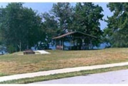
Old Federal Campground offers many outdoor recreation opportunities including fishing, swimming, picnicking and bike riding. On the lake there are opportunities for wake boarding, kayaking, boating and much more. There’s also a swimming beach and boat ramp available for campers.

Facilities

There are 65 campsites that have electric and water hookups (no sewer) and 12 primitive tent-only campsites. There are also 7 walk-in sites for those who don’t mind leaving their vehicles behind. Campers will have access to restrooms/bathouses, laundry facilities, two picnic shelters and a dump station.

Natural Features

Lake Sidney Lanier is nestled in the foothills of the Georgia Blue Ridge Mountains. The lake features 692 miles of shoreline and spans 38,000 surface water acres and 17,000 acres of lush terrain. The reservoir was created in 1956 with teh completion of Buford Dam on the Chattahoochee River.

Nearby Attractions

Lake Lanier Islands as well as other nearby Army Corps and county parks provide may different recreation opportunities at the lake. The nearby city of Gainesville provides many opportunities for those looking to explore the local area.

Charges & Cancellations

Cancellations must be made via the online/phone reservation system or in person at the gatehouse. Cancellation calls to the gatehouse will not be honored.

Reservation

More from CampingHiking.net:

BUSHAY RECREATION AREA, California Campground Images, Info & Reservations

Directions From the South (San Francisco, Santa Rosa, Ukiah): Follow Highway 101 North towards Ukiah. Approximately 5 miles north of Ukiah, take Highway 20 East. Continue on Highway 20 East for approximately 3 miles. Just after you see Lake Mendocino on your right, you will cross a tall bridge. Take

SULPHUR CAMPGROUND, Wyoming Campground Images, Info & Reservations

Directions From Evanston, Wyoming, take Utah Highway 150 (Mirror Lake Scenic Byway) south for 39 miles. Sulphur Campground is on the west side of the highway. From Kamas, Utah, take Center Street east. It becomes Utah Highway 150 (Mirror Lake Scenic Byway). Travel about 40 miles. There will be a

PRAIRIE FLOWER RECREATION AREA, Iowa Campground Images, Info & Reservations

Directions From I-35, take exit 90 to Ankeny/Oralabor Road and go west for 4.8 miles. The road turns into Highway 415, continue and follow signs to the campground. Phone 515-984-6925 Activities BIKING, BOATING, CAMPING, FISHING, HIKING, HUNTING, WATER SPORTS, SWIMMING SITE Keywords PRAF,SAYLORVILLE LAKE,PRAIRIE FLOWER NORTH,PRAIRIE FLOWER SOUTH,ASTER,BLAZINGSTAR,CONEFLOWER,DOGBANE,ELDERBERRY,FLEABANE,GOLDENROD,HONEYSUCKLE,IRONWEED,JUNEBERRY,KNAPWEED,LEADPLANT,MAYWEED,NIPPLEWORT,OXEYE,SAYLORVILLE LAKE Related

R SHAEFER HEARD, Georgia Campground Images, Info & Reservations

Directions From West Point, Georgia, take U.S. Highway 29 north for 4 miles, then turn left The West Point Project sign and then travel a shirt distance to a right turn, into the campground entrance. Phone 706-645-2404 Activities BOATING, CAMPING, FISHING, HIKING, DAY USE AREA, SWIMMING SITE Keywords RSH1,WEST POINT

WILLIAM KENT CAMPGROUND, California Campground Images, Info & Reservations

Directions William Kent Campground is 2 miles south of Tahoe City on California Highway 89. Phone 530-583-3642 Activities BIKING, BOATING, CAMPING, INTERPRETIVE PROGRAMS, FISHING, VISITOR CENTER, WATER SPORTS, SWIMMING SITE Keywords WILK,TAHOE CITY,WEST SHORE,LAKE TAHOE,LAKE TAHOE BASIN – FS Related Link(s) Rec Area Info & Images California State Tourism California

DEMOTTE, Arizona Campground Images, Info & Reservations

Directions From Kanab, UT the facility is 40 miles (35 miles from Fredonia, AZ) south on U.S. Route 89A to AZ State Route 67, at Jacob Lake. Then south 25 miles on AZ State Route 67 to DeMotte campground. From Bitter Springs intersection of U.S. 89 and 89A. Take 89A