OLD KUTTAWA, KY Campground Reservation, Info, Images, Map, Directions

OLD KUTTAWA, Kentucky Campground Images, Info & Reservations

Directions

From Nashville, take I-24 West to Exit 40. Turn left on 62 and then right on Highway 295. Follow Highway 295 to recreation area entrance.

Phone

LAKE BARKLEY RESOURCE MANAGERS OFFICE: 270-362-4236

Activities

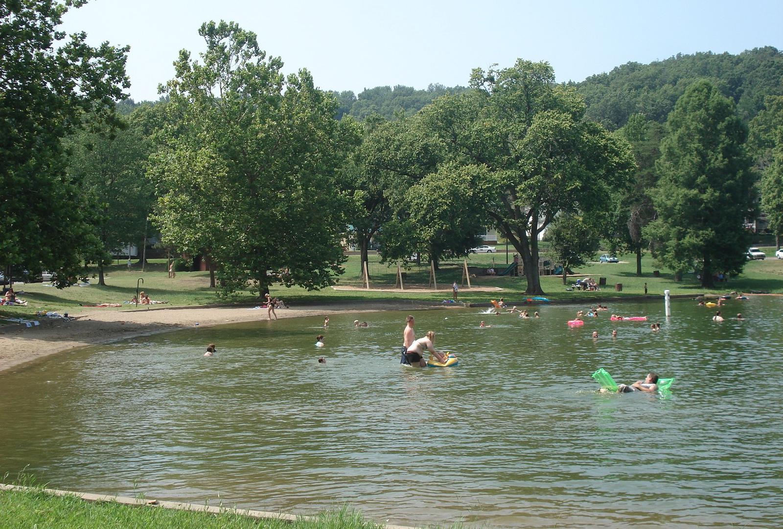
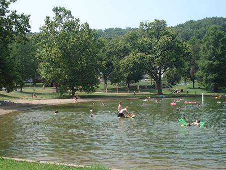
BOATING, FISHING, DAY USE AREA, SWIMMING SITE

Keywords

OLDK,LAKE BARKLEY,KUTTAWA,OLD KUTTAWA,BARKLEY LOCK & DAM

Related Link(s)

Rec Area Info & Images

Kentucky State Tourism

Kentucky State Road Conditions

Overview

Old Kuttawa Recreation Area is on the northern shores of Lake Barkley, near the narrow canal linking it to Kentucky Lake. Together, these two reservoirs combine to create one of the greatest freshwater recreation areas in the country.

Take pleasure in a day of picnicking or soak up the sun at the swimming beach, either way Old Kuttawa provides an ideal setting to enjoy nature at its best.

Recreation

The half-mile Anderson Woodland Trail is an enjoyable footpath for birding and viewing the great tall trees of the region. Other activities include swimming, fishing and boating.

Facilities

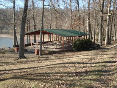
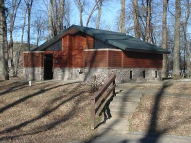
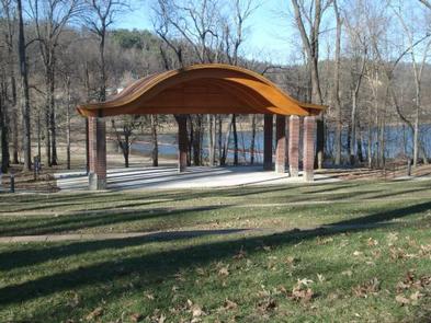
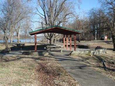
Two large picnic pavilions, an ampitheater, a playground, restrooms and paved parking are available. Plenty of picnic tables and grills are scattered around the recreation area, with ample shade for sunny summer days. **In order to reserve the ampitheater, you must reserve site 1 (large shelter).

Natural Features

Lake Barkley spans 57,900 acres with 1,004 miles of shoreline and offers warm water temperatures during summer months that make for comfortable recreation.

Running parallel to Barkley Lake is its neighbor, Kentucky Lake, with the Land Between the Lakes National Recreation Area nestled between.

Nearby Attractions

See the astonishing Floodwall Murals in the town of Paducah. It is a gallery that captures Paduca’s rich history.

Reservation

More from CampingHiking.net:

ELK LAKE CAMPGROUND, Oregon Campground Images, Info & Reservations

Directions From Bend, travel 33.1 miles southwest on Cascade Lakes Hwy (46) to north end of Elk Lake. Phone 541-323-1746 Activities CAMPING Keywords Related Link(s) Rec Area Info & Images Oregon State Tourism Oregon State Road Conditions Overview Elk Lake Campground is located on the north end of Elk Lake

MOON LAKE CAMPGROUND, Utah Campground Images, Info & Reservations

Directions From Duchesne, Utah, take State Hwy 87 north to Mountain Home, then north 12 miles to the Forest Boundary and Forest Road 131. The campground is about 36 miles from Duchesne on paved roads although some spots have pot-holes. Phone 435-738-2482 Activities BIKING, BOATING, CAMPING, FISHING, HIKING, HORSEBACK RIDING,

DEVILS CANYON, Utah Campground Images, Info & Reservations

Directions The campground is 13 miles south of Monticello, Utah and 9 miles north of Blanding, Utah on US Highway 19. The campground is approximately 1/4-mile off the highway. Phone 435-587-2041 Activities AUTO TOURING, BIKING, CAMPING, HIKING, PICNICKING, WILDLIFE VIEWING, INFORMATION SITE, STAR GAZING, SCENIC DRIVE Keywords DEVC,DRY WASH,JOHNSON CREEK,MANTI-LASAL

Walupt Lake Campground, Washington Campground Images, Info & Reservations

Directions Take I-5 to Highway 12 towards Packwood, then take Highway 21 to FS Road 2160 to the campground. Phone 541-338-7869 Activities BOATING, CAMPING, FISHING, SWIMMING SITE Keywords WALP,GIFFORD PINCHOT NF – FS Related Link(s) Rec Area Info & Images Washington State Road Conditions Forest Service Concessionaire Washington State Tourism

TAYLOR FERRY, Oklahoma Campground Images, Info & Reservations

Directions Address for GPS: Taylor Ferry South Campground, 33814 E. 746 Rd., Wagoner, OK 74467 From Wagoner, Oklahoma, travel 5 miles east on Highway 51. Turn left on South 330 Road and travel south for approximatly 1/4 mile. Turn left on East 746 Road and travel less than 1 mile