
Directions
From Interstate 85, take Exit 4 and turn East onto Old Dobbins Bridge Road.Turn right on Andersonville Road and follow the brown directional signs. Hattons Ford ramp is located at the end of Andersonville Road. Townville, SC, 29689
Phone
888-893-0678 HARTWELL PROJECT OFFICE
Activities
BOATING, FISHING, PICNICKING, SWIMMING, WATER ACCESS
Keywords
WELD,HARTWELL LAKE PROJECT
Related Link(s)
South Carolina State Road Conditions
Overview
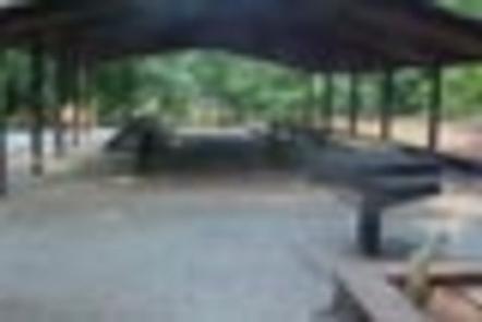
Weldon Island Recreation Area is a 138 acre siteconsisting of mixed hardwoods and pines, with fairly steep terrain. Area is currently developed as two separate day-use areas identified as Weldon Island and Hattons Ford and loacted less than .5 mile apart. Weldon Island presently offers day-use and boat launching facilities consisting of 11 picnic sites, 1 picnic shelter with water and electric service, 1 comfort station, 1 boat ramp, 1 courtesy dock and associated paved roads and parking areas throughout. Hattons Ford offers day-use and boat launching facilities consisting of 12 picnic sites, 1 boat ramp, 1 courtesy dock and paved roads and parking areas.
Recreation
Boating and water sports top the list of popular activities. Nearby Hattons Ford boat ramp is available year-round for visitors’ convenience.
Facilities
Weldon Island presently offers day-use and boat launching facilities consisting of 11 picnic sites, 1 picnic shelter with water and electric service, 1 comfort station, 1 boat ramp, 1 courtesy dock and associated paved roads and parking areas throughout. Hattons Ford offers day-use and boat launching facilities consisting of 12 picnic sites, 1 boat ramp, 1 courtesy dock and paved roads and parking areas.
Natural Features
Hartwell Lake is a man-made lake bordering Georgia and South Carolina on the Savannah, Tugaloo and Seneca Rivers. The dam and lake area boasts 8 campgrounds and 11 day-use facilities that are operated by the US Army Corps of Engineers. The Hartwell Project was originally authorized for hydro-power, flood control, and navigation. Later, recreation, water quality, water supply and fish and wildlife management were added. Surrounding vegetation allows for plenty of shade, and the 962 miles of shoreline provide numerous swimming beaches, picnic areas and boat ramps.
Nearby Attractions
Charges & Cancellations
A $10 service fee will apply if you change or cancel a reservation more than 14 days in advance of arrival date. If you cancel a reservation within 14 days of your scheduled arrival date, you will forfeit the reservation fee.