

Directions
From Albuquerque, New Mexico, take I-25 north to exit 264. Travel west on State Road 16 to the Tetilla Peak Recreation Area/La Bajada Village turnoff and follow the paved road into the recreation area.
Phone
505-465-0274
Activities
BOATING, CAMPING, FISHING, HIKING, SWIMMING SITE
Keywords
TPEA,COCHITI LAKE
Related Link(s)
New Mexico State Road Conditions
Overview
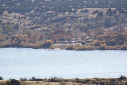
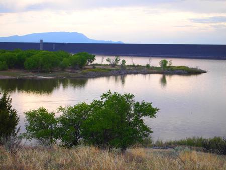
Tetilla Peak Recreation Area is located in Sandoval County, New Mexico, within the boundaries of the Pueblo de Cochiti Indian Reservation. The lake offers two public recreation areas: Cochiti on the west side of the lake and Tetilla Peak on the east side. Both sides offer spectacular scenic views of the water and surrounding mountains. The Cochiti Dam is one of the ten largest earth-fill dams in the United States, and also one of the largest in the world. The lake derives its name from the Indian Pueblo on the Cochiti Reservation.
Recreation
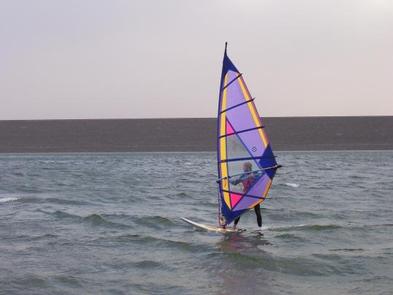
Our quiet lake is an ideal for all paddle and wind craft. The lake is also a popular fishing spot for species such as bass, crappie, walleye, catfish, sunfish, pike and trout. Santa Cruz Day Use area is open daily and provides visitors with acces to the lake as well as several shade structures, bathrooms, and two fishing docks.
Facilities
The campground consists of two loops. Cholla Loop includes 36 individual campsites, each with an electric hookup, table and grill. All electric campsites have shelters, and water spigots are located throughout the campground. This loop also provides a dump station and large restroom and shower building.
A partially paved road winds through Coyote Loop, which has 10 sites, each with a table and grill. There are no electric hookups, and water spigots are scattered throughout the loop. The restroom and shower building is centrally located for easy access.
The Tetilla boat ramp area offers a parking area and courtesy dock.
Natural Features
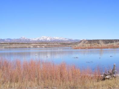
Cochiti Lake sits at 5,343ft in elevation and is nestlein the foothills of the Jemez Mountains. Our high desert environment is dominated by juniper, piñon trees, and mixed grasslands. There are many opportunities for wildlife viewing. Four osprey nesting platforms have been erected around the lake to provide nesting sites, as well as viewing opportunities. On the east side of the lake, deer, coyote, river otters, rabbits, beavers, and bear are often sided.
Nearby Attractions
Cochiti Lake is 23miles from Tent Rocks National Monument, which has fascinating geological formations.