
Directions
From Interstate 35 in Belton, Texas take the 294 exit (6th Avenue or Farm-to-Market Road 93) west. Turn north onto 317 (Main Street) and drive for two miles. Turn west on FM 439 (Lake Road) and go four miles. Turn right on Sparta Road, then take a right on Westcliff Park Road to the park.
Phone
254-939-9828
Activities
CAMPING, SWIMMING SITE
Keywords
BELTON LAKE,LAKE BELTON,WESTCLIFF
Related Link(s)
Overview
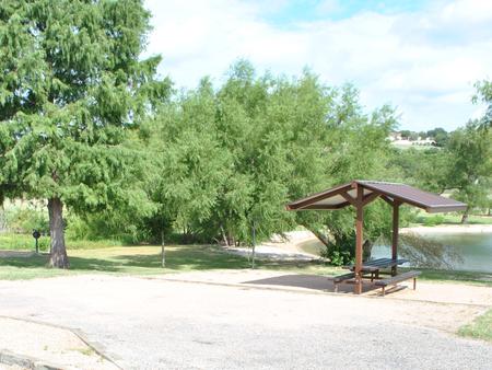
Westcliff Park is a day-use area and campground located on the southwestern shore of Belton Lake. The lake provides some of the best fishing and boating in Central Texas in addition to amenities such as a swimming beach, boat ramp, playground and picnic areas for RVs and tents, including four tent-only primitive sites.
Belton Lake was created by the U.S. Army Corps of Engineers with the construction of Belton Dam in 1954. The 12,300-acre lake is located on the Leon River, just upstream of the confluence of the Leon River and the Little River. It is a long, narrow and winding lake with many curves and coves perfect for fishing.
Recreation
With 136 miles of shoreline, Belton Lake offers a wide variety of recreation activities. Westcliff Park has a nice two-lane boat ramp and swimming beach, and a playground for children. The lake is also a popular fishing spot for hybrid striped bass, largemouth bass, white bass, catfish and sunfish.
Facilities
The campground has 31 sites, most of which have electric hookups for RVs and tents; Four are primitive tent-only sites without hookups.
All of the sites have a covered picnic table, grill and lantern pole. The facility also provides showers. The swim beach, restrooms, and boat ramp are available for both campers and day-users.
Natural Features
The campground is mostly open with a few trees providing shade at picnic areas and at some of the campsites. Westcliff is on a bluff overlooking the lake; while many of the campsites are directly on the shoreline, all campsites have a view of the lake.
The lake area is habitat for deer, wild turkey and water birds such as Great Blue herons, ducks, geese, many species of songbirds and even an occasional bald eagle. A man-made wetland on the opposite side of the lake was constructed to provide an additional 25 acres of wildlife habitat in the lake area.
Nearby Attractions
Belton Lake is located adjacent to the Fort Hood Army Base, which has several points of interest for the military buff.
The mural painted on the spillway wall of Belton Dam depicts the history of the Bell County area.