
Directions
From I-20, take Exit 175 (HWY 150) north 7 miles to campground sign. Turn left onto Mistletoe Road, go 2 miles and turn left onto Winfield Road. Campground is at the end of the road.
Phone
706-541-0147
Activities
BOATING, CAMPING, FISHING, HUNTING, WATER SPORTS
Keywords
WINF,J STROM THURMOND LAKE
Related Link(s)
Overview
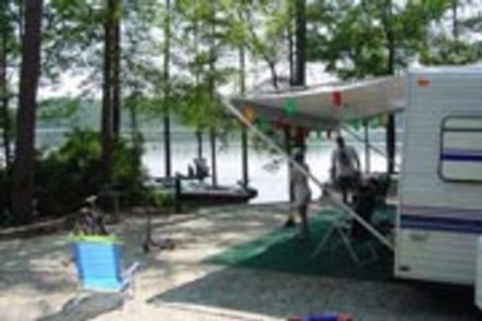
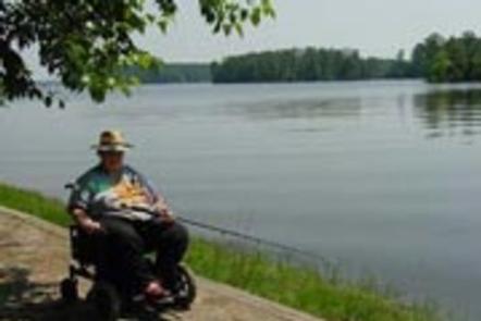
Winfield Campground is located on the Little River near Mistletoe State Park on J. Strom Thurmond Lake. The 70,000 acre lake and its 1,000+ miles of shoreline provide excellent boating, water skiing, swimming, fishing, hiking and picnicking.
Recreation
Thurmond Lake provides some of the best fishing, hunting, and water sports in the southeastern US. Anglers fish for largemouth bass, bream, crappie, catfish and striped bass. The large lake offers endless boating, water skiing, jet skiing, canoeing and swimming opportunities.
Mistletoe State Park is nearby, offering many hiking trails, a nature center and wildlife viewing.
Facilities
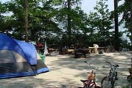
This wooded, waterfront campground contains 80 sites with electrical hookups. Amenities include flush and vault toilets, showers, drinking water, a dump station, playground and boat ramp.
Natural Features
Hot, humid summers and mild, pleasant winters characterize this heavily wooded area on the shore of Thurmond Lake. A mixed pine and hardwood forest covers the site, providing summer shade and fall color.
Wildlife is abundant around the lake. Visitors regularly see southern bald eagles, migratory waterfowl, wild turkeys and whitetail deer.
Nearby Attractions
Numerous parks and recreation areas lie around Thurmond Lake, providing additional boating, swimming, hunting, and hiking opportunities. Nearby cities house museums, art galleries, zoos, restaurants, and shopping areas.
The Augusta National Golf Club hosts the Masters Golf Tournament annually the first week of April.