HUNGRY GULCH, CA Campground Reservation, Info, Images, Map, Directions

HUNGRY GULCH, California Campground Images, Info & Reservations

Listen

Directions

From Bakersfield take Highway 178, to the town of Lake Isabella. From Lake Isabella, take Highway 155 North approximately four miles to the campground.

Phone

760-376-1815

Activities

CAMPING

Keywords

HUNG,LAKE ISABELLA,KERN VALLEY,SEQUOIA NF – FS

Related Link(s)

Rec Area Info & Images

California State Road Conditions

California State Tourism

Forest Service Concessionaire

Overview

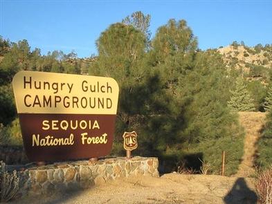
Hungry Gulch Campground sits 3 miles from Lake Isabella in the Sequoia National Forest of California. Visitors enjoy swimming, waterskiing, windsurfing and fishing on the scenic lake.

Recreation

Visitors enjoy fishing, swimming, water skiiing and windsurfing at Lake Isabella, which covers 11,000+ acres on the Kern River and has over 38 miles of shoreline. Anglers will find black and white crappie, bluegill, blue and channel catfish, largemouth bass and rainbow trout. Trout fishing is also available in area streams. Please click here for safety and permit information.

Many hiking opportunities can be found around Lake Isabella and along the Kern River.

Facilities

The campground offers nearly 80 non-specific sites. Picnic tables and campfire rings are provided, as are flush toilets and drinking water.

Natural Features

The campground is situated on a pine-covered hillside, 3 miles from Lake Isabella’s western shores at an elevation of 2,640 feet. Many sites have views of Lake Isabella off in the distance.

Sequoia National Forest, located at the southern end of the Sierra Nevada in central California, is named for the giant sequoia, the world’s largest tree, which grows in more than 30 groves on the forest’s lower slopes.

The forest comprises about 1.1 million acres. Elevations range from about 1,000 to 12,000 feet, creating precipitous canyons and mountain streams with spectacular waterfalls such as Salmon Creek Falls and Grizzly Falls.

Nearby Attractions

The Kern River is a short drive from the campground and offers hiking and fishing opportunities.

Reservation

More from CampingHiking.net:

MATHEWS ARM CAMPGROUND, Virginia Campground Images, Info & Reservations

Listen Directions From Washington, D.C. metro area, travel west on Interstate 66 to exit 43A. Take US Highway 29 South to Warrenton, Virginia, then take US Highway 211 west for 28 miles to Shenandoah National Park and Skyline Drive Thornton Gap Entrance. Follow Skyline Drive north approximately 9 miles and

BLACKHAWK, Utah Campground Images, Info & Reservations

Listen Directions From I-15, take exit 250 toward North Payson/Salem and proceed south on Main Street, then turn east onto 100 North/Highway. Turn south onto 600 East, which becomes the Nebo Loop Scenic Byway/Payson Canyon Road. Travel up the canyon to the campground. Phone SPANISH FORK RANGER DISTRICT 801-798-3571 OR

WILLOW BAY, Pennsylvania Campground Images, Info & Reservations

Listen Directions From Bradford, travel west on PA-346 for 16 miles. Willow Bay is located just south of the Pennsylvania-New York border. Follow signs to the Allegheny Reservoir and the campground. From the south, take PA-321 North to PA-346 and turn left. Continue to the campground on the left. Phone

Superbowl Group Site, Utah Campground Images, Info & Reservations

Listen Directions Turn west off US 191 onto Highway 211 and travel approximately 26 miles. The turn off to the campground is on the south side of the highway. The campground is located approximately 8.5 miles east of Canyonlands National Park and 13.5 miles northwest of Newspaper Rock. The group

CANDLE CREEK CAMPGROUND, Oregon Campground Images, Info & Reservations

Listen Directions From Sisters, OR: Travel 12.4 miles northwest on Highway 20, then 12.3 miles north on Forest Road 12, and then 1.6 miles east on Forest Road 1200 980. Phone 541-323-1746 Activities CAMPING Keywords Related Link(s) Rec Area Info & Images Oregon State Tourism Oregon State Road Conditions Overview