BELKNAP, CA Campground Reservation, Info, Images, Map, Directions

BELKNAP, California Campground Images, Info & Reservations

Directions

From Springville, California, proceed east on State Highway 190 for approximately 15 miles. Turn east on Nelson Drive and continue about a mile to the campground.

Phone

559-539-5230

Activities

BIKING, CAMPING, FISHING, HIKING

Keywords

BELK,GIANT SEQUOIA NATIONAL MONUMEN,SEQUOIA NF – FS

Related Link(s)

Rec Area Info & Images

California State Road Conditions

California State Tourism

Forest Service Concessionaire

Overview

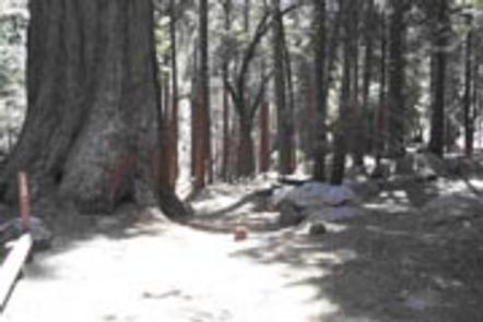
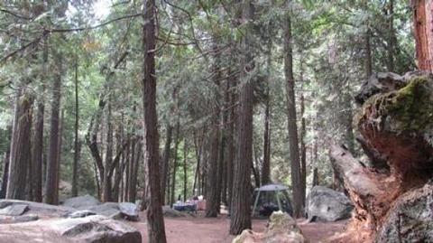
Belknap Campground sits by a small stream and sequoia grove at 5,000 feet elevation in the Giant Sequoia National Monument. The Tule River and Belknap Creek run through or near the campground.

Recreation

Trails in the monument are open to hikers, horseback riders and bikers. The trails wind through giant sequoia groves, up mountains and alongside wild rivers.

A hiking trail also starts within the campground, leading into the sequoia grove, with fishing in Tule River along the way.

Facilities

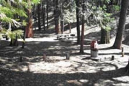
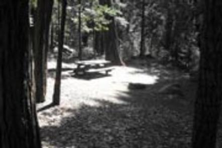
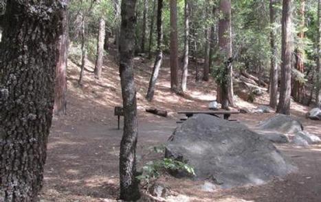
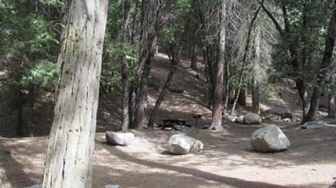
Belknap offers about 13 tent camping sites that can accommodate up to 6 guests each. Vault toilets, campfire rings and picnic areas are all provided.

Natural Features

The Sequoia National Forest, located at the southern end of the Sierra Nevada in central California, takes its name from the giant sequoia, the world’s largest tree, which grows in more than 30 groves on the Forest’s lower slopes.

The Forest comprises about 1.1 million acres, and elevations range from about 1,000 to 12,000 feet, creating precipitous canyons and mountain streams with spectacular waterfalls, such as Salmon Creek Falls near Fairview and Grizzly Falls on the Kings River.

Reservation

More from CampingHiking.net:

SUTTON BLUFF RECREATION AREA, Missouri Campground Images, Info & Reservations

Directions From Centerville, Missouri, travel 3 miles northeast on Highway 21. Take County Road 907 northwest for 7 miles, then turn on County Road 849 and travel south for 3 miles to the campground. Phone 573-729-6656 Activities BIKING, BOATING, CAMPING, FISHING, HIKING, HORSEBACK RIDING, HUNTING, WILDLIFE VIEWING, SWIMMING SITE Keywords

SUNRISE CABIN, Virginia Campground Images, Info & Reservations

Directions From I-81, take exit 80 (Fort Chiswell) and go east on US 52 for about 1 mile. Turn right and drive south on VA 94 for about 12 miles to the intersection of the Virginia Highlands Horse Trail. Turn right onto a gravel road marked with orange diamonds (this

DUCK CREEK, Utah Campground Images, Info & Reservations

Directions Take Highway 14 from Cedar City, Utah, 28 miles east to Duck Creek campground. Campground turnoff will be on the left hand side of the highway, before you reach Duck Creek Village. Phone 801-226-3564 Activities BIKING, BOATING, CAMPING, FISHING, HIKING, HUNTING, VISITOR CENTER, WILDLIFE VIEWING, PHOTOGRAPHY, MOUNTAIN BIKING, CANOEING,

ASPEN GLADE, Colorado Campground Images, Info & Reservations

Directions From Antonito, Colorado, go west on Highway 17 for approximately 15 miles to the Aspen Glade Campground. Phone 435-245-6521 Activities CAMPING, FISHING Keywords ASGL,RIO GRANDE NF- FS Related Link(s) Rec Area Info & Images Colorado State Road Conditions Colorado State Tourism Overview Aspen Glade Campground sits on the Conejos

GRAYBACK, Idaho Campground Images, Info & Reservations

Directions From Boise, take State Highway 21 north for 36 miles. Campground access road is located on the east side of the road, between mileposts 36 and 37. Turn right and travel a quarter-mile to the campground. Phone 208-392-6681 Activities CAMPING, FISHING, HIKING, HUNTING, VISITOR CENTER, WILDLIFE VIEWING Keywords GRA1,GRAYBACK