DORABELLE CAMPGROUND, CA Campground Reservation, Info, Images, Map, Directions

DORABELLE CAMPGROUND, California Campground Images, Info & Reservations

Directions

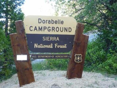
From Clovis: Take Highway 168 north for 49 miles to the town of Shaver Lake. Turn right on Dorabelle Road and go .5 miles to the campground. Campground registration information is at the campground entry station.

Phone

559-841-3533

Activities

BOATING, CAMPING, FISHING, HIKING, WATER SPORTS, SWIMMING SITE

Keywords

DORA,DOOR BELL,SHAVER LAKE,SIERRA NF – FS

Related Link(s)

Rec Area Info & Images

California State Road Conditions

Forest Service Concessionaire

California State Tourism

Overview

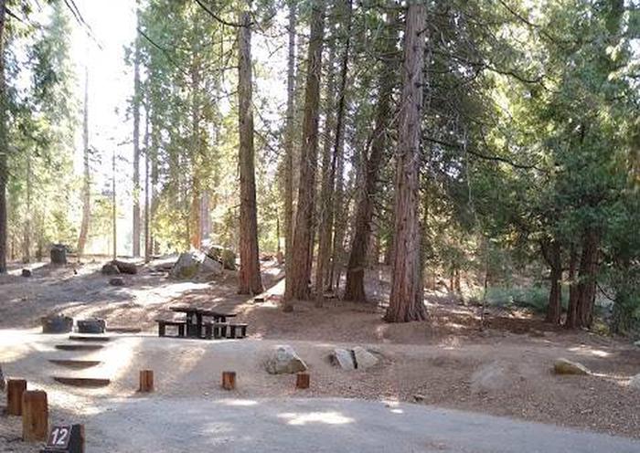
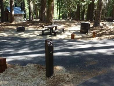
Dorabelle Campground is a popular family camping destination above Shaver Lake. Some sites are shaded by a thick stand of fir, cedar and pine trees, while other sites are more open.

This camp is a great base for experiencing the wide variety of recreational activities in the area. Boats can be moored nearby and some sites offer views of the lake.

Recreation

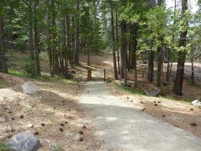
Hikers can access 5 trails from the campground: Dinkey Road (.5 miles), Musick Meadow (.75 miles), Peninsula Loop (1 mile), Burr Meadow (1.5 miles) and Osprey Cove (2 miles). Horseback riding is also offered nearby.

Popular activities at Shaver Lake include swimming, motorized boating, canoeing, kayaking, water skiing, jet skiing, windsurfing, sailing and fishing. Anglers can fish for kokanee salmon, rainbow trout, brown trout, smallmouth bass, catfish and bluegill.

Facilities

Each site has a dirt parking spur, table, fire ring, and grill. Drinking water and vault toilets are provided.

Natural Features

Surrounded by dense pine forest, Shaver Lake is a popular destination within the High Sierra Ranger District. It sits at an elevation of 5,500 feet and is known for its variety of fish.

The Sierra National Forest, located on the western slope of the central Sierra Nevada, is known for its spectacular mountain scenery and abundant natural resources.

The terrain includes rolling, oak-covered foothills, heavily forested middle elevation slopes and the starkly beautiful alpine landscape of the High Sierra.

Nearby Attractions

The picturesque town of Shaver Lake is nearby, offering restaurants and shopping.

Reservation

More from CampingHiking.net:

FISHERMANS CORNER, Illinois Campground Images, Info & Reservations

Directions From Interstate 80, take Exit 1 for Highway 84, East Moline/Savanna. Travel South on Highway 84 S/2nd Ave and follow for 1.5 miles to the campground. Entrance to campground will be on the right. From East Moline, travel North on Highway 84. Entrance to campground will be on the

TUTTLE CREEK COVE, Kansas Campground Images, Info & Reservations

Directions From the intersection of US-24 and K-13 at the west end of the dam, turn east onto K-13, then immediately turn north onto Tuttle Cove Road and continue 3 miles to the campground entrance. Phone (785)539-6523 Activities BIKING, BOATING, CAMPING, FISHING, HIKING, HUNTING, WILDLIFE VIEWING, SWIMMING SITE Keywords TTLE,TUTTLE

SOQUEL CAMPGROUND, California Campground Images, Info & Reservations

Directions From Fresno, take Highway 41 north through town of Oakhurst. Take the Sky Ranch Road (Road 632) east for 7 miles, turn southeast on Forest Road 6S40, and travel 1 mile to Soquel Campground. Phone 559-642-3212 Activities CAMPING, HIKING Keywords SOQU,SIERRA NF – FS Related Link(s) Rec Area Info

DEER CREEK LAKE DAY USE, Ohio Campground Images, Info & Reservations

Directions From Columbus, Ohio, take Highway 62 south to Mt. Sterling. Turn south on Route 207 and continue for 8 miles to the lake. Turn at the intersection; picnic shelter is on Crownover Mill Road. Phone 740-869-2243 Activities BOATING, CAMPING, FISHING, HIKING, HUNTING, SWIMMING SITE Keywords DCBD,BELOW DAM AREA,PICNIC SHELTER

CRESCENT LAKE (MN), Minnesota Campground Images, Info & Reservations

Directions Travel Highway 61 along Lake Superior’s north shore to Tofte, Minnesota. In Tofte, turn north (away from Lake Superior) on Sawbill Trail (CCHS 2). Follow the Sawbill Trail for 16 miles to The Grade (Forest Road 170). Turn right onto the The Grade and proceed east for 7 miles.