HOLEY MEADOW, CA Campground Reservation, Info, Images, Map, Directions

HOLEY MEADOW, California Campground Images, Info & Reservations

Directions

From Highway 99, turn east on J22. Travel on J22 through California Hot Springs, then turn left at onto M50. After approximately 10 miles turn left at M107. The entrance to Holey Meadow Campground is on the left about a mile after the turn.

Phone

559-539-5230

Activities

BIKING, CAMPING, HIKING

Keywords

HOLE,GIANT SEQUOIA NATIONAL MONUMEN,SEQUOIA NF – FS

Related Link(s)

Rec Area Info & Images

Forest Service Concessionaire

California State Tourism

California State Road Conditions

Overview

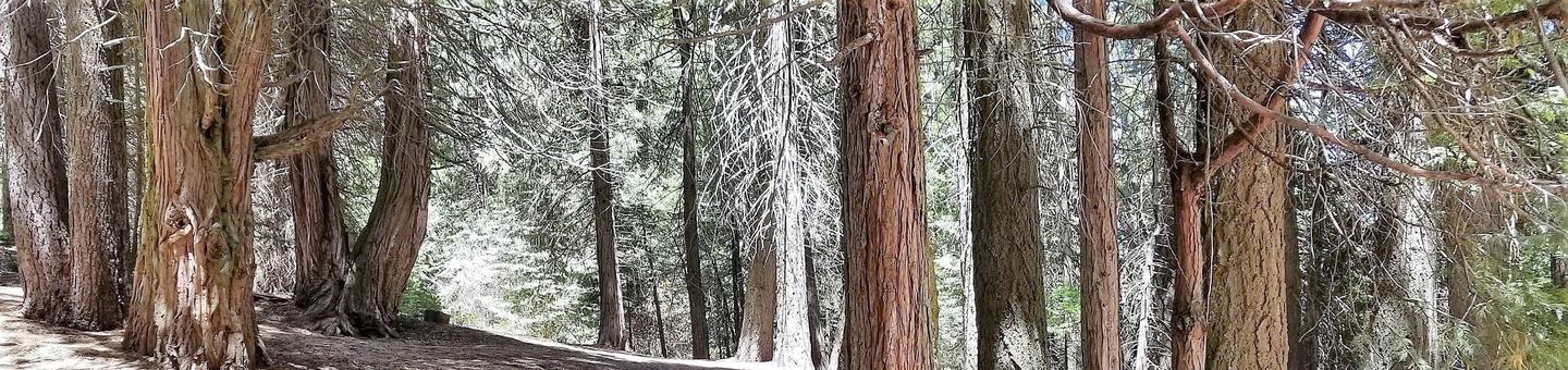
The Sequoia National Forest, located at the southern end of the Sierra Nevada in central California, takes its name from the giant sequoia, the world’s largest tree, which grows in more than 30 groves on the Forest’s lower slopes. The Forest comprises about 1.1 million acres.

Elevations range from about 1,000 to 12,000 feet, creating precipitous canyons and mountain streams with spectacular waterfalls such as Salmon Creek Falls near Fairview and Grizzly Falls on the Kings River.

This remote campground is popular with hikers and people who want to tour the giant sequoias, including the Trail of a Hundred Giants.

Recreation

Activities in this remote area include hiking and touring giant sequoias. Trails in the monument, open to hikers, horses and bikes, wind through giant sequoia groves, up mountains, and alongside wild rivers. Plenty of hiking is offered nearby, including a wheelchair-accessible nature trail, the Trail of a Hundred Giants.

Facilities

This campground accommodates tents only and has 10 individual campsites. It is primitive with no available water. Each campsite is equipped with a picnic table and campfire ring; vault toilets are available at the campground.

This facility is operated by Sequoia Recreation, a division of California Land Management and comments are welcome; comment forms are available from campground hosts or online.

Natural Features

This primitive campground sits at an elevation of 6,400 feet southeast of Porterville, California, within the Giant Sequoia National Monument. It is a short drive to the the Trail of a Hundred Giants, through the Redwood or Long Meadow sequoia grove.

Nearby Attractions

The Redwood and Long Meadow Sequoia groves and the Trail of a Hundred Giants are a short drive away.

Reservation

More from CampingHiking.net:

FRENCH GULCH, California Campground Images, Info & Reservations

Directions From Bakersfield, California, take Highway 178 east to the town of Lake Isabella. Turn onto Highway 155 north, following the western edge of the lake, for approximately 3 miles to the campground. Phone 760-376-1815 Activities CAMPING, PICNICKING Keywords FREG,LAKE ISABELLA,KERN VALLEY,SEQUOIA NF – FS Related Link(s) Rec Area Info

Laurel River Lake Picnic Area, Kentucky Campground Images, Info & Reservations

Directions From London, Kentucky, head west on HWY 192 for approximately 15 miles. Turn slight left onto KY-1193. Continue on KY-1193 until arrive at destination on left. Area is marked by "Laurel Dam Picnic Area" signs. Phone 606-864-6412 Activities HIKING, SWIMMING SITE Keywords Laurel River Lake Picnic Area,Laurel Picnic Area

VIOLA, Missouri Campground Images, Info & Reservations

Directions From Shell Knob, Missouri, take Highway 39 south for 7 miles and turn west to campground entrance. Phone 417-858-3904 Activities BIKING, BOATING, CAMPING, FISHING, HIKING, PICNICKING, WATER SPORTS, WILDLIFE VIEWING, DAY USE AREA, SWIMMING SITE, KAYAKING Keywords VIOL,TABLE ROCK LAKE,TABLE ROCK LAKE Related Link(s) Rec Area Info & Images

Dam Site Shelter, North Carolina Campground Images, Info & Reservations

Directions From Charlotte, North Carolina, take I-77 North (approximately 60 miles) before merging onto Highway 421 North towards Wilkesboro/Boone. Continue to Exit 286B (approximately 20 miles), turn left onto Highway 268, continue for approximately 4 miles and turn right on Reservoir Road. Turn left into the Visitor Assistance Center parking

POUND RIVER CAMPGROUND (VA), Virginia Campground Images, Info & Reservations

Directions From Clintwood Main Street, turn on to Brush Creek Rd., State Rte 631 2.2 miles. Turn right onto State Rte 754 for 1.1 miles. Turn right onto Pound River Campground Rd. Phone 276-835-9544 Activities BIKING, BOATING, CAMPING, FISHING Keywords Related Link(s) Rec Area Info & Images Virginia State Road