
Directions
From Portland, travel southeast on Highway 26 for about 32 miles.
Phone
503-630-5721
Activities
BIKING, HISTORIC & CULTURAL SITE, CAMPING, FISHING, HIKING
Keywords
TOLL,MT. HOOD NF – FS
Related Link(s)
Overview
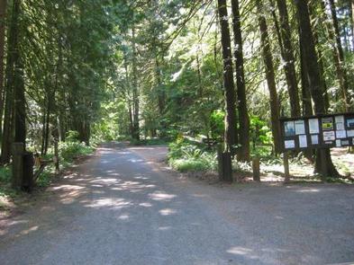
Tollgate Campground is one of the most convenient to Portland, making it a great headquarters for exploring the Mt. Hood area. It stands in the southwestern shadow of Oregon’s highest point, Mt. Hood. The campground provides access to a variety of trails, as well as historic sites, including spots along the famed Oregon Trail.
Recreation
A variety of hiking, mountain biking and horseback riding trails are available in the area. The nearly 10-mile Pioneer Bridle Trail passes through the campground. A replica of the original Barlow Road tollgate is just east of the campground. The gate was used by travelers along the Oregon Trail from 1879 to 1919.
A day-use picnic area at the campground, providing access to the scenic surroundings, as well as the nearby river and Camp Creek. Anglers enjoy the sport of catch-and-release fishing for small trout and whitefish.
Facilities
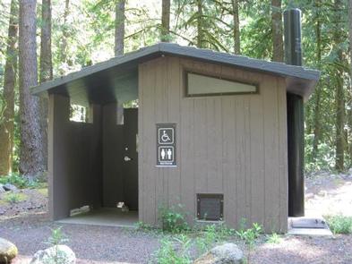
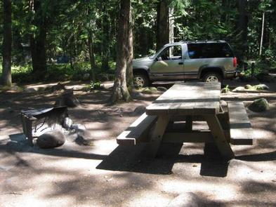
The campground offers single-family sites for tent and RV camping. Parking surfaces are dirt and gravel and sometimes uneven. Each site is equipped with tables and campfire rings with grills. Accessible vault toilets and drinking water are provided.
An adjacent picnic shelter can be reserved for day use and can accommodate up to 30 people and 10 vehicles. It is equipped with multiple tables and pedestal grills.
Natural Features
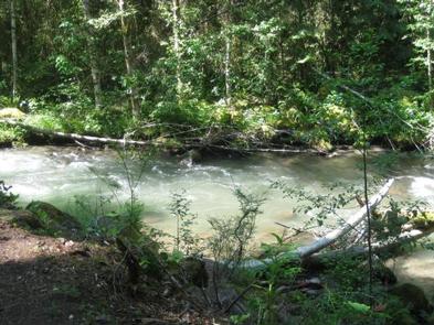
The campground is located in the Mt. Hood National Forest, approximately 32 miles southeast of Portland, at an elevation of about 2,100 feet. The campground sits on the north bank of the Zigzag River, just east of the community of Rhododendron, in a humid, semi-subtropic environment of Douglas fir and cedar trees.
Tollgate Campground was originally constructed by the Civilian Conservation Corps, and some historic features, such as rock fireplaces and a reconstructed picnic shelter still remain.
Nearby Attractions
The campground is 2.5 miles from the town of Zigzag, which offers a variety of services, including lodging, eateries and a variety of shops.