RIVERSIDE (OR), OR Campground Reservation, Info, Images, Map, Directions

RIVERSIDE (OR), Oregon Campground Images, Info & Reservations

Directions

From Estacada, travel east on Highway 224 for approximately 26 miles, then keep right onto Highway 46 for approximately 2 miles to the campground.

Phone

503-630-5721

Activities

BIKING, CAMPING, FISHING, HIKING, WATER SPORTS, WILDLIFE VIEWING

Keywords

RIVX,MT. HOOD NF – FS

Related Link(s)

Rec Area Info & Images

Oregon State Road Conditions

Oregon State Tourism

Forest Service Concessionaire

Overview

Riverside Campground is a charming and rustic campground, situated alongside the Wild and Scenic Clackamas River in Mt. Hood National Forest. It provides access to a variety of hiking, mountain biking and horseback riding trails and is a great place to experience nature.

Recreation

Fishing is very popular in the Oak Fork and anglers can expect a catch of winter steelhead, spring Chinook and late summer Kokanee salmon, as well as other species of freshwater fish. The Clackamas River also provides miles of wild water as it bends through the scenic Cascade range, making whitewater rafting a popular activity.

The 5-mile Riverside National Recreation Trail, popular for hiking and mountain biking, is located not far from the campground. The surrounding area provides numerous additional opportunities for hiking.

Facilities

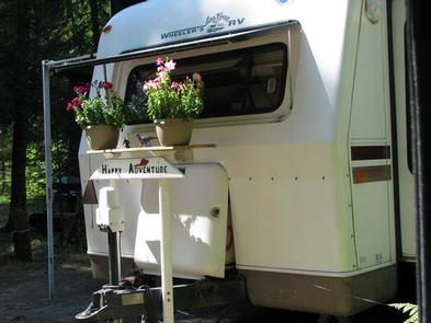
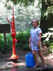
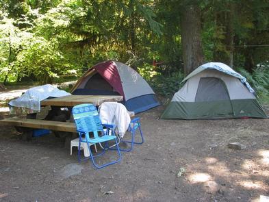
The campground offers more than a dozen single-family sites for tent and small RV camping. Each site is equipped with a table and campfire ring with grill. Accessible vault toilets and drinking water are provided, but no hookups are available. Parking surfaces are paved and gravel.

Natural Features

The campground is located in Mt. Hood National Forest along the Oak Grove Fork of the Clackamas River at an elevation of about 1,400 feet. Huge maple and Douglas fir trees cover the area, and dense shrubbery provides some privacy between campsites. The campground is not far from the Ripplebrook Ranger Station and Ripplebrook Pond.

The river provides habitat for the federally protected bald eagle and northern spotted owl, as well as an occasional peregrine falcon. A variety of wildlife makes its home in the area.

Nearby Attractions

Bagby Hot Springs is located about 14 miles southwest of the campground. A popular site for soaking and relaxing, the springs are in a heavily wooded area in the scenic Cascade Range. The available bathhouses are fed by three major hot water springs and several minor outlets in the area. A historic guard station was built there in 1913.

Reservation

More from CampingHiking.net:

FRYING PAN, Utah Campground Images, Info & Reservations

Directions From Highway 24 northwest of Loa, Utah, take Highway 25 northeast approximately 15 miles to the campground. Phone 435-836-2811 Activities BIKING, BOATING, CAMPING, FISHING, HIKING, WILDLIFE VIEWING Keywords FRYI,FISHLAKE NF – FS Related Link(s) Rec Area Info & Images Utah State Road Conditions Utah State Tourism Overview Frying Pan

Contorta Flat Campground, Oregon Campground Images, Info & Reservations

Directions From Crescent, OR: Travel 12.2 miles west on County Road 61/Crescent Cut-off Road, then 3.5 miles north on Highway 58, then 9.9 miles southwest on Forest Road 60. Phone 541-323-1746 Activities CAMPING Keywords Related Link(s) Rec Area Info & Images Oregon State Tourism Oregon State Road Conditions Overview Contorta

MOUNT ROSE (NV), California Campground Images, Info & Reservations

Directions From Highway 395 south of Reno, travel 17 miles west on State Route 431, following signs to the campground. The Actual Mailing Address is: PO Box 104, Markleeville, CA 96120. The Physical Address is: Mt. Rose Hwy, State Route 431, Reno, NV 89511. Phone 530-694-1002 Activities BIKING, CLIMBING, CAMPING,

WHITE CLIFFS PARK, Arkansas Campground Images, Info & Reservations

Directions Located six miles south of Cowlingsville on State Highway 317. Phone 870-287-4253 Activities BOATING, CAMPING, FISHING Keywords Related Link(s) Rec Area Info & Images Arkansas State Tourism Arkansas State Road Conditions Overview White Cliffs Campground is located on the east bank of the Little River feeding into Millwood Lake

HUNGRY GULCH, California Campground Images, Info & Reservations

Directions From Bakersfield take Highway 178, to the town of Lake Isabella. From Lake Isabella, take Highway 155 North approximately four miles to the campground. Phone 760-376-1815 Activities CAMPING Keywords HUNG,LAKE ISABELLA,KERN VALLEY,SEQUOIA NF – FS Related Link(s) Rec Area Info & Images California State Road Conditions California State Tourism

THREEMILE CAMPGROUND, Wyoming Campground Images, Info & Reservations

Directions From Cody, Wyo., follow Sheridan Avenue west through Cody until the road leaves town and becomes the Buffalo Bill Cody Scenic Byway (U.S. Highway 14/16/20). The campground is located almost 49 miles west of Cody, on the south side of U.S. Highway 14/16/20, next to the Shoshone River. Phone