

Directions
From Estacada, travel east on Highway 224 for 26 miles to the campground, which is just past the Ripplebrook Camp Store.
Phone
503-630-5721
Activities
CAMPING, FISHING, WATER SPORTS
Keywords
RIPP,MT. HOOD NF – FS
Related Link(s)
Overview
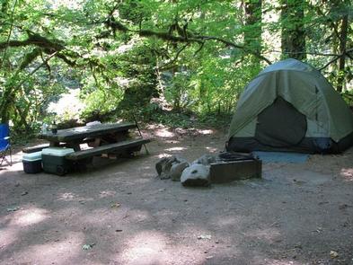
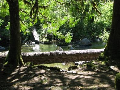
Ripplebrook Campground is a charming facility for nature enthusiasts and lies in a beautiful forest setting. Fly fishing and whitewater rafting are popular near the campground, as it neighbors the Clackamas Wild and Scenic River. The small facility is geared more toward tent camping, however, tent trailers and RVs under 19 feet are welcome.
Recreation
Fishing is very popular in the Clackamas River and anglers can expect a catch of winter steelhead, spring chinook and late summer kokanee salmon, as well as other species of freshwater fish. Whitewater rafting is also a favorite pastime. The Clackamas provides miles of wild water as it bends through the scenic Cascade Range.
The 5-mile Riverside National Recreation Trail, popular for hiking and mountain biking, is located not far from the campground. The surrounding area provides numerous additional trail opportunities.
Facilities
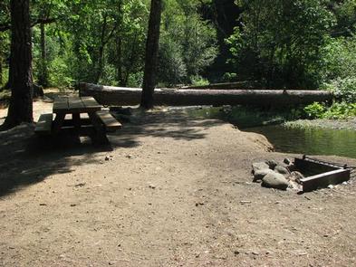
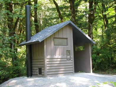
The campground offers single-family sites for tent and small RV camping. Each site is equipped with a table and campfire ring with grill. Accessible vault toilets are provided. Utility hookups are not available. Parking surfaces are paved and gravel.
Natural Features
The campground borders the Oak Fork of the Clackamas River in a dense forest of mature maple, cedar and fir trees. Large shrubs and ferns blanket the forest floor, providing privacy between campsites. The campground is situated at an elevation of about 1,400 feet. The Ripplebrook Ranger Station and Ripplebrook Pond are close by.
The river provides habitat for the federally protected bald eagle and northern spotted owl, as well as an occasional peregrine falcon. A variety of wildlife makes its home in the area.
Nearby Attractions
Bagby Hot Springs is located about 14 miles southwest of the campground. A popular site for soaking and relaxing, the springs are in a heavily wooded area in the scenic Cascade Range. The available bathhouses are fed by three major hot water springs and several minor outlets in the area. A historic guard station was built there in 1913.