Howell Run Picnic Area, WV Campground Reservation, Info, Images, Map, Directions

Howell Run Picnic Area, West Virginia Campground Images, Info & Reservations

Directions

From Cumberland, MD, take US 220 south to US 50W, go west to WV 42N, go north to WV 46E. Follow the signs to the Howell Run Picnic Area.

Phone

304 355-2346

Activities

BOATING, CAMPING, FISHING, HIKING, PICNICKING, SWIMMING SITE, OTHER RECREATION CONCESSION SITE

Keywords

Jennings Randolph Lake,Picnic Area

Related Link(s)

Rec Area Info & Images

West Virginia State Road Conditions

West Virginia State Tourism

Overview

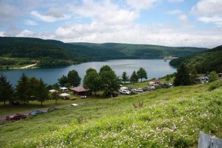
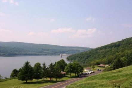
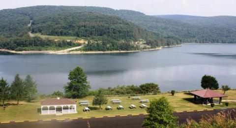
The Howell Run Picnic Area is a day use facility overlooking Jennings Randolph Lake, providing a beautiful backdrop for picnicking, sightseeing and hiking. A nesting pair of bald eagles call Jennings Randolph Lake home. Bring binoculars for the lucky chance to spot a bald eagle.

Recreation

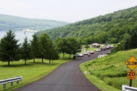
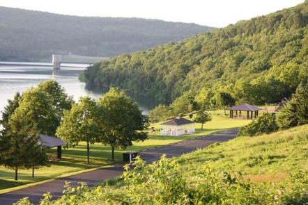
At the Howell Run Picnic Area, enjoy the panoramic view of the lake. Walk the Lakeside trail which connects the picnic area with the Shaw Beach area.

Facilities

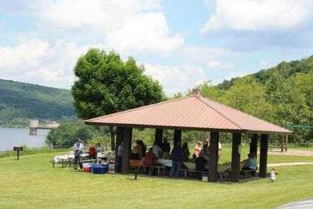
Shelter #2 is handicap accessible and has running water. It is closest to the restroom and playground equipment. The Gazebo is located in the center of the picnic area. Shelter #1 is the first shelter as you drive in. Each shelter comfortably accommodates groups of up to 30 people in a lovely lakeside setting.

Natural Features

The Lake spans 952 acres in the rugged hills of the West Virginia Allegany Mountains.

Nearby Attractions

A mile down the road is Shaw Beach where you can enjoy swimming. The project offers facilities for hiking, fishing, biking, swimming, boating and camping.

Reservation

More from CampingHiking.net:

WHITETAIL CAMPGROUND, Arizona Campground Images, Info & Reservations

Directions From Tucson, Arizona, go north on Catalina Highway approximately 30 miles from Tucson until you reach Milepost 20. Turn Left on Whitetail Road. Phone 520-576-9198 Activities CAMPING, HIKING Keywords WHTE,WHITE TAIL,WHITE TRAIL,WHITETAIL,WHITE TALE,CORONADO NF – FS Related Link(s) Rec Area Info & Images Forest Service Concessionaire Arizona State Road

SNAKE CREEK, Oklahoma Campground Images, Info & Reservations

Directions From Gore, OK, go 15 miles northeast on Highway 100, then turn left and go 1/2 mile west on paved access road. Phone 918-487-5252 Activities BOATING, CAMPING, SWIMMING SITE Keywords SANK,TENKILLER LAKE,TENKILLER FERRY LAKE,TENKILLER FERRY Related Link(s) Rec Area Info & Images Oklahoma State Road Conditions Oklahoma State Tourism

DEER CREEK LAKE DAY USE, Ohio Campground Images, Info & Reservations

Directions From Columbus, Ohio, take Highway 62 south to Mt. Sterling. Turn south on Route 207 and continue for 8 miles to the lake. Turn at the intersection; picnic shelter is on Crownover Mill Road. Phone 740-869-2243 Activities BOATING, CAMPING, FISHING, HIKING, HUNTING, SWIMMING SITE Keywords DCBD,BELOW DAM AREA,PICNIC SHELTER

SMITH RAPIDS, Wisconsin Campground Images, Info & Reservations

Directions From Fifield, travel east on State Highway 70 for a little more than 12 miles and turn left (north) onto Forest Service Road 148. Continue for 2 miles to the campground. Phone 715-762-2461 Activities BOATING, CAMPING, FISHING, HIKING, HORSEBACK RIDING Keywords SRAP,CHEQUAMEGON-NICOLET NF – FS Related Link(s) Rec Area