
Directions
From Sandy, Oregon, travel east on Highway 26 for approximately 40 miles to Skyline Road/Road 42. Turn right on Skyline Road and continue south for about 9 miles. Turn right on Forest Service Road 57 and travel west for 2 miles, then turn right again at the Hoodview Campground entrance sign.
Phone
503-464-8515
Activities
BIKING, BOATING, HISTORIC & CULTURAL SITE, CAMPING, INTERPRETIVE PROGRAMS, FISHING, HIKING, HORSEBACK RIDING, PICNICKING, WILDLIFE VIEWING, PHOTOGRAPHY, PADDLING, SWIMMING, MOTOR BOAT, WATER ACTIVITIES, CANOEING, BERRY PICKING, STAR GAZING, BIRDING, NON-MOTORIZED BOATING, EVENING PROGRAMS, SAILING, AMPHITHEATER, CRAWFISHING
Keywords
HOOD,MT. HOOD NF – FS,Timothy Lake
Related Link(s)
Overview
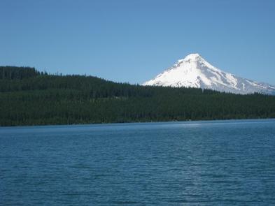
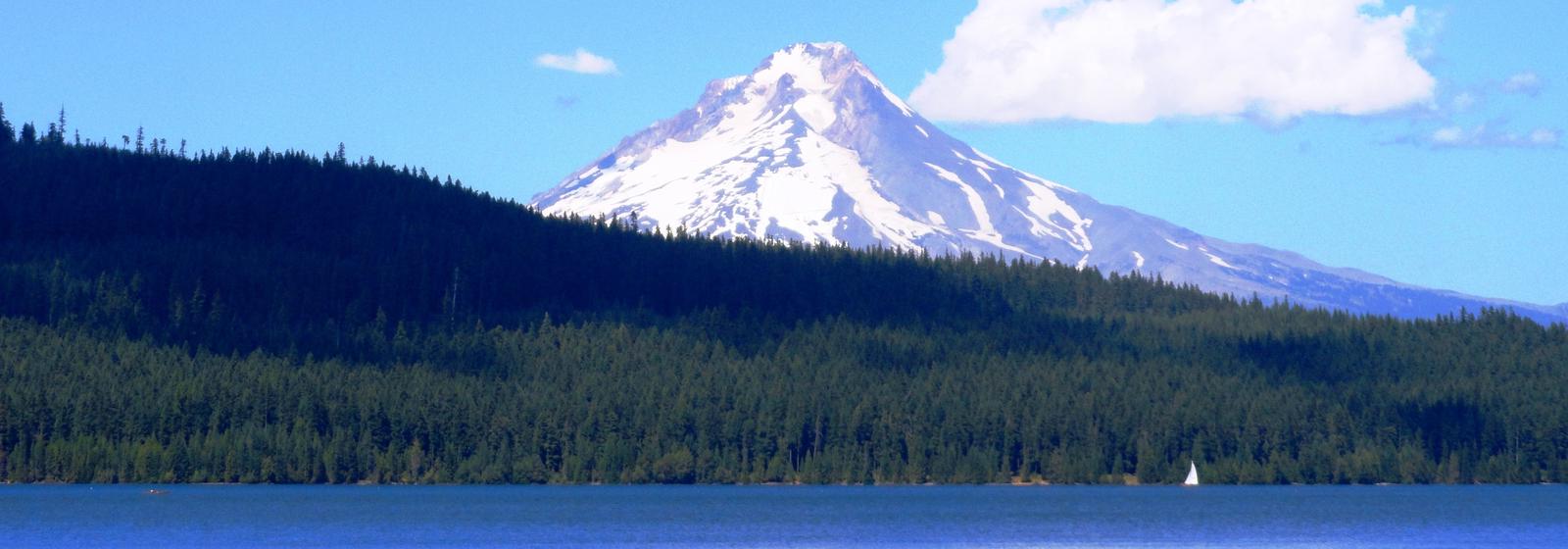
The Hoodview Campground sits on the shores of Timothy Lake, in the shadow of Oregon’s Mt. Hood. The surrounding forest setting offers spectacular views, miles of trails for exploration and abundant fishing.
Recreation
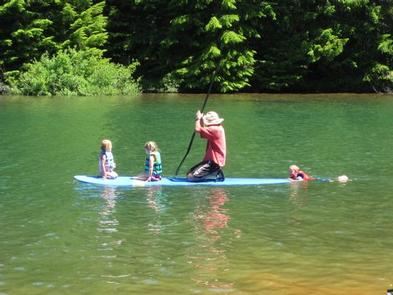
Proximity to Timothy Lake allows campers to enjoy a variety of water-related recreation activities, including boating and sailing, as well as swimming, windsurfing and fishing. Anglers can expect a catch of kokanee salmon and a variety of trout. A range of trails are located in the area. The Timothy Lake Trail is popular for hiking, mountain biking and horseback riding. The 12 miles of relatively level terrain loops trekkers around the lake, providing scenic views of the area. It connects to the Pacific Crest National Scenic Trail, a lengthy hike that extends across three states, from the borders of Canada and Mexico. Portions of that trail also lead southwest to Clackamas Lake Campground. The Clackamas Lake Ranger Station Historic District is less than 3 miles from the campground. It was built to house forest service workers in the early 1900s. The rustic architecture and historic nature of the buildings and the surrounding area draws thousands of tourists each year.
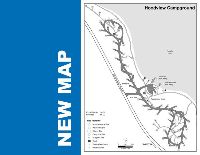
Facilities
The campground offers dozens of single-family campsites for tent and RV camping. Each site is equipped with tables and campfire rings with grills. Accessible vault toilets and drinking water are provided. A campground host is also available on-site.
Natural Features
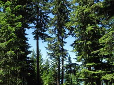
The campground is situated on the southeastern shore of the roughly 1,400-acre lake, at an elevation of 3,400 feet. Timothy Lake was created in 1956 as a storage reservoir for the Oak Grove Hydroelectric Project. It is one of the larger lakes in the Mt. Hood National Forest. The campground is nestled in a mixed conifer forest, with many sites with views of the water’s edge, offering views of Mt. Hood. A thick understory of rhododendron bushes provide privacy between sites.
Nearby Attractions
Hoodview is about 28 miles from the base of majestic Mt. Hood, the highest point in Oregon. The historic Timberline Lodge in Government Camp offers scenic views of the snow-capped mountain.
Charges & Cancellations
A service fee will apply if you change or cancel your reservation. Late cancellations are subject to additional fees. For full details see Recreation.Gov, Rules & Reservation Policies.