CRANE VALLEY, CA Campground Reservation, Info, Images, Map, Directions

CRANE VALLEY, California Campground Images, Info & Reservations

Directions

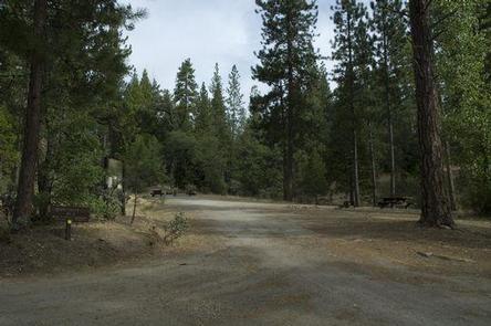
From Fresno, California, take Highway 41 north through Oakhurst. Turn right on Forest Road 222, towards Bass Lake. Keep right for 3.5 miles to the campground.

Phone

559-642-3212

Activities

BOATING, CAMPING, INTERPRETIVE PROGRAMS, FISHING, HIKING, WATER SPORTS, SWIMMING SITE

Keywords

CRVA,BASS LAKE OAKHURST AR,SIERRA NF – FS

Related Link(s)

Rec Area Info & Images

Forest Service Concessionaire

California State Tourism

California State Road Conditions

Overview

Crane Valley will be closed the entire 2019 – 2022 camping season due to a massive hazard tree removal

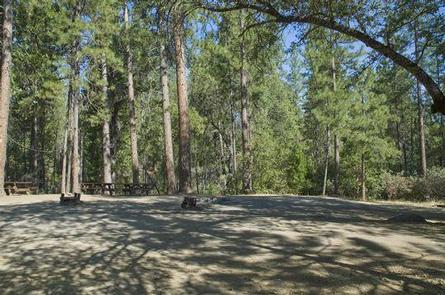
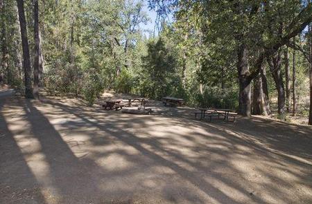
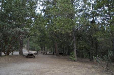
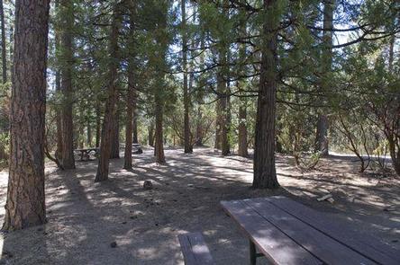
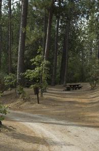
Crane Valley Group Campground is located adjacent to Bass Lake and can accommodate up to 7 groups with tents and RVs. The facility is shaded by a dense forest of oak, cedar and pine trees, and although none of the sites offer direct views of the lake, the campground offers convenient access to the many recreational activities and attractions in the area.

Recreation

Activities on Bass Lake include motorized and non-motorized boating, fishing, swimming, hiking, sailing and water skiing. California Land Management sponsors a variety of interpretive programs throughout the summer at several locations in the Bass Lake area.

Facilities

This group campground has 7 sites that can accommodate between 12 to 30 people each. Each site has grills, fire rings and tables. Portable toilets are provided, but campers must bring drinking water.

Natural Features

The Sierra National Forest, located on the western slope of the central Sierra Nevada, is known for its spectacular mountain scenery and abundant natural resources.

The terrain includes rolling, oak-covered foothills, heavily forested middle elevation slopes and the starkly beautiful alpine landscape of the High Sierra.

Nearby Attractions

Yosemite National Park is under an hour away and makes an ideal day trip from Crane Valley Campground.

Reservation

More from CampingHiking.net:

ROBINSON POINT, Arkansas Campground Images, Info & Reservations

Directions From Mountain Home, AR, travel 9 mi E on US 412/62; turn right onto CR 279/Robinson Pt. Rd. for 3 mi to park entrance. Follow signs into campground. Phone 870-492-6853 Activities BOATING, CAMPING, FISHING, HIKING, VISITOR CENTER, SWIMMING SITE Keywords ROBP,NORFORK LAKE,NORFORK LAKE Related Link(s) Rec Area Info &

CHEOAH POINT CAMPGROUND, North Carolina Campground Images, Info & Reservations

Directions From Robbinsville, North Carolina, continue on Highway 129 north for approximately 6 miles. Turn left on SR # 1145 – Thunderbird Mountain Road. Continue approximately 1.3 miles on Thunderbird Mountain Road to the Cheoah Point Campground. Phone 828-479-6431 Activities BOATING, CAMPING, FISHING, HIKING, SWIMMING, WATER ACTIVITIES, KAYAKING, CANOEING, NON-MOTORIZED

SARAH TOTTEN CAMPGROUND, California Campground Images, Info & Reservations

Directions From I-5, take exit 786 to Highway 96 (Klamath River Highway). Follow Highway 96 west for about 35 miles. The campground entrance is on the right, about 1 mile east of Hamburg, CA. Phone 530-493-2243 Activities CAMPING, FISHING, SWIMMING, WHITEWATER RAFTING Keywords SATO,KLAMATH NF – FS Related Link(s) Rec

STONY POINT, Minnesota Campground Images, Info & Reservations

Directions From Walker, Minn., take Highway 200 east 6 miles to County Road 13. Go north 3 miles on County Road 13 to Forest Road 3793, then east 2.5 miles on FR 3793 to the campground. Phone 218-547-1044 Activities BOATING, CAMPING, FISHING, HIKING, SWIMMING SITE Keywords STOP,CHIPPEWA NF – FS