LONE ROCK (CA), CA Campground Reservation, Info, Images, Map, Directions

LONE ROCK (CA), California Campground Images, Info & Reservations

Directions

Take Arlington Road off Highway 89 (near Crescent Mills) to Taylorsville Road, continuing on Genesee Road and Indian Creek Road to Antelope Lake.

Phone

530-283-0555

Activities

BIKING, BOATING, CAMPING, INTERPRETIVE PROGRAMS, FISHING, SWIMMING SITE

Keywords

LON1,ANTELOPE LAKE,SUSANVILLE,TAYLORSVILLE,JANESVILLE,PLUMAS NF – FS

Related Link(s)

Rec Area Info & Images

California State Tourism

California State Road Conditions

Forest Service Concessionaire

Overview

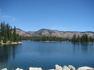
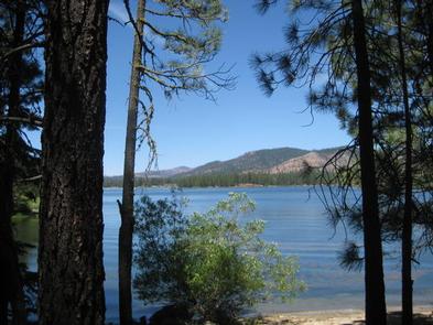
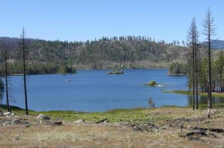
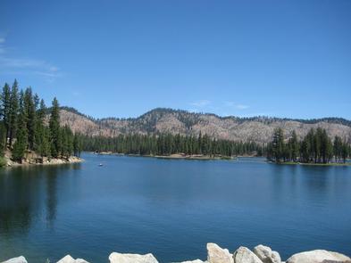
Lone Rock Campground is one of three in the Antelope Lake Recreation Area. Nestled in the beautiful northern Sierra Nevada mountain range, it offers forested woods and scenic vistas as far as the eye can see.

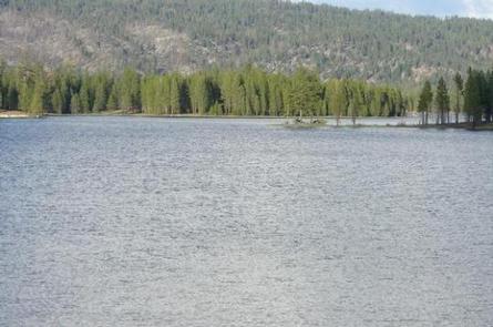
Antelope Lake is one of the more remote, quiet lakes in the Plumas National Forest, making it a popular destination for anglers and explorers of all abilities.

Recreation

The campground’s close proximity to the lake provides visitors with access to fishing, swimming, boating, water skiing and other water-related recreation activities. Anglers can look forward to a well-stocked trout, bass and catfish population.

Educational programs are offered at the campground’s amphitheater. Hiking and mountain biking opportunities abound. The Sunset Point trail begins near the campground.

Facilities

The campground offers multiple sites for both tent and RV camping, several of them adjacent to the lake, providing views of the lake. Space allows for two vehicles at each site; extra vehicles can be parked in nearby overflow parking at no extra charge.

Tables and campfire rings with grills are provided, as well as vault toilets and drinking water.

Natural Features

Tall pine and fir trees provide plentiful shade to the area, which is situated at an elevation of 5,000 feet.

Nearby Attractions

The campground is 30 miles from the small town of Taylorsville. The drive along Janesville Grade has some terrific views.

Reservation

More from CampingHiking.net:

Little Lava Lake, Oregon Campground Images, Info & Reservations

Directions From Bend, travel 38.4 miles southwest on Cascade Lakes Hwy (46), then 0.7 miles east on Forest Road 4600 500, and then 0.4 miles east on Forest Road 4600 520. Phone 541-323-1746 Activities CAMPING, FISHING Keywords LILA,Lava Lake,Lava,Little Lava Related Link(s) Rec Area Info & Images Forest Service Concessionaire

HORSE CAMPGROUND, California Campground Images, Info & Reservations

Directions From Oroville, California, travel east on Oro Dam Boulevard to Highway 162/Olive Highway. Continue on Highway 162/Olive Highway for 5 miles to Forbestown Road. Turn right and go 16 miles to La Porte Road. Turn left and travel 27 miles to La Porte, then 2 miles to signs for

MORGAN-CASE HOMESTEAD, Montana Campground Images, Info & Reservations

Directions From Missoula, Montana, travel east on Interstate 90 for about 20 miles to exit 126. Drive south on Rock Creek Road for about 30 miles. Rock Creek Road is a hardened surface for 12 miles and the remainder is a gravel, single-lane road, with intermittent pull-outs. It is not

SUNSET, Oregon Campground Images, Info & Reservations

Directions From Klamath Falls, go 32 miles northwest on Highway 140. Turn south on Dead Indian Memorial road and continue approximately 2.5 miles to the campground. Phone 866-201-4194 Activities BIKING, BOATING, CAMPING, FISHING, HIKING, SWIMMING SITE Keywords SUSE,LAKE OF THE WOODS,WINEMA NF – FS Related Link(s) Rec Area Info &

ASPEN POINT, Oregon Campground Images, Info & Reservations

Directions From Medford, Oregon, travel 32 miles east on Highway 140, then turn south on Forest Road 3701 and continue .6 miles to the campground. Phone 541-949-8020 Activities BIKING, BOATING, CAMPING, FISHING, HIKING, SWIMMING SITE Keywords APEN,LAKE OF THE WOODS,WINEMA NF – FS Related Link(s) Rec Area Info & Images