LONG POINT (CA), CA Campground Reservation, Info, Images, Map, Directions

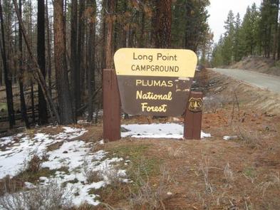
LONG POINT (CA), California Campground Images, Info & Reservations

Directions

Located 30 miles northeast of Taylorsville, on the Genesee-Antelope Lake Road. From Janesville, take County Road 208 for 4 miles and turn onto Forest Service road 28N01 for 9 miles, then turn right on Forest Service road 28N03 and continue for 2 miles.

Phone

530-283-0555

Activities

BIKING, CAMPING, FISHING, SWIMMING SITE

Keywords

LALO,ANTELOPE LAKE,JANESVILLE,SUSANVILLE,TAYLORVILLE,PLUMAS NF – FS

Related Link(s)

Rec Area Info & Images

California State Tourism

Forest Service Concessionaire

California State Road Conditions

Overview

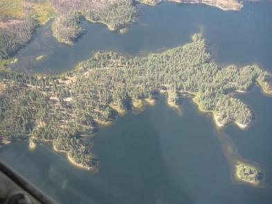
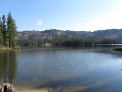
Long Point Campground is one of three in the Antelope Lake Recreation Area. It is situated on the lake’s southwestern side, providing clear water views at nearly every location within the campground.

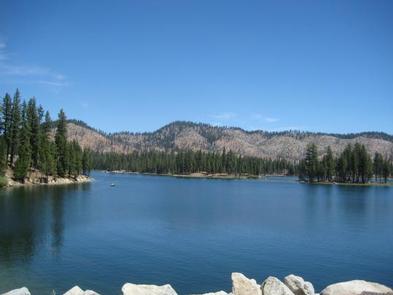
Antelope Lake is one of the more remote, quiet lakes in the Sierra Nevada’s Plumas National Forest, making it a popular destination for anglers and explorers of all abilities.

Recreation

Due to its prime location on the lake, Long Point is known for great bass fishing. Sailing and other boating activities are also popular at Antelope Lake.

Some sites are very near to shallow water and are ideal for wading near the campground; other sites are near deeper water, allowing visitors the opportunity to anchor their boats nearby.

Facilities

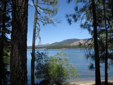
The campground offers multiple single-family and larger group campsites, accommodating both tent and RV camping. With Antelope Lake adjacent to the campground on three sides, most sites have a view of the water.

Tables and campfire rings with grills are provided, as well as vault toilets and drinking water.

Natural Features

The campground is situated at an elevation of 5,000 ft. and is shaded with plentiful pine and fir trees. It is nestled in the beautiful northern Sierra Nevada mountain range, offering forested woods and scenic vistas as far as the eye can see.

Nearby Attractions

Campground is located about 30 miles from the small town of Taylorsville.

Reservation

More from CampingHiking.net:

STORM MOUNTAIN, Utah Campground Images, Info & Reservations

Directions From I-215, take the 6200 South exit and travel a mile east to Wasatch Blvd. Take Wasatch Blvd a mile south to junction with Big Cottonwood Canyon/Highway 190. Make a left at the junction and travel up Big Cottonwood Canyon 2.8 miles to the picnic area. Phone SALT LAKE

DELTA, Oregon Campground Images, Info & Reservations

Directions Located 51 miles from Eugene OR on HWY 126 to the Cougar Reservoir turn off. Take a right turn (south) on Aufderheide Drive and cross the McKenzie River, turn right on to the campground entrance road Forest Road 400. Follow the road approximately 1 mile to the campground. Phone

JARVIES BOAT IN GROUP, Utah Campground Images, Info & Reservations

Directions Cedar Springs Marina is the closest boat ramp to Jarvies. Jarvies Canyon is the first canyon west and a little north of the marina and is only accessed by boat. From Vernal, Utah, take U.S. 191 north 42 miles. Turn north onto Forest Road 183 and travel approximately 2

CALABASAS, Arizona Campground Images, Info & Reservations

Directions From Tucson, Arizona, take I-19 south for about 56 miles. Exit onto AZ 289 (Exit 12). Turn right (west) onto AZ Highway 289 (Ruby Road) and continue to the Pe Blanca Recreational Area. From Nogales, Arizona, take I-19 north for about 4.4 miles. Exit onto AZ 289 (Exit 12).

CHAPMAN CAMPGROUND AND GROUP, Colorado Campground Images, Info & Reservations

Directions Take I-70 west of Denver to Glenwood Springs, Colorado. Take exit 116 (Highway 82) south to Basalt. At Basalt, take Frying Pan Road. Go 29 miles to Chapman Campground. Phone 970-927-0107 Activities BIKING, CAMPING, FISHING, HIKING, WILDLIFE VIEWING Keywords CHAP,CHAPMAN LAKE,WHITE RIVER NF -FS Related Link(s) Rec Area Info